 |
| View across from South to North. |
Over the years we have met many hiking friends. Some of them we meet on the trail, others are family and friends, and sometimes we even find that our clients have the same passion for the outdoors we do. That was the case when we discovered that our wonderful business contacts at Heritage Foods shared the same love of long hikes to incredible locations we do. Our main contact there, Gayle, has been hiking for many years and is out on the trail as often if not more than us. We share our hiking adventures and last year friends Clark, Michelle and Steve joined Gayle and her group for a February hike at the Grand Canyon to do a South Rim to river and back up. Gayle's group had been making plans for this years Rim to Rim (R2R) hike for over a year and asked if we would like to join them. We couldn't resist, we had to say yes!
Gayle's group of hikers has done the backpacking thing and overnight hikes for a lot longer than my group of hikers. They have done all the big stuff we have embarked on, they just did it a few more years ago than us. They prefer to stay in lodges and hotels and skip on the freezing nights on lumpy, uneven ground and eating your meals out of a ziplock bag. They have substituted pleasantly scented body lotion for the smell of insect repellent and prefer a meal that requires reservations instead of rehydrating. In the end, who can blame them, it sounds like a much better deal to me as well!
The reason the planning for this hike was started so long ago revolves around our intended starting point. We were going to hike the Grand Canyon from the North Rim to the South Rim. Accommodations at the North Rim can be hard to come by and book up very fast. You can make reservations up to one year in advance and Gayle had suggested we get on the phone exactly 1 year in advance at 8AM to make those room reservations. My coworkers wife Michelle was on the phone early that morning to get our reservation made for the North Rim. The trip planning was officially started and the rest would fall into place over the next year.
As we approached our final few weeks before the hike we all needed to finalize our plans. Room reservations for the South Rim had been made and dinner reservations for the main dining rooms in the lodges were set. Initially we were going to ride over with our friends from Heritage Foods and they had non-hikers going along to shuttle cars and gear the 200 mile drive from the North Rim to the South. We found out with two weeks to go that the empty seats we thought were available to us were not and we needed to arrange transportation. I volunteered/coerced my parents to drive us out there and offered to bring my youngest, Eric along for the ride. What Grandparent could resist a 3 day road trip to the Grand Canyon with their Grandchild on board? We were able to grab an extra room at the North Rim from a person in our party of 25 hikers that had to cancel and were lucky enough to get an extra room at the South Rim on short notice. The trip was on!
 |
| We finally arrive at the North Rim. |
We all gathered on one of the big viewing patios at the North Rim Lodge for drinks and socializing. The views from these lookouts are incredible and it iwas such a wonderful way to celebrate our arrival. We all had dinner in the main dining room which hangs on the edge of the majestic cliffs that rise from below. This has to be one of the best dining room views I have ever seen!
 |
| Ready to go at 5:15AM at the North Kaibab trailhead. |
 |
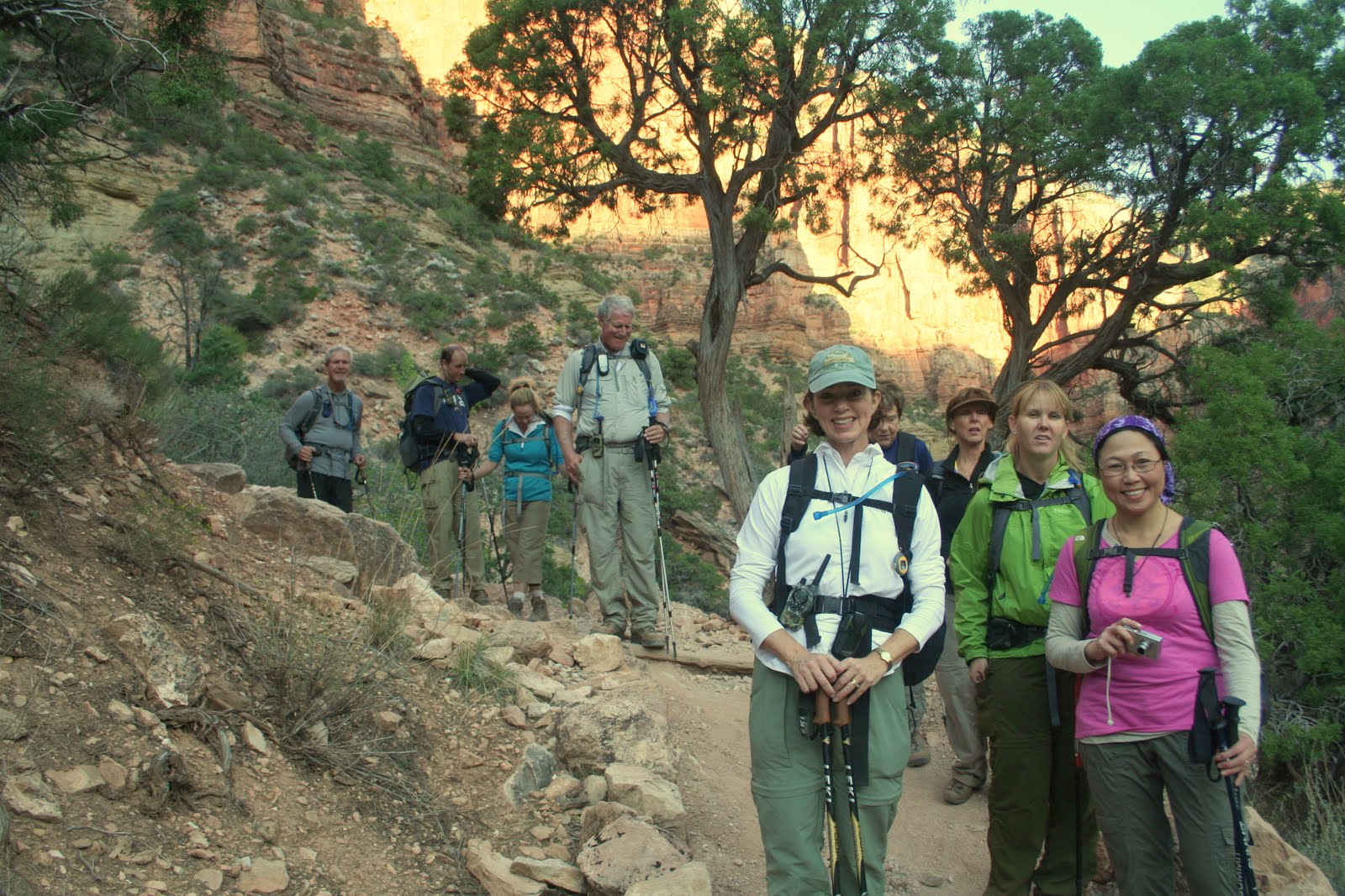
| One of the first pictures that morning at first light. |
We descended steeply down to a bridge where we could now look up the trail we had just come down and got a real feel for how steep this section is. You could see others in our party spread out along the trail by looking for their headlamps as many still had them on. It was a shame it was not an hour or so later as the views in this area were so incredible. The grand vistas of the canyon itself had not opened up yet but the view of the smaller canyon we just descended was picturesque all by itself.
 |
| The ledges. |
Before long we had reached the bottom of the canyon we were descending as it merged with the Bright Angel Creek. This creek flows down to the Colorado River and we would be following it for the next 7 or so miles. There was a nice waterfall and shortly after a bathroom and water stop. Most of the group of 25 hikers wound up congregating here as we ate a snack, refilled water supplies and emptied our personal waste fluid reservoirs, our bladders!
 |
| Our trip coordinator Gayle in the blue hat and most of her crew. |
 |
| Easy hiking along the bottom of the canyon. |
 |
| We arrive at Phantom Ranch. |
Our smaller group of four which consisted of Clark, Michelle, our friend Steve and myself decided to get moving. We had determined prior to our arrival that we would climb the Bright Angel Trail. Others in the group left the decision to be made on the trail. While they were deciding, we headed out as the rain looked likely and Clark and I really wanted to swim or at least soak our feet in the river.
 |
| Our bridge across the river. |
 |
| The view upriver from the bridge. |
 |
| Michelle breaks out the rain jacket. |
 |
| One of the great views behind us as we reached Indian Gardens. |
 |
| Steve poses by one of many signs telling you to never go from the rim to the river and back in a day. Hahh!! |
 |
| About halfway up the switchbacks looking across the canyon. |
The switchbacks got steeper, much steeper and the rim was visible but I got a cramp in my neck looking up so high to see it! We all stuck together up to the three mile to go point where I chugged some additional water and had some electrolytes. I had a small amount of water on me as I had drank my fill at the rest stop. I set out on a solid pace, quicker than the others wanted to go. We had decided ahead of time that we would all hike our own pace to finish out the hike. I wanted to finish in under 12 hours and kept my pace accordingly. I hiked right past the final rest/water stop as I felt as if I stopped I would never get going again. As I neared the top of the rim the trail was loaded with Asian tourists as if several tour buses unloaded them and sent them down the trail. While others complained that they blocked the whole trail and they had a hard time getting by I did not experience this. While the trail was loaded with people, I think the combination of my 6'5" size, speed and certainly smell parted the visiting tourists as I sped by. I reached the top of the South Rim at 4:45PM, 11 1/2 hours after starting that morning.
 |
| I was very happy to be on the South Rim! |
Right on the 12 hour mark from when we started the rest of our immediate group appeared at the top. Michelle headed directly to get checked into her room while Clark, Steve and I staggered around a little along the touristy South Rim area before stumbling over to our adjacent rooms. We got cleaned up and headed over to the El Tovar Lodge to make our 7:30 dinner reservation that Michelle had optimistically placed over a month prior. We once again enjoyed a fantastic dinner and appreciated the fact that we did not have to cook it on a backpacking stove. We learned that a few hikers from our group were just finishing as some had opted for the shorter, yet steeper South Kaibab trail. Many missed their dinner reservations or were just to darn exhausted to make it to dinner. We spotted Gayle on our way back to our rooms that night. She had a bag of ice and was going to take and ice bath to relieve her tired muscles. She claimed it worked well but I much prefer the warm bath I took to accomplish the same thing!
With the whole hike complete we had a chance to compare our thoughts. We all agreed that the trip was just too short, 3 days in total, and we would much prefer to spend lots more time here exploring the area.The North Rim was an awesome experience and would have been a great place to spend a full day to really soak in all the beauty. The hike itself was not really that difficult as elevation was not a big factor. The final three miles were difficult but out of 25 miles to have 3 uphill strenuous miles is a small price to pay. The logistics of this trip were very complicated including lodging, transportation and car/gear shuttling. I cannot begin to fathom the logistical nightmare of a Himalayan expedition including flights, gear requisition and transportation and everything else that goes along with it. We just travelled to an adjacent state and it was a difficult task!
We all agreed we would do it again. Our planning was good and our equipment worked perfectly. We seem to be getting better at this stuff as we go as we are learning fewer lessons the hard way. A multi day trip through the canyon would sure be fun to explore all the other trails that are down there. They will just have to wait until we return.
Click here for the full set of photos from our trip.
