Monday, June 13, 2011

Trans Catalina Trail, Hiking the Island

Well summer has arrived and what better way to celebrate than spending 4 days in the Channel Islands off the coast of California. Our destination was Catalina island to hike the fairly new Trans Catalina Trail (TCT) that was officially opened back in 2008. My friends wife Michelle has been wanting to do this ever since she had heard about it so this was her trip to coordinate. What she discovered is that since this trail has really only existed for a few years, there is not much information floating around out there about it. Our goal was to not only do the hike but also document it well enough that this blog posting will serve as a great reference document for future hikers of the TCT. Our backpacking group consisted of Michelle, co-workers Mike D., Clark and I as well as a good friend of Clark and Michelle, Mike Y.

Officially the TCT is just over 37 miles and stretches from just south of Avalon to the northwestern point of Starlight Beach. Since you cannot easily get dropped off or picked up at either end of the trail, a little extra hiking and backtracking is involved which made our hike a total of 52 miles with about 9,000 ft. of elevation gain and we planned on covering it in 4 days. Three of those days would be used to complete the TCT and the last day was to get ourselves back to a port we could catch a ferry home from. More on that later. How can a hike on an island with a high point of 2,010 ft. have 9,000 ft. of elevation gain you ask? Simple, there is NO flat trail on this island!

The island of Catalina sits about 26 miles off the coast of California. It is mostly managed by the Catalina Island Conservancy. The Conservancy was responsible for completing the trail and appear to be the promoters of this route. What we found when researching the trip is that apparently few people have actually hiked the whole thing and even fewer have it done it in a contiguous manner. Most who had done it before complained of difficult navigation and it being a very strenuous route.

The planning stage was rather difficult for the above mentioned issues. We decided we could get away fror 4 days to complete the route. We were able to view some of the camping locations and to do the route in 4 days we planned on day 1 from Avalon to Blackjack, 15 1/2 miles, day two Blackjack to Two Harbors, 13 miles, day three Two Harbors to Starlight Beach and back to Parsons Landing, 16 miles, and day 4 Parsons Landing back to Two Harbors via the coastal road, 7 miles. Michelle booked campsites online for Blackjack, Two Harbors and Parsons Landing with the Catalina Conservancy.

Michelle informed me that I was in charge of maps and navigation. Well I have not gotten any of us lost yet so I accepted the job. Finding maps proved difficult. Since the TCT was only officially completed in 2008 you will need a fairly recent map. I checked for maps at the usual places and had no luck. Some have said that you can get a map of the trail at the Catalina Island Conservancy located in Avalon but I really wanted this information long before I got there. I finally found what I was looking for after poking around the Catalina Island Conservancy website where they have a great collection of maps as pdf files available for free download. With the maps in hand and some additional information on the trail segments from the Conservancy I was ready to do my research and get a feel for the route. One of the best maps they provided had the full trail shown along with the elevation profile. I realized quickly that this was not going to be a flat hike! They even have a smartphone app to help but since I NEVER rely on electronic devices on the trail I ruled that out.

I had been to Two Harbors to camp in the past and Clark, Michelle and Mike Y. had been to Parsons Landing to camp. We all knew what to expect at those locations. Two Harbors has everything, food, water, bathrooms, showers, store, the works. Parsons is primitive. They have pit toilets and your campsite includes a bundle of wood and 2 1/2 gallon jug of water in a locker. You can purchase additional water/wood if needed ahead of time and get a key for additional lockers. Blackjack was to have water and pit toilets and again a locker with a bundle of wood came with the site.

Michelle had made our ferry reservations. We utilized Catalina Express out of San Pedro as they had the earliest arrival times in Avalon and also serviced Two Harbors. We boarded the early boat which got us to Avalon a little after 9AM. Once we arrived we had to find the location to check-in and get our hiking permit and locker key. This location is known to change so it is best to get that info directly from the Conservancy when you place your reservation.

The street to begin our hike in Avalon.
We were finally ready to begin the hike.I had to look over some instructions provided by the Conservancy about the actual start point as the TCT does not begin in town. It officially begins about a mile and half south of Avalon at the intersection of Wrigley Rd. and Renton Mine Rd. which you can easily view on Google to figure out how to get there. The road to get there starts off with a good climb out of Avalon. I was happy to have lightweight gear on this trip. My pack was only 26 1/2 lbs with 4 days of food, fuel and 3 liters of water. Less food and water it would have been 15 lbs!


Official start point of the TCT.
 The views as you climb up along Wrigley Rd. are great. You can really get some nice photos of Avalon as you make your way to the official starting point of the TCT. As Wrigley Rd. begins to descend you will quickly reach the start point on your right clearly marked with a sign showing the Trans Catalina Trail and pointing up Renton Mine Rd. From here you are heading up a dirt road that is only accessed by hikers and bicycles. They did do a good job at keeping the TCT free of vehicles. While a little over half of the entire route is road, you will not see cars as they are not allowed on these sections.

The TCT leaves the road and transitions to trail.
Our first day was long and rather warm. We were relieved to discover that shortly after the TCT left the road and transitioned to trail that you reached Haypress Reservoir where you can fill up with water from the tap as they have a small picnic area there. The trail continues next to the playground and I missed it. Fortunately the others in the group spotted the TCT trail sign and we were back on the trail. The trail gets fairly faint intermittently for the next couple miles or so and you really need to keep an eye out for the little brown markers that say TCT next to the trail. We had no problem following the trail but then again we had five sets of eyes to spot the markers in the difficult sections. It is also nice that every mile on the TCT they have a short wooden marker showing your mileage.

Some of the buffalo herd brought to the island by the Wrigley's
The first nights destination was Blackjack campground and after looking at the map we realized it was adjacent to the highest point on Catalina which is 2,010 ft. with the campground maybe 200 ft. below that. The transmitter on the summit had been our marker all day as it had been in sight off and on throughout our hike. It was finally getting closer but not without yet another descent then climb back up to our final destination. We reached Blackjack around 6:30PM and all were exhausted. We are used to climbing mountains but the constant up and down is not what we typically do. We gained about 4,000 ft. of elevation on the first day and had clocked 15 1/2 miles. We were happy to see that there were outdoor cold showers at Blackjack. We had a nice campfire, ate dinner and retreated to our tents early as it had been a long day as we had been up since around 5AM to get to the port that morning.

See the little people on the ridge?

The happy crew at the airport.
Waterfront camping at Two Harbors.
Our second day was to be easy. Only about 2,000 ft. of elevation gain and a short 12 1/2 miles. We finally headed out of camp around 8:30AM after tending to blisters on Michelle and Mike Y. Our first destination was the airport. We arrived there in about an hour and enjoyed the shade, store, flush toilets, warm water and hospitality. There is a cafe there but we were too early. Snacks and beverages were available. We then headed down and easy road that descended all the way to the coast at Little Harbor. This was a campground as well and had a very nice beach. Some people were surfing in the the adjacent Shark Harbor and it made a great picture spot. We had lunch at a picnic table right on the beach and made use of the bathrooms and fresh water that was also available here. If we planned the hike again we all thought this would be a great place to add an extra day and finish day 2 here. That was not in our master plan so after lunch we were off to Two Harbors. Remember the 2,000 ft. of gain I mentioned? Well here it comes and most of it in the first two miles. The climb up out of Little Harbor was tough but the views off the ridgeline we were on were stunning. The trail finally dropped down into Two Harbors 5 miles later where we had all the amenities of a small town. Everyone frowned when they learned that camp was just over a small hill 1/4 mile away. Once at camp we set up our tents and cleaned up. A few spent the big bucks and walked back to town for a hot shower, 90 seconds of water for 50 cents, while the rest of us took semi-cold showers at the campground. We all met up back in town for buffalo burgers and a few fermented beverages were consumed.

Michelle's foot patched up for day 3.
Michelle and I near Silver Peak with clouds rolling in.


The view from Fenceline Rd. down to Parson's
Day three involved some tough decisions. It was to be our hardest day yet, 16 miles and 4,500 ft. of elevation gain. Two in our party had decided they were not up to uphill/downhill and opted for the shoreline road out to Parson's Landing. Three of us, including Michelle with her blistered and swollen feet were off to tackle the big hill between us and Parson's where hopefully we would all meet up for lunch and then figure out who was going on to Starlight Beach. This is a section of trail that is easy to follow on the map but not very well signed. You have to head back to the trail you came into Two Harbors on and continue to the right. I never saw a sign pointing you left toward the north side Catalina Harbor. We turned where I knew we needed to based on the map and followed the dirt road along the north side of Cat Harbor where we finally came across the mile 27 marker indicating we were headed the right way. Miles 28 and 29 will leave you cursing! They are steep and hot. Soon after you reach Fenceline Rd. which descends STEEPLY down towards Parson's Landing. This is the official TCT. In our opinion, it would have been better to route the trail onward to Silver Peak and down to Starlight Beach which would save several miles overall and in looking at the topo maps would save you from some very steep sections. Since we planned on doing the full TCT start to finish we followed the trail along Fenceline Rd. which was noted by others as being very steep. At first I wondered what all the fuss was about, it was steep but not that bad. After a awhile the trail really showed it's ugly self and I would rate it a 10 out of 10 on the black toenail scale. If you don't know what I am talking about, you really don't hike long, steep downhills do you?

The final trail to Parson's Landing just ahead.
Clark at the terminus of the TCT, Starlight Beach.
The view of Parson's below me as we return from Starlight.
As we neared Parson's Landing we met up with the others in the group. We all arrived at Parson's for lunch which was yet another stunning beach to enjoy. We ate and Michelle was thinking hard if she would continue. Her feet were in bad shape and we knew we had 9 miles and 2,500 ft. of gain left in the day. The Catalina Conservancy information is very deceiving at times and it lists the elevation change at 666 ft. for this section. They only list the total difference from the highest to lowest point, one way and leave out the fact that you will gain it several times....each way! Three of us left Parson's together but Michelle turned around about a 1/2 mile out of camp. She wanted to make the end so bad but realized she also had to get back, not just to camp, but back to Two Harbors the following day. It was a very difficult decision to make and in hindsight it was the best one. Clark and I continued on to the end at Starlight Beach and the so called trail had some exceptionally steep ups and downs that would have torn her feet up even worse. Clark and I finally made it to Starlight and took our pictures and put our feet in the ocean for the first time on the trip. We both wanted to swim as we were rather hot from the strenuous hike out here but didn't have a towel and feared the hike in wet clothes would be rather destructive on our already worn out bodies. It was great to make it to the end of the TCT but sad we could not all finish it together. We left Starlight and kept a brisk pace and returned to Parson's with our one way time at and hour and a half. It was now 5:30PM and the breeze was blowing and I was cold once I stopped hiking. Clark still went in the ocean, I needed to but did not want to freeze so I put on some dry clothes I had washed the evening prior. I nearly fell asleep in my tent as laying down felt so good after the exhausting day that included the completion of the TCT.

Great sunset at Parson's Landing.
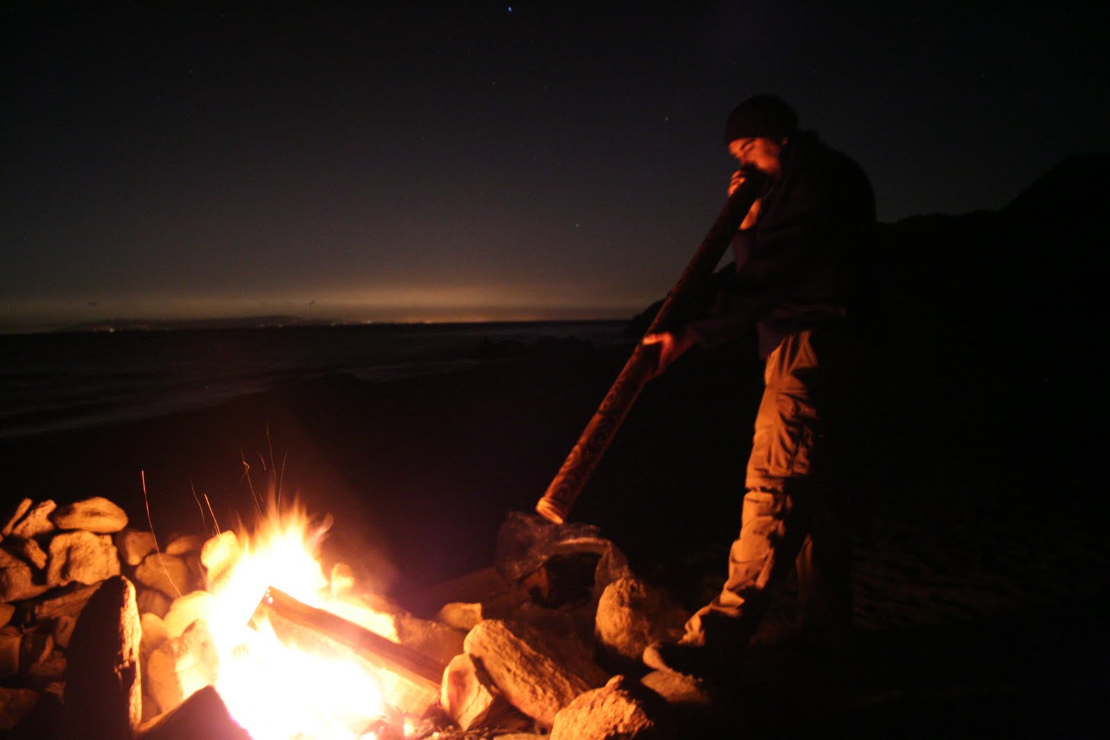
Mike Y. serenades us with his didgeridoo.
Clark & Michelle's tent and the Big Dipper.
That night we used up most of the food we had left, had a raging campfire and Mike Y. who had carried his didgeridoo on the whole trip played a little for us fireside. The sunset view at Parson's is unbelievable and we all took a few photos of the event. I headed to bed a little ahead of everyone else who played a marathon game of UNO that lasted over an hour for a single hand. I did wake up as they were going to bed and grabbed some nice shots of the stars before I was done for the night.

In the morning we all wished we had an extra day. Michelle felt she could have gone to Starlight that morning after having a good rest. We had a boat to catch back in Two Harbors at 4:15PM and only 7 miles of flat trail/road separating us from our destination. We lazily packed up camp and headed out. The final hike back to Two Harbors was very scenic, following the coastline the whole way. We walked past a couple of the Boy Scout camps on the island, Emerald Bay and Cherry Valley as well as several other camps. The sight of Two Harbors brought joy to all of us. Our feet were tired and we were hungry. We did not plan a lunch for the last day as we would enjoy what the town had to offer. More buffalo burgers and fermented beverages were consumed. We limped around town with all the other folks there. We even met some guys with a ukelele that were playing some lovely island music who took interest in the didgeridoo. I said they need to work up a duet for the two instruments, jokingly I thought. These guys used the WiFi access and looked up one and had a little jam session there at the bar. A strange combo of instruments indeed but plenty fun none the less.

Cherry Valley BSA camp.

The boat ride home was calming and drew to an end yet another incredible adventure. We discussed what we would do differently if we did it again. Adding two days would be great. One extra day to stay at Little Harbor and another at Parson's Landing would be ideal. It would let you alternate hard days with easy days and provide more time at the end of every day (except the first) to play in the ocean while it is still warm and the afternoon winds and clouds have not developed. We also would have preferred to not taken Fenceline Rd. and instead head from Two Harbors directly out to Starlight Beach and then back to Parson's. We still are not sure why this is not the official route of the TCT. We also all agreed that the published information from the Catalina Conservancy is a little misleading. While they post elevation gain for each segment of the trip, they do it by only comparing your starting elevation to finish elevation for that segment. This leaves out all of the ups and downs along the way of which there are many. The most grossly understated elevation change is the final trek from Parson's to Starlight as I had mentioned earlier. This was a strenuous hike and this is coming from us who have hiked numerous peaks and logged hundreds of miles climbing the highest points in California. For an island with a high point of 2,010 ft., the TCT's elevation gain will kick your butt!

Our final view of Two Harbors as we approach it for the last time.
This adventure was a major change from my recent snowbound journeys in the Sierra's. I will admit, I prefer the mountains over the beaches but that is my personal preference. Perhaps growing up and working in Huntington Beach for all of my 41 years has filled my enthusiasm for beaches. With that said, if there ever was a beach journey to take, the TCT should be at the top of your list.

The full collection of pictures can be viewed by clicking here.

Wednesday, May 4, 2011

Exploring the San Mateo Wilderness and Doing it Ultralight!

Clark and I enter the San Mateo Wilderness.
It is now the end of April. I was supposed to be headed to Mt. Whitney for a multi-day climb of the Mountaineers Route this weekend. After my Split Mountain adventure I headed up to Mammoth and again was faced with heavy winds, blasting snow and cold days. Upon my return from that trip I laid a good coat of summer wax on the skis and informed my winter friends I was done for the season. My mind had moved on to warm weather excursions, ATV riding and summer backpacking at Catalina.

As a prep for our upcoming Trans-Catalina Trail (TCT) we needed to get out in some warm weather at low elevation with short but steep inclines. While we are always doing local day hikes we figured an overnighter is what we needed to shake down some new gear and try some new concepts on the trail. We decided upon a 2 day backpack trip within the San Mateo Wilderness in the Cleveland National Forest straddling the Orange/Riverside County line just south of the Ortega Hwy. Our route would start at the infamous Candy Store (Bear Canyon Trailhead) and take us south to Tenaja Falls and Fishermans Camp where we would overnight and return via a different trail following a ridge the next day. The total loop was to be 22 miles and evenly split between the two days.

I have been doing a really good job at lightening my pack on my recent winter trips. I have removed a lot of stuff that I have not touched all season and have done a much better job at not bringing too much food. So many trips ended with a bag full of uneaten food amounting to several extra pounds. With this trip heading out on a weekend with daytime temps in the 80's and nights at 50 it seemed like going light, or ultralight, seemed like a good idea.

Clark's pack on the left, mine on the right at 14.8 lbs!
My major items would be a sleeping bag (Mountain Hardware Phantom 45, 1lb), sleeping pad (Thermorest NeoAir, 1lb),  alcohol stove system with fuel (10 oz.), my new ultralight tent (AppyTrails Mark III, just under 2lbs with Tyvek groundcloth and stakes), 3L Camelback bladder and my REI 18L Flashback to stuff it all in. Yes I had my first aid kit and ten essentials as well but it was a lightweight version. My personal clothing consisted of an extra pair of underwear, socks, long sleeve shirt and a backpacking towel. No jacket on this trip, I would just double up my shirts. I did splurge on a 2.3 oz. backpacking pillow as I had no jacket to wad up for that purpose. I also left the camera at home as hauling a 2.2 lb. digital SLR camera kind of goes against ultralight packing. I would rely on Michelle to take pictures on this trip. Without food or water I was at 8 1/2 lbs.! With food loaded up and 2 liters of water I had 14.8 lbs total to put on my back. This was a new record for me! I even wore a lightweight pair of trail shoes rather than the leather boots I have always worn in the past.  My friends traveling with me had differing tactics. Michelle went lightweight while Clark made up for all of us and traveled heavy. He claims it was the lightest his pack had ever weighed at 40 lbs. which was true, at least this time he did not carry a TABLE strapped to the back of his pack! Even their dog Ranger was required to carry his own load.

Strolling through the woods on our way to the falls.
The trip from the trailhead down to Tenaja Falls was very scenic as the whole area was very green from the abundant rain we had this year. While we did not have grand views of mountains and lakes we did have very nice scenery and enjoyed walking through fields of wildflowers and oak covered trails with small creeks still flowing everywhere. We reached the falls, 8 1/2 miles into the hike, around noon. They were crowded as they can be reached via a much shorter route (less than a mile). We enjoyed lunch at the falls and put our feet in the water. Clark decided he would submerge himself in the rather cold water which wasn't a bad idea as it was warm day.

Michelle, Ranger and I at the top of the falls.

More hanging out at the falls.
We left the falls and headed towards our evening destination, Fishermans Camp. When we arrived there we discovered a Boy Scout Troop of about 20 people had descended upon it before us. Not only were all the descent camp spots taken, we were there to enjoy nature and get away from it all, not camp on top of somebody else. We decided to head down the trail another mile to our next scheduled trail junction and look for a better spot along the way. This proved to be a great choice because once we reached the junction of the San Mateo Creek Trail and North Tenaja Trail we discovered a beautiful camp location complete with a sandy beach along the creek, a babbling brook, shade trees and numerous flat tent areas. We were happy to have found such a secluded location with all the amenities. This location was far superior to Fishermans Camp so the crowd really did us a favor.

My new ultralight tent, big enough for 2 adults.
Now it was time to test out my new tent. Up to now, my ultralight travel had gone very well. The small pack performed perfectly although I did need to lash the tent to the outside of the pack. I had practiced the setup of the tent a few times at home in the backyard to make sure I had it down and had already rigged it with the appropriate cord. I used my trekking poles as the tent poles and had the tent set up rather quickly.  Because it must be staked out I did have to hunt for a less sandy location so that my tent stakes could really hold. With the tent set up I moved in my stuff and was very impressed with how much room this lightweight tent had in it. To save weight, the tent does not have a floor. I had ordered and cut a sheet of Tyvek to make a footprint for the tent and used that. The tent was good enough to keep flying bugs out but not good enough to stop the crawling type. No big deal to me if it means shedding 3 or more pounds out of my pack!

The new tent was very roomy given the low weight.
Clark broke out the radio and the camp chairs, water filter, the cooking pot and heavy liquid fuel stove. I grabbed my iodine tablets and meager alcohol stove and we commenced on dinner. I noticed that a strange thing occurs when multiple people are travelling with different concepts or ideas. Even though Clark had a water filter, I wanted to prove I did not need it and purified my own water. Clark refused to leave his heavy stove behind and just bring a few ounces of alcohol for mine. He wanted to check his new large pack with a heavy load. Michelle's new pack was really cutting into her shoulder even with her light load. I offered to swap packs with her but she decided she got herself into this and was going to get herself out of it. I am not sure if this is a common phenomena or if we are all just the most stubborn people on earth!

Clark, Michelle and Ranger at our lovely camp.
After dinner we sat around and enjoyed the radio along with a few games of Uno, our favorite trailside pasttime. Clark whipped up a batch of popcorn that I was more than happy to eat even though there is no way I would carry a pot or enough fuel to cook it! We finished up our game of Uno and headed to our tents. The frogs were really going off that night. These were not your typical croaking frogs, these were frogs that made very long groaning sounds. With about 3 of them near my tent I was serenaded ALL night long!

Having travelled ultralight I had skimped on a jacket. In the middle of the night that was looking like a bad idea. I was cold and shivering. I pulled my thin backpacking towel out of my pack and wrapped my head with it. It may not sound like much but that was all I needed to be comfortable for the rest of the night.

I was pleased to find that when morning rolled around that I had no moisture buildup in the tent. It was a dry weather pattern we were in but with a single wall tent that was zipped up all night you never know what will happen. We made our breakfast and packed up and rolled out of camp later than we would have liked at 9:30.

Our final picture overlooking San Mateo Creek.
Our first 1 1/2 miles were tough as we climbed 1,300 ft. to gain the top of the ridge behind our camp. The remainder of our hike was very beutiful as we were hiking along the ridgeline for most of the way back. We had views of San Jacinto, San Gorgonio, Baldy as well as the ocean. With temps in the upper 80's and only 2 liters of water in my pack I was hoping to finish before I went dry. We did as we finished a little after noon. We bypassed our optional Sitton Peak side excursion as it was just too hot and we were all ready for a good lunch.

Over a great lunch back in San Juan Capistrano we discussed our experiences. Michelle will return her new pack and go back to a smaller one she has used many times before. Clark the pack mule really liked his new even bigger pack even though he carried the lightest load ever, about 35-40 lbs. I was very pleased with my results on going ultralight with a new pack and tent. The pack was very small and I really had to plan ahead to keep the things I would need at lunch either at the very top of the pack or in my pockets. I just cannot fit anything else in the little pack and will have to use something bigger for Catalina as I will need to carry a little more food, fuel and clothing. If I can keep the Catalina weight to around the low 20 lb. range I will be extremely happy. I think I gave ultralight backpacking a really good try and did well. I am intrigued to see what other tricks are out there to not necesarily reduce weight but rather bulk so that I can get everything in my little 18L pack and even have a jacket next time! The learning never ends.

Tuesday, March 15, 2011

Backcountry Ski Trip to Split Mountain

Split Mountain, 14,053 ft.
Having done some reading on the California Fourteeners, I thought a winter trip to Split Mountain on skis sounded like a good idea. I want to reach all of the fourteeners in the state and having recently acquired backcountry ski gear I am always looking for an opportunity to get out and use the stuff! My friend Jason was on board before I even finished telling him the plan. Like me, he is always up for a winter trip where skiing or splitboarding is a possibility. We tried to get some others to join us but had no luck. Once again, it was just the two of us for another backcountry adventure.

Split Mountain is located along the spine of the Eastern Sierras between Independence and Big Pine. The typical driving route to the trailhead is supposed to take 1 to 1 1/2 hours on some rather evil dirt roads as you leave Hwy 395. After doing a little research we found an alternate route that may cross private land, but may not and SHOULD not have any locked gates. It is rather tricky to navigate unless you are very good with a map, and fortunately we both are. We made it from the Hwy 395 to the trailhead in a half hour and wondered what everybody was making such a big deal about. No other cars were parked there as this is a rarely used trail even in the summer, let alone the winter!

Jason points the way up the canyon.
Is it rather odd to start a backcountry ski trip when you are standing in the high desert. Dry brush surrounded us and it was warm. We would be heading up the South facing side of the canyon where there was no snow until we got up another thousand feet. Surprisingly the other side of the canyon had a thin layer of snow nearly down to where we were parked but it looked too thin to travel on so we hiked. Having learned how uncomfortable long approaches are in my backcountry boots, I brought a light pair of tennis shoes to start the hike in. I figured I would just leave them alongside the trail when I transitioned to my boots and recover them on my return.

We didn't transition to skis until we were about a mile or more in. The trail to this point is just as others had described it.....crappy! This trail has probably not seen maintenance since the Great Depression and it showed. The lower sections are rocky and often lead you into a thicket of bushes near the creek. When we finally had reached snow it was so soft that were postholing yet it was not continuous enough to ski tour. When we finally reached the point to transition to skis we were both relieved. We did notice that on the other side of the canyon (north facing) the snow ran much further below us. Because of this we decided we would descend on that side which meant we would not be coming back the same way. This forced me to carry my lightweight hiking shoes on up the mountain.

Jason lays down a fresh skin track on virgin snow.
The ski tour was very nice for the next mile or so. Gently climbing and following easy terrain was a joy. Unfortunately one look up told us the story of what was still before us. There was a large climb to the top of the canyon and from our maps it looked like we needed to go to the highest point. We began the long climb up, kickturning our way up the steep slope. As we neared the top it was getting late in the afternoon and the sun had dropped behind Split Mountain. This meant that the snow was now cooling fast and quickly went from a soft, easy to traverse slope to an ice crusted face. I needed to lead as it is easier for me to edge with skis than it is with Jason's splitboard. He followed my track on up.

We finally made it to the top and saw that we needed to do a long traverse along a very icy surface with a slope around 35 degrees. As I had been edging for over the last hour I was getting tired of this. I pulled out my ski crampons from my bag of tricks. Like crampons for boots, these are designed to provide metal spikes along the side of your skis when traveling in icy conditions. I had never used them before and was very glad I had them now! I headed out and was silly how easy these made this. I wished I had been using them for the last hour! The only downside was that they sound like a cowbell as they make contact with the ice. All I could think about was the Saturday Night Live skit with Christopher Walken calling for "more cowbell!" We needed a little humor to keep going this late in the day and that provided it.


We arrive at camp and view our goal, late!
We finally rounded the ridge on our traverse and saw what we had been waiting for, the headwall of Split Mountain. This meant we had arrived at the area we planned on camping, Red Lake. It was totally snow covered so we set up camp where we had some trees for a little wind protection and most importantly, a flat spot for the tent. Jason was not very perky and was ready to get camp set up. We got the tent set up quickly as it was already 5PM and darkness would be upon us within two hours tops. We got that done and anchored the tent very well with my homemade snow anchors, a tip I picked up from Jason. Jason then asked me what my thoughts were on having a fire? We were within the area we could have one, just barely, and it sure would make the cold more tolerable. I said I thought it would be great and he instantly got to work building a nice fire pit on an snowless patch just 15 feet from the tent. Before long we were getting water going on my stove and enjoying the warmth of a fire. There was plenty of wood around which was surprising with all the snow but we came up with enough for the evening without much trouble.

A campfire to lift our spirits.
It was finally time to take it all in. We were surrounded by immense beauty. Split mountain jetting up from Red Lake right before us and we were the only people up there to enjoy it. With a fire to warm us, we stayed up until a little after 9PM, fairly late considering we had up since 2:30AM to make the drive up. We did not want to start the climb from camp up Split Mountain too early in the morning as we needed the sun to work it's magic and soften the icy surface on the snow to make travel easier; and safer.

The night brought some fairly gusty winds but our well anchored tent did perfectly. The forecasted temps for this elevation were to be 10 degrees at night and 29 during the day. That night might have been that cold outside the tent but with both of us in the tent it was running in the high 20's which was not so bad. We both slept fairly well and awoke to a sunshine filled morning and light wind. We got ready to head out and were heading for the summit by 8:30AM. We wanted to let the snow soften yet still allow us ample time to reach the summit and return under good snow conditions.


Me at the top of the false saddle with the true saddle and summit behind me.
The initial travel was a long gradual traverse heading toward the false saddle above Red Lake. The conditions were very icy as the sun had not yet hit this area. Jason was still using his crampons with his board on his back while I was making good progress with my ski crampons. As we started to climb the final leg toward the top of the saddle the weather had turned for the worse. High winds were blowing down the icy slope, clouds covered the sky and the peak and the surface was wind scoured and very icy. Jason was doing OK in full crampons and my ski apparatus was at it's limit. I made my way over to the side of the slope where I could safely transition to full boot crampons and put my skis on my pack. I made it up to the top of the slope to join Jason. From the top of the false saddle we could see the path to the true saddle on the ridgeline before us. It looked even worse than what we had just done. Ice was now blowing with the wind gusts and pelting any exposed flesh. The clouds continued to build and no sun was anywhere in sight. I looked at Jason and said, "I'm done.....".

Jason was a good sport and said, "I can turn around at any time..... I just didn't want to say it first." Fortunately we both recognized the danger in continuing onward. It was already around 11AM and there was still plenty more to go. Getting caught on the summit in what would surely be extreme winds and very icy conditions is not what we had in mind. The descent back to camp was not going to be that great as the sun never softened the snow and it would be another long, icy adventure. We took some pictures and wind readings. The wind was gusting to 40 MPH and the windchill was hitting -8 F. With the wind transporting large amounts of ice crystals I felt like I was inside a snowcone machine! Jason walked up to the 12,000 level next to the mountain for a picture before we packed up and headed down.

Back at camp looking toward the summit.
The downhill portion was a little scary as the slope was extremely icy. I locked the front bindings on my skis as I figured if one came off it would travel 1,500 ft. below to the frozen lake as ski brakes don't work well on ice. While making a turn on the icy slope I had a wipeout. I slid for at least 50 to 75 ft. before coming to a stop. My knee was in great pain. Here I was, in the middle of a steep, icy and windblown slope with my knee in extreme pain and not knowing if I was going to stay put or begin to slide again. I laid there for several minutes. Jason was below me and stopped. I could barely hear him ask if I was alright over the wind. I moved a little to let him know I was not totally incapacitated. I managed to get my skis situated and continued on over to meet him.

My knee hurt but in the binding it was not too bad as it limited the amount of movement. We made it back to camp just before noon. The sky looked even worse up high on the mountain as it was now covered in clouds clinging to the summit. I took off my ski boots and put on my down slippers to limit the weight swinging on my knee. I took some pain meds and settled in for what looked to be a pleasant afternoon by the fire. We collected wood, made meals and melted snow and drank plenty of fluids for the rest of the day. I was upset we did not summit but relieved to be back at camp really enjoying ourselves.

Clear night on Split Mountain.
The campfire once again provided hours of warmth and entertainment. Heating liquids and drying gear was also made much easier with our blaze. As night fell the winds picked up again. We ducked inside the tent again around 9 or so. Many fears ran through my head that night. Would my knee swell up or be in such pain that I could not make it out in the morning? Would the sun come out tomorrow and soften the slope or would it be another hair raising experience as we either downclimb or ice skate our way out with the wind gusting and blowing us around with full packs. In addition, the winds that night were very strong and woke us up multiple times. There were occasions where the wind was actually blowing under the tent. We stuck the anemometer out one of the vents and recorded winds at almost 40 MPH but we had also had worse ones. We stopped as the ice being blown along with the snow was coming in the tent and that was not good. Jason made a very profound statement, "Our lives are in the hands of a couple paper thin layers of nylon and Chinese stitching." We both got a laugh out of it but it was true. Without a tent we would be screwed! We both were exceptionally pleased at how well the REI Arete ASL 3 tent held up to a full side-on wind. We did not even run all the guylines out, just the basics and it still held.

Clothing break on the way down.
Morning came and with the sun came the change in the wind pattern we were hoping for. The gusts were less frequent and much milder. We got up and were pleased to see lots of sun! We were not in a hurry as we needed to let the snow soften so we casually packed up and got our gear ready. We tore down our fire pit and put the black sides of the rocks down. We headed out around 9:30AM. The snow conditions were great and my knee was a little better, certainly no worse than the night before.

We enjoyed 4,000 vertical feet and nearly 4 miles of skiing back toward the truck on untracked snow. This is what backcountry skiing is supposed to be! I did have a few wipeouts as I am not accustomed to skiing with a full pack and I was a little timid on the upper, steeper slopes due to my knee but I finally got into a good rhythm. We skied all the way back to within a 1/4 mile of the truck  taking our gear off and hiking the remainder. I started the descent with 4 layers on top including a down jacket. We stopped a little over halfway down and stripped down to t-shirts as we were roasting! What a difference a few thousand feet and some sun make. I was so happy to see the truck after all the bad thoughts I had the night before. I was also rather tired from the long ski back down and did not bother taking off my pack for my first rest. I just opened the tailgate and laid face down on it and it felt so good!
The end of a great adventure.
I'm tired, I will rest right here!

Every trip is a new learning experience. Most of my backpacking has been where fires were prohibited but I must say that I will seek out more locations where this is allowed as it makes the time around camp much more enjoyable. In the future I will also stake out my tent better even if the wind is not blowing at that time as things change, quickly! Jason and I also discussed that perhaps our trips should be day tours to higher elevations and ski back down to the lower areas for the night. This will mean less wind, warmer nights and perhaps even some steaks on the bbq for dinner! All good lessons learned. I am eager to get out for more. I have a guided backcountry ski trip coming up in 2 weeks and I am sure I will learn plenty on that. At least on that trip we will be staying in a condo so no more frigid nights!

Click here for the complete set of photos for this adventure.

Thursday, February 10, 2011

Skiing the Baldy Bowl


With the less than harsh January weather of Southern California, my friend Edd figured it was time for a Brunch on Baldy hike in the 70 degree weather. It is not often we get to climb up Mt. Baldy in the snow with such pleasant temps in January so we figured we would head out and get it done before the weather changed.

As I now have backcountry skis this would be my first ascent on Baldy carrying my skis up and then carving turns down the bowl rather than glissading as I have done in the past. The dilemma I was faced with was what to wear? Sounds like my feminine side coming out I know but as a skier and a hiker I am sometimes put at odds. The main issue I was wrestling with was the boots. Backcountry ski boots are designed to be walked in but typically that is for on snow and not all that far. While they have settings to make them flex and you can buckle them loose to make them more comfortable for walking they are still no comparison to a good pair of regular boots for comfort. I thought about just bringing some lightweight hiking shoes for the approach and then switching to the boots for the climb up past the ski hut. This sounded great but that meant I would have to pack my heavy ski boots in my backpack. Problem is they will not fit in my new ski mountaineering pack and I would have to bring a bigger pack not designed for skis. To simplify things I just went with the ski boots for the whole trip.

As this was a brunch hike I planned on having a really nice meal at the top. I had planned a menu with my friend Jason to include carne asada omelets with jalapeno-muenster cheese, fresh onion and green peppers and topped with fresh tomatoes and avocado. I had also recently rigged up a device for toasting English muffins over my stove and we would have those as well. We were both to bring stoves as I would heat water for tea and then toast the muffins while Jason cooked up our omelets on his stove and pan. I am getting hungry just writing this!

We were to be on the trail by 6:30AM which meant a very early wake-up to get ready and meet my friends before driving up to the trail head at Manker Flats. I had a voice mail on my phone and unfortunately Jason could not make it as he had been out hiking the desert over the last two days and just home at 1AM the night prior. Bad news for me as he was to have the fry pan and stove for the omelets! Fortunately I made a quick phone call and arranged a new carpool and borrowed some time on my friend Edd’s stove with fry pan as my new stove will not fit anything other than a pot.


We got to the trail head in the dark and met up with the others in our group. We set out at about 6:45AM, with me in my ski boots. The hike up to the ski hut was not too bad but my pack was heavy with food for two (except only I would be eating it) and all my ski and avalanche gear. The avalanche danger was exceptionally low but there was evidence of some recent slides so it was better to be cautious.

Making our way up the bowl.
We reached the ski hut in a few hours and the snow below it had slowed us down as we kept stepping through it. We put on our crampons and helmets and grabbed our ice axes and were ready to head up the bowl to the summit. Due to the soft snow the trip up the bowl was very difficult. We sunk quite deeply with every step and had to kick step all the way up. While I had the largest feet and sturdiest boots by far, I also weighed more than anyone else, especially with all my ski gear. This made the climb up rather difficult, but those behind me really appreciated the gigantic platform steps I left for them. We all took turns leading to share the burden of kicking in the first steps.

We finally reached the summit at 12:30PM. I can’t say I was starving (that takes about 3 weeks with no food) but I was extremely hungry! My English muffin and a granola bar I had 7 hours prior was not much to go on for such a climb. It was windy on the summit so we dropped off the top and found some shelter in a tree well nearby. It was finally time to get down to the brunch portion of the brunch hike!

My backcountry English muffin toaster.
I got out my avalanche shovel and made a nice seat to start. I then passed the shovel off to my friends. It is amazing how such a simple tools is so valuable in the snow. I then proceeded to melt some snow and make hot water for tea. With my new MSR Reactor stove, this was done with lightning speed! If you read my blog on my Mammoth ski trip you will understand my frustration with waiting for hot water from snow melt. I then prepared my apparatus for toasting English muffins. It was nothing more than some stainless steel wire I fabricated into a circle with a tail that I could attach to the handle of my pot. A little positioning of the stove to obtain the ideal distance of 8 inches between burner and muffin (determined the day prior in the comfort of my kitchen) and I was toasting. I shared the toasted and buttered muffins with the group as we all share on these adventures. Edd finished with his stove and I proceeded to cook up my feast. With the fresh tomato and avocado topping off my breakfast scramble I easily won the best looking breakfast award! I did share some but my stomach kept me from sharing too much.

Geared up on the summit for a quick descent.
With brunch complete it was time to head down. I mounted my skis while others prepared for the glissade. The snow was soft as it was so warm out. This is nice for glissading the steep slope but not so good for skiing. As we descended I enjoyed the upper sections greatly. Wide open snow fields were great for making big sweeping turns. It felt great even though the snow had the consistency of mashed potatoes! As we neared the ski hut I had a hard time navigating through the rock and bushes on the line I had chosen. Fortunately the others did not see my wipeout as my path narrowed and one ski went over top of a bush mostly covered by snow. Not only did I fall but I broke through the snow and landed in the bush on my back. I felt like a poor turtle turned over and had to jettison my skis and get myself out of the hole I was in which was made more difficult by my pack. I walked the remainder of the way to the ski hut, a few hundred yards.

Back at the ski hut we put away all our ice gear and prepared for the walk back down. Some were complaining of cold feet. I on the other hand had the reverse problem. My boots worked great at keeping my feet warm in Mammoth in near zero degree weather but at that moment in the 70 degree heat my feet were soaked from sweat! I guess it is hard to make a breathable ski boot that works well at zero as well as 70 degrees.

The hike back down from the hut to the trail head always seems twice as long as it was on the way up. I was tired and my feet were now beginning to hurt. I could feel I had a few spots rubbing and they were completely wet. Back at the car it felt so good to remove my boots and let my feet breath. Putting on my tennis shoes was so rewarding as I felt like I was walking on air!

I always learn something on these trips. Long walks in backcountry ski boots suck! My new stove was awesome and could melt snow better than anything else I have ever used. My toaster apparatus worked great and I really enjoyed the hot English muffins on the trail. As always I learned more about the wildly different experiences you can have on snow based upon the current conditions. In the summer this is typically not an issue. It is going to be dirt and rock, just like the last time. In the winter you can have powder snow, warm soft snow, slush, ice, corn snow and you can even have all of these on the same trip! Now throw in the variable snow depths and quickly changing weather patterns and you can see why this is a challenging environment even for the most experienced winter adventurers. I will keep at it and build my skills in a slow and safe manor so I can continue doing this for a long time to come.

Tuesday, January 4, 2011

Kick Turns and the Crystal Crag

Base camp below the Crystal Crag

What do you think of when you hear about two 40 year old guys heading off for 4 days to live it up? A couple of balding guys in a big red Cadillac convertible heading to Vegas to enjoy wine, women and song perhaps? Well how about we trade out the Cadillac convertible for a 4x4 pickup, we make the destination Mammoth instead of Vegas and we lose the wine, women and song and trade that out for backcountry skiing, mountaineering and snoring and farting in a tent. And by the way, only one of us has male pattern balding and it’s not me!

Once again my friend Jason and I are off to enjoy the snow. We have done Baldy and Mt. Shasta together in the past with me enviously looking at his split board as I have had to walk back down the mountains and he snowboarded the whole way back to the car. Well this Christmas season I decided it was time to do something about it. I researched exactly the gear I wanted, sold a kidney (you don’t really need two, right?) and proceeded to spend my riches on what I thought would be the perfect backcountry ski setup. My wife appreciated that she had to do no shopping for me at all. Boxes would arrive at the house and I just told her to give it to me for Christmas. If only shopping for her was this easy!

I am a pretty good resort skier so the backcountry ski concept seemed like a great way for me to enjoy my love of hiking, mountaineering and skiing all at the same time. I read up on the unique attributes of backcountry skiing of which there are apparently many. Skinning, or skiing uphill, kick turns to facilitate such an endeavor, use of ski crampons and setting a skin track were all new concepts to this downhill skier. My family must think I am nuts for putting on my ski gear and skis in the front room of the house to practice all these new skills I will need. After wiping out the manger scene my wife had set in front of the Christmas tree with my ski tails multiple times I had figured out how to do a kick turn. Now if doing these maneuvers on the snow is as easy as it is on the carpet, I am a master! As I was still a little rusty on my rope handling skills I had learned while taking a snow travel course 6 months prior, I also brushed up on those including butterfly coiling my new rope and making a kiwi coil for travelling in a roped up scenario. Easy to do in the comfort of my home in front of the fireplace, I just hope it translates well to the cold environment on the snow covered slopes.

With just a couple days until our departure the weather at our destination, the Mammoth Lakes area, turned for the worst. Heavy snow and winds gusting up to 75MPH were in the forecast. As I had learned on Mt. Shasta, it pays to be flexible when planning trips in snowy environments. We opted to delay a couple days. The new days had some partly sunny days and light snow in the forecast with minimal wind for the first two days and no wind report for the final two. The temps would be cold with our first night at -5F and the high on the last day of 20F with the rest somewhere in between.

We departed home at 3AM and got up to Mammoth at a reasonable time. We had noticed that my fuel bottle for my 25 year old stove was leaking so we headed into our favorite gear shop in town, Mammoth Mountaineering, and got a new and improved fuel pump for the old reliable MSR XGK and headed over to get our permit. All went well at the Forest Service office and they reminded us of the high avalanche danger (this sounds like the Shasta trip all over again) and off we went to our trailhead.

There's a first time for everything!
As we arrived at the trailhead where they stop plowing the Lake Mary road we looked for a parking spot. The roads were plowed but still snow covered. I saw a spot that looked like I could park in and headed in. Unfortunately as I pulled forward into the snow bank my right front tire dropped off the road and sank about a foot. I tried reverse but my 4x4 with well worn tires better designed for dirt, sand and mud wasn’t going to get me out of this one. Out came the shovel and Jason and I started digging. We tried multiple times but no luck. I always carry a tow strap and after asking a couple people I found a guy willing to give me a tug to get out. I reparked in a much better spot that had become available. This was the first time I had ever had my truck stuck so it was a humbling experience. Already worn out from digging and sweating in the 15 degree temps, it was time to get our gear ready to head out.

We finished packing up our monster size backpacks which consisted of two packs for each of us. Our main pack to haul all our gear to our base camp plus a second, lighter and smaller pack for our ski mountaineering day trips. To use a phrase my Dad has accused the family of on many a vacation in the past, we looked like “Hannibal crossing the Alps!” Unfortunately for us, we had no elephants to carry the load, just us!

The great news is the couple mile trek from the trailhead to Lake George, our intended base camp area, is accessed via a groomed road. Unfortunately, it is all uphill! With the sun shining upon us and our monster top heavy packs on we put the skins on our skis and headed on up the groomed road. If either of us tipped over along the way we would have looked like a turtle flipped upside down, and been just about as coordinated as well!


We arrived at Lake George and set up base camp. Jason instructed me on the fine points of setting up camp in the snow such as stomping out a tent platform to compact the snow and then getting off it for at least a half hour to let it firm up. We positioned the tent to avoid wind blowing in the door and set up a kitchen area complete with snow couch with a great view of the Crystal Crag, a prominent rock feature on the far side of the frozen lake. We enjoyed the sun while we had it as it dropped behind the ridge at 3:30PM. We started with some prosciutto and mozzarella on parmesan crisps complete with Grey Poupon (but of course) that led into an early dinner and hot beverages while we worked on making camp improvements like walkways as the snow was so deep you would sink up to at least your knee if you stepped off the beaten down paths we were making.

It was an early night to bed as we had been up very early that morning. Since the forecast for the night was -5F we needed to do some extra prep before bed. We both had 2 sleeping pads to insulate us better from the snow. We put our water bottles in insulated containers and kept them close us all night to keep them from freezing. It turns out that the homemade cozy for my alcohol stove fits a 1 liter Nalgene bottle perfectly and was put to great alternate use on this trip. Prior to the trip I contemplated my situation as my lowest rated sleeping bag is good to 10 degrees F. I have a silk liner that might add 5 to 10 degrees of comfort but that is still cutting it close and I hate to be cold all night. The solution came to me a couple days before our departure. I also have a 45 degree summer bag that weighs just over a pound and packs down super small. I would bring both bags and put my cold weather bag inside the summer bag and combine the warmth of both down bags. Combined with my new down booties which I wore to bed it worked out perfectly and I not only survived my coldest night in the outdoors, I enjoyed it.

We awoke to a lovely sunshine morning. We fired up the stoves and found Jason’s to be running at no more than a simmer. Apparently it was in need of some maintenance. Why did we both bring stoves you ask? Well if one fails you always have a backup and it was looking like that was a really good idea. We melted snow to fill up our water bottles for the day, Jason cooked up some sausage patties and we worked on more camp improvements and packed our gear for the day. It was forecast to be about 11 degrees that day and with the sun shining it felt good. When we finally set off to ski up a nearby ridge bordering the lake I was down to a long sleeve t-shirt on top as I knew we would be heating up during the climb.

Awesome fresh powder and the Crystal Crag
Me at the top of the ridge above Lake George.
               The uphill ski touring was strenuous but not overly technical. The snow was soft as the powder snow was at least 10 feet thick. We made our way through the trees following the path laid down that morning by a couple on snowshoes. We had selected the route that morning based on the relative slope and safety of the ridge from avalanche danger. We reached the top of the ridge and sat down in the sun for a snack. The views were incredible and even our base camp was in sight as you could see the orange tent although it appeared as merely a small speck in this grand view from high atop the ridge. We removed the skins and converted our gear into downhill mode and I prepared for my first real powder run.
Jason having a rest at the ridge top.
Me taking in the views before our first ski down.


Back down to the lake after our first run.
Heading down the ridge in the deep powder was a learning experience for sure. As this was the first time since I have had good ski skills to encounter such an environment and I found it challenging. My legs got so tired on the trip down I had to stop several times. This was primarily due to the fact that I was going too slow given the conditions and I was having to work very hard to make the turns through the trees. I did not realize how slow deep powder can be and took a very cautious approach for this first run. We made it all the way down to the frozen lake. We had stayed off of the lakes the day prior and that morning as were not sure if they were safe to travel on. While up high on the ridge we had seen several people cross a few of the lakes in the area and figured if we stayed near the edge we should be fine. We made our way back to camp to enjoy another early dinner in the sunshine.

Jason shows off our quesadillas.
By the time we reached camp, the clouds had moved in and blocked the sun we were hoping for. We had plenty of time to cook and whipped up some pork loin and jalapeno muenster quesadillas for an appetizer while sitting on the snow couch enjoying the view. Since refrigeration was not a problem we were able to bring some tastier items than we normally might. We did discover that heating them from rock hard frozen can be an issue. We would rotate between cooking and doing camp improvements to keep warm and be properly fed/hydrated until about 8PM when we decided it was time for bed. The nights are very long and the days short so we had plenty of time in the tent for conversation and prepping gear for the following day. This was our exciting New Years Eve in the backcountry!
In the middle of the night the wind had picked up, Happy New Year! By early morning we could hear it snowing on the tent. When we finally got our of the tent it was breezy and snowing. Our camp improvements were almost entirely covered on snow that had blown in. The tent had a fair accumulation of snow around it as well. Out came the snow shovels and we started digging out. I had to dig down to the kitchen area and then uncover the stove. By leaving it out I let snow and ice build up in the jet and had to bang it a little to clear out the crud. With Jason’s stove relegated to simmer duties only this could be a crisis. I tried to prime the stove and the fuel just bubbled out of the jet rather than squirting like it usually would. I figured the jet had iced up and hoped that a larger amount of priming fuel would be all that it needed to warm up enough to clear. Fortunately I was right and I got the stove humming along and melting snow.

Heading up the ridge in a blizzard.
After a simple breakfast we both got our gear ready for the day. With snow falling and the breeze turning to a wind we layered up a little more than the day prior. We headed out to enjoy the same ridge again as it had proven to be safe and very fun. The track we had laid down the day prior was nearly invisible as the snow that night had filled it all in. We skinned up the ridge into what was turning into a blizzard with visibility down to 50 yards at times. When we hit the top we quickly converted to ski mode and flew back down. This time I carried more speed and the powder skiing was much easier. We made our way down to the very exposed lake and were greeted with wind gusts reaching about 40MPH! As quickly as we could we converted back to ski touring mode and made our way off the lake to seek some shelter and eat a snack. After that we did the same route all over again completing our second “lap” for the day, a first for both of us.

We skinned back to camp in a blizzard. Once again, all the work of the morning dig out was almost completely erased by the snow that had blown in. All I wanted to do was fire up the stove and make hot beverages but we realized we needed more wind protection from the 40MPH gusts driving the snow at us. Jason laid out a new plan and we started by making a snow wall near the vestibule of our tent to protect us. We were initially planning on cooking in the vestibule while we were inside the tent and in our sleeping bags. While building the snow wall Jason realized the tree adjacent to our tent was doing a great job at blocking wind and reduced the blowing snow. We decided to dig out yet another kitchen and snow couch and take advantage of both our snow block wind wall and tree. It proved to be a much better location but lacked a view. I guess you just can’t have it all. We finally fired up the stove nearly 2 hours after returning to camp to finally get a hot beverage. Due to the cold windy and snowy conditions we made this a very quick liquid and soup dinner and were in the tent for bed by 6:30PM. We both hated to go to bed this early as we knew it was going to be a VERY long night but the conditions warranted the action.

We both awoke at midnight and were wide awake. We shared in the joy that the wind had stopped but the snow was still falling. Jason had brought an ipod he could watch a movie on. I normally would be disgusted at the thought of bringing such an electronic device on a trip to the backcountry but I was the student and Jason the master. He knew how long and boring a night in the tent can be in the middle of winter so we watched a movie on the 2 inch screen and shared a pair of earphones, one ear for each of us. He went back to sleep and I paid the price for getting two great nights of sleep by laying there awake for the next four hours or so. To occupy my time I conceived every possible way I could cook the egg, sausage and cheese breakfast croissant sandwiches I had brought along with the available gear we had. In my mind I fashioned a steamer with a blend of the pots and lids we had with us. With my stomach rumbling from our shortened dinner the night before my focus on the cooking task before me was hyper focused.

At first light I had enough of the tent. I sprung out of it to find that I needed to get out the shovel again the dig out the minimal amount of snow that had accumulated in our walkway and kitchen. Having learned from the night before, I left my pot turned upside down over the stove so snow and ice did not accumulate in the burner. I had it fired up in no time. First a hot cup of cocoa and then the breakfast croissants! I cannot begin to tell you satisfying sound my stove makes once lit. I think it is a blend of the smell of white gas burning and the jet engine sound it makes that brings instant warmth and happiness to my soul. This was repeated every morning on this trip but none as sweet as this one, our final day on the four day adventure.
Breakfast croissants at last!

While the water boiled I dug out our tent which was covered in snow on the sides to a depth of between 12 to 18 inches. Light snow was still falling but the wind had finally abated which made the morning even better. I poured us both a cup of hot water to make our morning drinks and got to work on my boiler for cooking the much anticipated croissants. It did not work out exactly as planned but it worked well enough and within 15 minutes we were both enjoying a wonderful breakfast. Funny that at home this would be no big deal at all. Pop the silly thing in the microwave for 90 seconds and done, but not here!

We packed up camp during the light snowfall. Jason informed me it was good backcountry etiquette to fill in the major holes we had dug so we made quick work of that. We threw the monster size packs on our backs and headed out. While it was mostly downhill it still wasn’t easy. The slope was not quite steep enough to ski so it took awhile to make it back to the truck. We had been wondering how snowed in the truck would be given that it has snowed the last three days. Fortunately there was only about a foot surrounding it and it was quick work. Starting my diesel truck was my next worry as it had cold soaked for 4 days and never saw a temp over 10 degrees F. I had treated the fuel so it should be OK. It turned over ever so slowly at first. It started rather quickly but ran so rough and sounded so loud you would have thought you were standing next to a stamp mill in a gold mining town. After about a minute it smoothed out and all was well.

The trip home was most enjoyable as it snowed from Lone Pine all the way down to the 14 and 5 merge. Seeing Ridgecrest, Palmdale and Lancaster in the snow was a really new experience. Given the weather conditions, we did surprisingly well on our return.

I learned so much on this trip. I discovered that you do not need to buy a super cold rated sleeping bag if you have two semi cold rated bags. I found a new use for my cozies from my alcohol stove. The new tent I had purchased for this trip worked out perfectly and was just right for the two of us and all our winter gear. I learned that while hanging out at camp and cooking sounds fun, it is darn cold and your body wants to just get it done. Both of us hauled home at least half of the food we took. I have read plenty of stories of guys on Everest and that about all they eat is soup when they are up high on the mountain. While we were nowhere near the conditions they face, I think I have begun to understand what they are going through. My new backcountry ski gear worked flawlessly which is great as it was the first use on most of it. I discovered that the short days make for long nights in the tent, and that sucks! In the future I plan on getting a stove I can operate inside the tent which can at least make those first morning beverages a little easier as well as offer the ability to retreat from really bad weather and cook inside the tent. I discovered that my wool gloves were great around camp and actually do keep you warm even when wet. Most importantly I found they can be dried by keeping them in your sleeping bag all night! I also learned that I should have left my rope, harness, carabineers, amateur radio and ski and boot crampons behind and saved about 10 lbs. of stuff I never touched!

While learning and discovering new things on this trip, the most important one I think I figured out is that this would be more comfortable if done in the spring when the days are longer, the sun shines more often and the temps are milder. With that in mind I am planning on a springtime trip to Split Mountain to complete another California fourteener. Until then, I will keep practicing my winter skills and hope for good snow but also some warmer temps to enjoy it in!
Click here for the pictures from the whole trip.