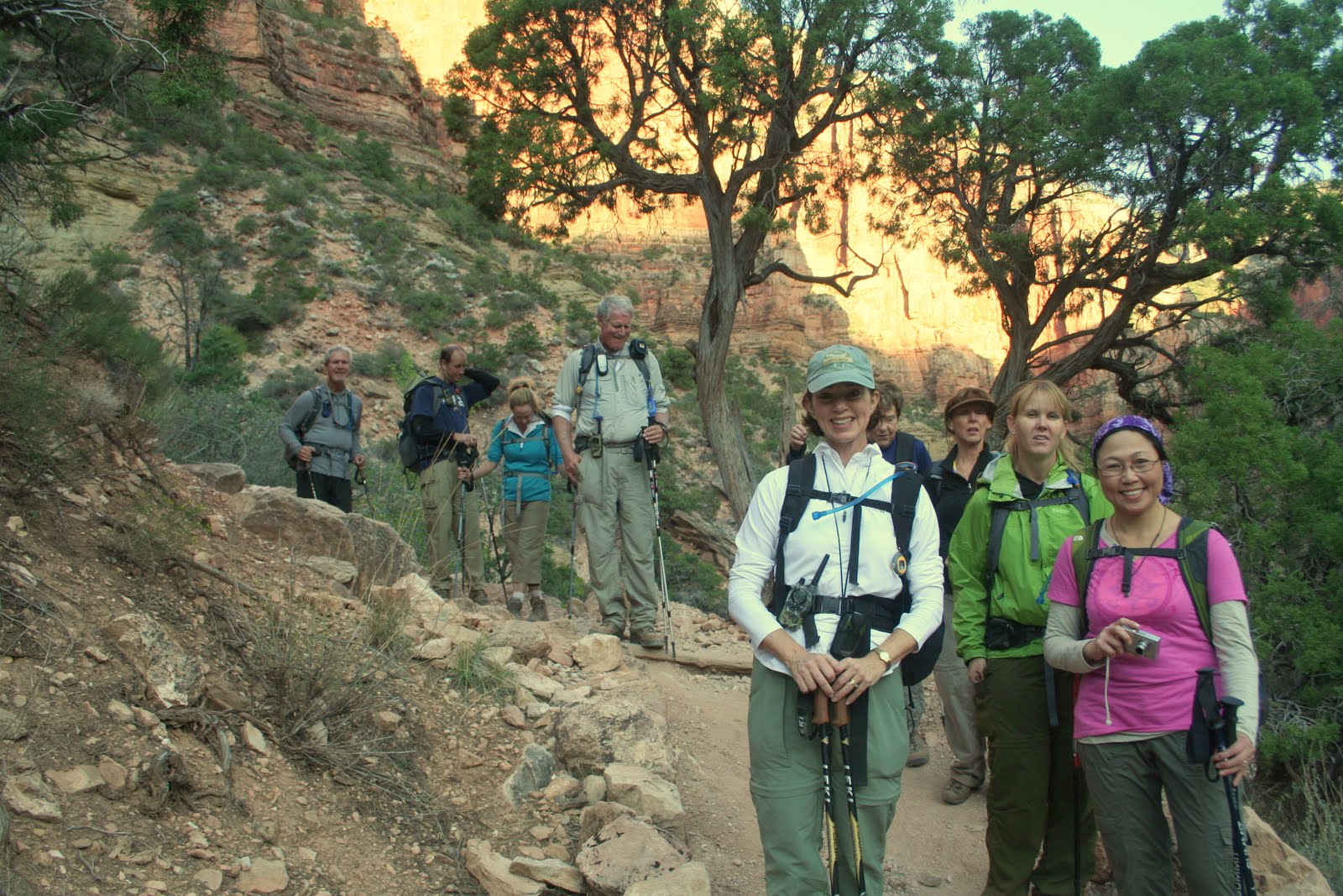
Monday, July 2, 2012

Hoofing it up Halfdome

Halfdome, Yosemite National Park
Back in February while hiking our regular biweekly conditioning hike in Turtle Rock my friend CP mentioned he was considering putting in for permits to hike up Halfdome. I told him instantly I was in! He commented that he did not have permits, was not sure of the dates or if he would even get them if he did apply. I told him it did not matter, I was in! So many people have heard of my list of peaks I have climbed and just assume Halfdome was one of them. Regretfully, it was not and here was a great opportunity to rectify that and do it with great friends.

CP put in for the permits and we waited. I still remember getting his text in April that not only did we get the permits but that we got our preferred day! How lucky we were. Six of us were going to be part of the adventure, I was going to be one of them along with CP, that is the benefit of telling the group leader you are on board before he even has a permit or a date for the adventure. Within short order CP had filled the trip attendees out with myself, Erica and Yong who are regulars on the Turtle Rock hike I lead and friends Clark and Michelle whom hike on the weekends with us regularly.

As I am typically the navigator for our adventures, maps, routes and scheduling was assigned to me. This was also done as both Clark and I have a good friend and client, Gayle from Heritage Foods, who we have hiked with before and has done Halfdome several times and shared her stories and pictures with us. One thing she made clear was that it is best to start early to avoid long lines and crowds at the cables during the final ascent of Halfdome. Our plan was to meet at the trailhead at 5AM and start hiking shortly thereafter to try to make it to the cables by 10AM which we were told would help us avoid the major congestion that is typical at this location. We also decided on a hike to the top of Yosemite Falls the day prior to loosen up our hiking legs and get ready for the big adventure.

Yosemite Falls in the background.
Our master plan was to arrive and meet at the Awahnee Hotel in Yosemite Valley the day prior to the climb. Since many of us were travelling in on different days and from different locations this was a big challenge. Fortunately 5 of us arrived on schedule and headed off to hike Yosemite Falls as planned. Yong was caught in traffic and would start the hike a little later. We made our way to the lovely Yosemite Falls trail and enjoyed great views of Halfdome and the valley below. CP's wife and son joined us up the trail and his son Rahul proved to be a great hiker just like his dad and kept pace with us up front. Once we reached the bottom of upper Yosemite Falls Michelle's foot was bothering her and she decided it was better to turn back and preserve herself for the following day, a good call indeed. CP figured his son had pushed it pretty hard and turned back with him and Clark followed Michelle back down as well. Just Erica and I pushed onward. Shortly after that we got a glimpse of the trail ahead. Good grief, it looked like a wooded version of the 99 switchbacks on Mt. Whitney! Up and up we went and finally crested the top and got to the top of the falls and enjoyed the view. We took a few pictures, soaked our feet in the nice cold water and headed back down. After grabbing an ice cream as a treat for our accomplishment we rejoined Clark and Michelle for dinner before heading off to camp for the night.

We awoke on the morning of the big hike at about 3:30AM. We had to pack up our camping gear as we were outside the park, pick up CP at his hotel where he and his family were staying for the week at 4:30 and then get to the trailhead. We pulled it all off and arrived on schedule at 5:00AM! We were hiking by 5:20AM with just enough light to not need headlamps.

Starting our hike in the early hours.
We had decided to take the Mist Trail, a trail that follows along the river and right past Vernal and Nevada Falls. Both waterfalls are absolutely stunning, Vernal falls at 317 ft. (right Erica?) was amazing. The mist blowing off of it makes the rocks near the trail look black and grass grows everywhere giving you the impression you are in a rain forest rather than California. The view was great and the mist was not that bad and we quickly made our way to the top of it where we soon got a glimpse of Nevada Falls. I have been to Yosemite Valley at least 10 times before but had never seen these falls before so this was a really great experience for me. We kept on hiking up the numerous steps carved into the rock all along this trail. We were all very excited to finally be on this great adventure that had been in the planning for months and as we reached the top of Nevada Falls we were about halfway towards our goal of Halfdome.

Me on a short leash! CP is ready for his first attempt.
We quickly cruised through Little Yosemite Valley. We would have liked to have done the trip as a backpack but all the permits for this area go quickly and we had no luck trying to procure them. I did notice the lovely San Joaquin river flowing through the valley and mentally marked a location where the current was slow and the river ran wide and deep, could be nice on the way back.

The trail began to climb again as it wrapped around the northwest side of Halfdome and began to bring us toward the north shoulder of the peak. At first view, you could see the cables section way up on Halfdome itself but there was the shoulder of the dome directly in front of us that looked quite menacing all by itself. Our group had strung out a little bit, maybe 10 minutes separating us but were all in contact via radio so all was well. Erica, Yong and I reached the top of the shoulder after climbing the steps carved into the rock right at 10AM. How is that for running on schedule, our target time to reach the cables and we nailed it dead on!

It was a bit windy and exposed on the shoulder but this was where we needed to put on our summit gear. Yong had opted to wear a climbing harness with a pair of carabiners on 2 ft. leaders so he could clip to the cables that run along the route to the summit. CP was going to go like most people do and just use the cables to pull himself up. Erica had expressed a little concern prior to going and I offered to have her tethered to me  and we would both wear climbing harnesses. Each of us also had a carabiner on a short leader to clip to the cable if need be. I figured this would give us the greatest speed and flexibility on the ascent and if she slipped I could provide assistance by securing her until she regained her footing to continue. Clark and Michelle were to do the same but when she arrived and had a look at the cables, which ascend a steep 45 to 60 degree slope, she firmly stated that she was happy to have made it this far and that was the end of the line for her. No amount of encouragement was going to budge her so we headed out to climb the final part of this mountain, the infamous cables.

Clark makes quick work in the lead up the mountain.


Clark took the lead with CP, Erica, myself and Yong pulling up the rear. Clark made it look easy and zoomed as fast as was possible with the others on the route. CP, Erica and I were a little slower but at a comfortable pace. About a third of the way up CP looked back and said he was turning back and that he was slipping. He wished us luck and we continued onward. As Erica and I neared the top, Clark was snapping photos of the occasion. I must say that reaching the top of the cables did give the feeling of euphoria I have often experienced on the fourteeners I have summited. Yong arrived shortly thereafter and we all gave each other hugs, laughs and high fives. We made it! Clark inquired about CP and we gave him the news that he had turned back.


My big chance to throw Clark off a mountain!
Once on the summit we found it a little windy but not too bad. We all took turns heading out to the "diving board" for the famous Halfdome summit shot. Clark headed back down rather quickly to rejoin Michelle who was waiting at the bottom of the cables. Yong, Erica and I enjoyed lunch up top and were harassed by the marmots which were more entertaining than a nuisance. While eating lunch both Erica and I came up with the same idea at about the same time. She asked me if I would be willing to go up again with CP tethered to me and I informed her I was just thinking the same thing. I radioed CP down below to let him know we were about to descend and that I was willing to come back up with him tethered to me. His reply was short, "OK" came back on the radio. The three of us headed down. Me first, facing up the mountain, then Erica tethered to me and Young working his carabiners on the cables. We did well heading down, I had to manage my descent speed to not pull on the tether, look behind me to make sure it was clear and advise Erica of any slippery spots or when I needed her to stop. A few times it proved to much and I pulled on the tether which she quickly let me know about. We made it down and were congratulated by Clark and Michelle which was great. We then headed over to CP to the next phase of the journey.

Yong and Erica on the descent.
We approached CP and I told him I was ready to go back up with him. At first he said no, he did not want to hold up the group. We informed him that there was nothing more important to us than seeing that he make the summit. He told us that he had a mild panic attack when he had turned back the first time and that he had even tried a second time but found that his boots and gloves were slipping. Now this is when Erica used her charm and peer pressure tactics to great success, it was truly magical to watch. She instantly pulled off her gloves and gave them to CP and told him that were so sticky that her hands never slipped. CP took them and felt them and agreed they would help. He then commented about his feet slipping. She took off her shoes and had him try to put them on, no luck. She looked to Yong and asked his shoe size and then ordered him to take off his shoes and let CP try them on. They fit and he felt he had more grip. So now with CP wearing magic gloves and shoes she gave up her harness and he put it on and I clipped him to me, we were ready to go! I asked Yong if he wanted to go up again and he looked at me like I was stupid, "I have no shoes!" he said. How quickly I forget.

CP gets his summit picture and I get my second of the day.
Erica saw us down to the cables and saw us off while shoe-less Yong just waived from his perch. Off we went, heading up the cables again. At this point I was really glad I have been doing push-ups and adding to my upper body workouts lately and the rock gym muscles were really coming in handy for gripping the cables. CP looked confident and I could coach him from behind to let him know when we were on the steepest section and how long it would last until the slope decreased and we would reach the top. It wasn't all that long and he was standing on the summit of the mountain he had been the group leader for. I was very proud of him for giving it another try and happy to have been part of getting him to the top although really I was just there to make him feel comfortable, he did it all on his own. We quickly took his summit pictures and he was ready to head down. As we descended I would call out his name and let him know if we needed to be on both cables, the right or the left. Several people heading up heard me say his name and asked him, " are you CP?" When he replied yes they told him congratulations as they had heard his story down below and told him he had a huge cheering section down below! Our other team members shouted out some encouraging comments on the radio that we both carried as well. We finally made it down and he had the biggest smile on his face you have ever seen. Erica was there to greet us and gave him a big hug. We returned to shoe-less Yong who found another lady who was unable to make the top and said, "are you ready to go again Glenn?" Thank God he was joking. I accused him of being a true entrepreneur by selling my sherpa services but the fact was that after two trips up and down my arms and especially my hands were shot and not ready for another trip without a rest. Fortunately they were just messing with me and I was a good sport about it.

Me, Clark, CP and Erica take a swim, COLD.....!

Erica at Nevada Falls.
Yong got his shoes back and we removed our climbing gear and headed out. It wasn't too long and we had caught up to Clark and Michelle and we were all hiking along together again. We came across quite a few people still heading up to the mountain but were glad to be on our way down. It was rather warm as we descended into Little Yosemite Valley and I floated the idea of going for a swim in the river I had spotted earlier. Clark was all for the idea but nobody else chimed in. As we got closer I tried again and asked if anyone wanted to put their feet in the water to cool off, this time I got a few more people interested, Clark and I still with full intentions of jumping in the ice cold river. We stopped and several of us stripped down and were heading in. I was about to go all in and Erica chimes in that she was not going to be beat by me and jumped in with her clothes on! Well before long Erica, Clark, CP and I were all in the water up to our necks enjoying the cooling power of a cold river in the Sierras. We were in for just over 5 minutes before we got out and felt refreshed. Michelle had her feet in and Yong was our official photographer for the occasion.

Erica and Yong at Vernal Falls.
Shortly after getting back on the trail we reached a point where we needed to decide what trail we wanted to take. We could return via the Mist Trail we had taken up, my preference as the pictures of the falls would be far better in the sun that our early pre-sunrise pictures, or via the John Muir Trail, a slightly longer route with less steep steps. We opted to split up, CP, Clark and Michelle would take the JMT as CP wanted to preserve his knee that had been acting up over the last several months on steep descents while Yong, Erica and I took the Mist Trail to take more photos. Both routes proved to be spectacular and we radioed each other when the trails intersected again later and they were only 15 minutes back. We pushed onward to the trailhead and back to our cars and all met up there to complete our journey.

We later discussed our journey and came to one really big conclusion. We worked very well as a team and everybody looked out for each other. Our radio communication kept us all informed and on the same page even if we were not right next to each other. Our group effort to get CP to the top was a stellar example of why you should hike with people you know and trust. When things get tough you need people with a positive can-do attitude and you will not find a better bunch of them than this group of six! It was an honor and privilege to be together on this journey with great friends, something I am sure none of us will EVER forget.

For the full set of pictures click here.


Michelle sums up our feelings upon completing this outstanding adventure together!


Tuesday, June 5, 2012

Memorial on Mammoth Mountain

Getting air on the final day!
It has been awhile since I made a blog entry. I hoped to have many backcountry ski adventures filling the pages this winter to share. The fact is, this winter was pretty bad, so bad that I thought I was not going to ski at all this year! The good news is that I took up mountain biking as a substitute and now I am hooked on yet another sport I once enjoyed as a kid.

As my 42nd birthday approached, my buddy Jason, who also was bummed we had not gotten a chance to ski and board this year, asked me if I wanted to do something on the Memorial weekend. He and I did Mt. Shasta for my 40th birthday and we have a habit of planning some great adventures together. We asked another friend, Alex, who had a birthday coming up at the same time if he wanted to do something, anything, and he was onboard as well. After throwing a few ideas around we decided we would head to Mammoth and try to ski, mountain bike, shoot, off-road, hike and whatever else we could squeeze into 3 days!

To get the adventure started right, I had them meet me at my house at 2:45AM on Saturday morning for a 3AM departure. Nobody liked getting up early but I knew we could have a full day in Mammoth if we did this. As promised we arrived in Mammoth at 8AM, just in time for some breakfast. It was a cold morning in Mammoth. Clouds clung to the mountain and the lakes basin but the town was sunny. The most interesting part is that snow was falling even though the town was in full sun! We got checked into our cabin that Alex had arranged for us and I let the guys know that I really wanted to go riding as I have never biked with snow falling and I really wanted the experience. It was new to them as well so we quickly got ready in our riding gear and headed out.

Mountain biking in the snow, wearing shorts!
Alex finishes the descent on the Mammoth Rock Trail.
Since I summer in Mammoth every year, I am quite familiar with the area. A quick ride, uphill, from our cabin via Old Mammoth Road would take us to the Mammoth Rock Trail which I had hiked before. The uphill portion was overly difficult as we had just arrived at 8,000 ft. having left sea level about 7 hours prior. We made it to the trailhead and enjoyed the fact that it was snowing, there was some snow on the ground and we were about to head out on a great trail. I was a typical Californian and was riding in the snow wearing shorts! What a great experience. The trail was great, not a riding trail but a hiking trail so it was rough, challenging and raw. Just the way I like it! The views as we descended down along the Sherwins looking across the caldera toward the White Mountains, capped with snow, was incredible. It was difficult because I needed to keep my eyes on the trail in front of me yet I wanted to take in the incredible view all around me at the same time. I found a balance and enjoyed both.

Jason and Alex enjoy our outdoor oasis in the Village, in the snow!
We rode back into town and headed to Starbucks and then hung out in the Village for a little rest. The large patio furniture around the fire pit in the Village became our outdoor living room for the next three days which we retreated to often for a break after an awesome ride on the mountain. There we were, sitting around in the bright sunshine, having our beverages and relaxing all while it was still snowing! This was a great experience and after our long morning it was very relaxing. We talked over our options and decided to head back to the cabin, grab our swim suits, and head off to the hot springs for a nice afternoon dip in the natural springs that run on the other side of hwy 395. It also meant we got to do a little off road driving which is always a favorite of mine.

The trip out to the hot springs was great. Once there we saw we were not the only people with this idea and it looked quite crowded. As I got ready to head over I took out my wallet, and my KEY, and locked them in the truck. As soon as the door closed I got that horrible feeling, why did I just lock my key in the truck?! Well now we had to figure out the next issue. I called AAA from the nearby hilltop where I could get reception and spoke to them. They gave me the number of the local place that could help and asked if I had a pen. I told the lady to go really slow as I needed to use small rocks to write out the number with rocks on the dirt in front of me. She laughed and took her time with me. In the end I could not reach the lock service so we just opted to attempt to break in. The guys were good helpers though, they made quick friends and scored a beer for all of us as ours were locked in the car, more motivation to get in! Between a u-lock, a tent stake, a rock and my very long arm we managed to get in. Now we could finally enjoy the hot springs!

We made quick friends in the hot springs and enjoyed our time there. The muscles sure appreciated the soak and before long we had an invite to a bbq just a few minutes down the road from our cabin. A quick trip to the store and a little cleanup and we were having a bbq with new friends from the hot springs. We finally got to bed at 1:30AM. I am not sure when the last time I had a 23+ hour long day without a rest break, maybe in the Air Force but even they would give us a little rest time so this may have been yet another first!.

Standing on the summit at Mammoth.
I was up fairly early, 5 hours of sleep later to be exact, to make breakfast and get day two underway. This day was to be yet another first for me, ski and bike on Mammoth Mountain on the same day with the same lift ticket! I think we were skiing by 9AM. Jason was feeling the effects of the night prior, sometimes it pays to be the designated driver, lucky for me I guess. We skied the mid mountain for awhile and kept looking at the top. By about 10:30 the top looked like it had softened up enough so we headed up there and skied the black diamond bowls until 1PM when we were ready to ski down , grab some lunch and transition to bike gear!

By 2PM we were back on the mountain in full bike gear and riding the shuttle from the Village up to the main lodge as only the lower portion of the mountain was open for riding. I think we made 4 laps riding from the lodge back to the village via the riding trails. The last run we split up. Jason and I did a black diamond route and Alex did a blue run with a long traverse. Jason and I were flying off of two plus foot drops, landing in rock gardens, flying off of big jumps, navigating very steep, rocky and loose descents and were just plain crazy! Alex found a great traverse and some fantastic sweeping turns as well as some great bridges over a creek and some steep, narrow and shaded single track. We met back in the Village and shared stories from our final run. Alex swore he had the best time on his way down. I asked him if it involved a woman, he looked at me funny and said no. Jason and I told Alex that we found the most awesome route and it had to have been better since the only way he could have more fun would have been some encounter with a fine mountain biking woman. By the end of the day we were beat. It was a much slower paced evening as compared to the the prior. Shower, dinner, movie, bed. We did hold the final day open to either go back and do what we liked best so far or go hiking, shooting, off-roading or all. It was unanimous that we would go back on the mountain for the final day of riding.

Looking at our cabin as we went to bed looked like something out of the norm for a bunch of 40+ year olds.   A few empty growlers of beer, 4 pairs of skis and a snowboard, a couple of rifles, hiking gear, ski boots, bike helmets and three mountain bikes stuffed in the kitchen. Ahhhh, brings back great memories of trips in my younger days with the guys in the Air Force!

Great views on the traverse.


With a GOOD nights sleep under us, we hit the mountain right when they opened at 9AM. This time we took Alex's long traverse ride and he was right, it was great. Awesome views everywhere and some really fun riding. We extended it and even did a little uphill to make a big loop before dropping down to the Eagle Lodge and then riding back to the Village for some lunch. Jason and I then did some additional crazy runs on the black diamond stuff and Alex played on the blue runs. The most memorable portion of the ride for Jason and I was a log. It was about 50 feet long with a ramp on the entry and exit. If you messed up the bailout could be quite painful. I looked at it as I flew past it the day prior and thought it was crazy. I showed it to Jason and he said why not! Well I got him on video doing it and I must say he made it look easy. Now his center of gravity is about a foot and a half lower than mine and he makes even the nastiest stuff look simple but I had to try it. He grabbed my phone to take the video and I headed up to give it a shot. I have the video posted here, it was not a pretty dismount but I did survive it and gained even more confidence in the process. I blew a tire as I came off but it really didn't matter, I made it and gained a lot of confidence in the process.

We were all packed up and rolling out of town at 4PM and got back home at 9:30. We all decided that another trip up there was in order for this summer and we would go when the whole mountain was open so we can ride from the very top all the way back down! My downhill skills definitely improved on this trip with so much practice on tight turns at speed in loose dirt. Good skills to have as they just graded many of my favorite fireroads back here and the conditions are now similar. I have gotten good at controlling a two wheel drift at speed and not winding up in the bushes! Looking forward to my next visit to the mountain.

All pictures from the adventure are available here.

Sunday, March 25, 2012

Moonlighting on Santiago Peak

As the winter season quickly draws to a close a few things have crossed my mind. I have not been skiing yet this year and it seems unlikely I will do so, I went snowshoeing only once this year and lastly, I have not been up to encounter any Orange County snow which would break a 5 year track record I have! With such a lack of winter adventures I have done what any normal Southern California person would do, take up summer sports! My recent reintroduction to mountain biking has been great but I still need to get in a good hike every now and then and felt the need to cook up something interesting.

While driving with the family to dinner a month back I saw the full moon rising low on the horizon over Santiago Peak. It was at that very moment I realized I had to plan a full moon hike to the peak! A week or so later I looked up the next full moon and rise and set times and had the date set. We would go on a Friday night and the moon was set to rise at 9PM so I figured an 8PM hike start time would be perfect. The plan also included about an hour worth of party time on the summit, no need to just tag the summit and head out, I wanted to enjoy a feast up top with my friends and take in the view we would have.

I put the word out to all my regular hiking friends. Many thought I was insane to want to hike all night, others thought I was just a little crazy but they figured why not, what else do they have to do other than sleep! The hike is about 16 miles and most had done it before. The group was to be nine of us, evenly split between my Turtle Rock hiking group from the Orange County Hiking and Backpacking Club and some friends I have met through Boy Scout training activities. We consisted of Aleshia, CP, Miranda and Pete from the club and Kathy, Brian, Darby and Kirk from the Scouts and plus me. Two of our hikers had never been on the summit before, CP and Miranda, so this would be a very memorable experience for them to summit the highest point in Orange County at 5,687 ft., let alone in the dark!

Those that know me understand I am a punctual person and detest tardiness! My itinerary called for for us to meet at 7:15PM, consolidate and head out to the trail head by 7:20PM and start hiking by 8PM. Fortunately for me I was on time as everyone was at the rally point waiting for me. I handed out glow sticks for all to put on their packs and we crammed into the two cars and headed out, exactly at 7:20PM. We reached the trail head parking for the Holy Jim Trail and got ourselves ready and were hiking at.......7:58PM! I was praised for my scheduling and punctuality, I love it when a plan comes together!

We started under full darkness as the moon would not be up for another hour. We were a talkative bunch and had a great pace that kept us all together with our headlamps guiding us along. We were in mountain lion territory so we needed to stay together. I was certain we were not going to sneak up on anything with as much noise, light and dust we were producing. As if on cue, at the expected moonrise time of 8:58PM, we all got a glimpse of the moon rising over a nearby ridge and we all cheered. The big event was here!

We kept on hiking to the first crossing of the Main Divide Road. We took a quick break here, 10 minutes tops, and then set out down the road to intersect the Upper Holy Jim Trail. We all decided to go lights out at this point as the full moon was lighting the path quite well. We were finally up high enough to catch a glimpse of the lights of the Inland Empire. They looked so nice below us and was a view I had never seen in Orange County before. It wasn't long before we had made up the Upper Holy Jim Trail and met the road again. The finish was in sight but we needed a little snack to keep us going. We took another 5 minute break to fuel up and then set out for the final push up the roadway to the summit. Fortunately for me, in the deep shaded sections of the roadway I came across some snow. I didn't really see it in the dark so much as notice that the dirt sounded very crunchy and was a little slippery. I then looked out ahead a little and saw several nice patches along out route. This was good news for me as I realized that this year would not break my OC snow streak!

Miranda was showing a few signs of being tired but we showed her that the top was just around the corner. I think we bribed her with good food at the summit that was just minutes away to keep her going. By this time, we were all in need of some meaningful food. We had strung out a little in the final push to the top. Aleshia, Miranda and I pulled out a lead on the group with Kathy close behind. I knew I needed to get there to get my food going as it would take awhile, perhaps the rest with me just wanted the first omelet! We finally arrived at 11:30PM, a little ahead of when I thought we might make it given the darkness. We celebrated Miranda and CP's first summit on this mountain and it was now time to eat!

I had been planning my meal stuff for several weeks. I pulled out my old school MSR XGK white gas stove I got when I was 14 years old and fired it up. My plan was to cook omelets for everyone. Out came the onions, green peppers, mushrooms, cheese, butter, eggs, and carne asada so I could get busy. Miranda's bottle of wine was popped open and Aleshia got out her biscotti and strawberrys/blackberries to share. As others arrived out came more stuff. Pete had some cookies he had baked that afternoon and a few other stoves were fired up for hot tea and coffee. CP had some couscous to share. Brian made his regular backpacking meal, mashed potatoes and passed some around as well while his wife Kathy got out some cinnamon bread. I was rather busy cooking away and making sure I did not burn the omelets which would be rather easy to do on my stove. I think I cooked up 4 of them before everyone had their fill. I never drink booze when on the trail as I am usually pushing myself pretty hard but this was a party so I did enjoy a little wine on this special occasion. We all took in the incredible view of the whole OC skyline at night, something rarely seen. By 12:45AM we were all packed up and headed down.

I had fallen to the back of the group as we left the summit, it was just so hard to leave to view. I was able to send out a few texts to those that could not join us of what they missed. I just followed the string of glow sticks in front of me when Darby sounded off, "This doesnt look right!" We all stopped and I looked at the skyline below us and he was right. I should have been seeing the lights of the Inland Empire but instead the OC lights were below. We had made a wrong turn on the road near the summit. It added about a mile in total the hike and I was very appreciative he spoke up when he did. We got back on course (after going uphill, again) and made a fairly quick descent. I decided I would introduce the group to the Old Upper Holy Jim Trail, a rarely used segment of trail that is no longer maintained. It involved a little bushwhacking and a slippery section that brought us back to the Lower Holy Jim Trail. The route finding at night on this segment was a little tricky but I always like a challenge and we all made it so I consider it a success.

We were still all quite talkative as we finished out the hike, our adrenaline was still flowing. Once back to the cars at 4AM at the trail head I could tell it was wearing off. The drive out of the canyon was a little quieter and some head bobbing was noticed. We debated if the question should be "How late does Starbucks stay open?" or "How early does Starbucks open?" Neither answer would meet our needs, they were closed! We all said our goodbyes at our meeting spot and everyone rounded up their stuff and headed home. I was showered and in bed at 5AM and then up at 8AM to start the day with the family, they probably never even missed me.

I always learn something on my travels. Hiking all night with a fun bunch of people is great and very rewarding. It took a hike I had done many times before and made it new again. Having a feast planned for the summit really kept me excited about getting there and the views we got were something to be remembered forever. For the first time in a long time I ignored how much weight I was going to carry and just got wrapped up in the party we could have up top if I traveled heavy and it was worth every pound! I will definitely plan more full moon adventures as they are quite fun and an excuse to do something out of the ordinary, even by my standards!


Monday, December 19, 2011

Walking in a Winter Wonderland: San Jacinto Peak, 10,834 ft.

Walking in a winter Wonderland!
The holiday season is upon us and what better way to get in the Christmas spirit than to go walking in a winter wonderland. Our local peaks are just beginning to get some substantial snowfall so the idea of a snowshoe trip was very appealing. The snow coverage was thought to be too light for a backcountry ski trip here locally but snowshoes would be perfect. I had not been out on my snowshoes since my Mt. Shasta trip a year and a half ago as I have been bitten by the backcountry ski bug. This trip would provide good information on the possible ski conditions on Mt. San Jacinto in the early season and provide a great opportunity to get out in the snow with friends and enjoy the cool weather.

The idea sprang up just a few days prior when my friend Alan had mentioned he was heading up there with the San Jacinto Meetup group for a snowshoe adventure. I made some quick emails and found a few more that wanted to go. I decided I had better check the weather report to see what the forecast was. I was not happy with what I read. While the temps would be cold, 10 to 20 degrees, and there would be light snow that did not really bother me. What I was most unhappy about was the wind forecast of 25 MPH wind with gusts to 50! Since nearly all of my recent winter adventures have involved battling high winds I was really looking forward to a day of minimal interference from blasting snowy winds. I shared my thoughts and firmly stated that I was not up for that however the following day conditions looked much better.

Most people decided to go on the original day, including Alan who had other plans on the next day I had suggested. Fortunately for me, my friend Erica was able to go on the following day which was very fortunate for me for several reasons. I was not going to do this alone so just the fact that she was going meant the trip was on. Secondly, while I grew up in a beach community building sand castles and going body boarding she was raised in Northern Canada and was building snowmen and going snowshoeing, much more appropriate skills for what was before us. In addition to all that, she and her husband have done many winter travels and winter mountaineering courses together so her winter knowledge far outweighs mine.

I got a call from Alan on his way back from his day on the mountain. They did not make the summit and one of the main reasons was the slow and difficult conditions that the snow had presented. He said they were sinking up to their knees very early on and up to their waist in some sections up higher. This makes for very slow travel. He did say that the wind was minimal so at least that was good news. He also informed me that a lady named Ellen from their trip was planning on going the next day and that she was going to look for me at the tram station and try to join us.

Enjoying the easy part of our adventure.
For those that have never been up to the San Jacinto Peak area there are two primary ways to get there. I have been to the summit many times and all of my summer adventures have been variations of beginning over near Idylwild and hiking from there. Typically that is a hike of 15 to 18 miles round trip and 4,000 to 5,000 ft. of elevation gain. Those numbers are just not practical for a winter day hike so the cheater way must used, the Palm Springs Aerial Tramway which takes you from just above the desert floor up to 8,500 ft. in just about 10 minutes. The route to the summit from the top of the tram is just 5 miles one way by trail but can be shortened to 3 miles in winter by utilizing cross country travel.

The infamous Ellen of San Jacinto on the left.
We arrived at the tram station in time to catch the first one up at 8AM. Erica and I were the only people there that looked like mountaineers so I figured Ellen was a no show. While putting on some of our equipment before getting on the tram along came a lady meeting the description Alan had given me on the phone. She walked right up to me and stuck out her hand for a handshake and said, "You must be Glenn, I'm Ellen." For a lady with a few years on me and white hair she had a firm handshake, a loud voice and appeared to be a battle hardened veteran of this mountain. Erica did not know quite what to think as I had not mentioned that Ellen may be joining us. We boarded the tram almost immediately and it became apparent that Ellen knows everybody on the mountain as she knew every ranger and worker on the mountain we came across and we could see why as she was a very easy person get along with and we all became quick friends.

Up top we stepped out of the tram station (after Ellen was personally greeted by at least 5 other workers on the mountain) and found the conditions to be perfect. No wind, about 20 degrees and partly cloudy skies. We headed down to the ranger station to get our permit. At this point we just let Ellen handle it as it was quite obvious she had done this a few times before (probably over 100) and we strapped on our snowshoes.

We headed out from the ranger station with Ellen in the lead and she shared the experience from the day prior. We were all very thankful for the efforts from the group the prior day as it meant we had a good stamped down path to follow with minimal trail breaking. Erica and I wanted to take the winter route, a much more direct yet steeper route to the summit. Ellen was pleased with our thoughts as the day prior the group had taken a longer more traditional route to the summit and got bogged down in snow drifts and ran out of time far from the summit.

Having fun with friends.
We reached the point where we needed to divert from the beaten path to forge our own trail and attempt to establish this seasons winter route to the summit. Once we got out onto the fresh untracked snow it got much more difficult. While we offered to take the lead, Ellen just kept on marching at the front, breaking trail and doing at least twice the work of Erica and I. We finally stopped to take a break and admired the winter wonderland we were surrounded by. The trees were completely covered in snow, a light snow was falling and we were the only people out there to enjoy it! It was a wonderful feeling.

View of the snow covered trees near the summit.
We began the serious portion of our climb towards the San Jacinto-Miller Saddle. The going was tough not just because we were headed up a very steep incline but also because the bushes on the slope were not fully covered in snow so every step up was met with a sinking into the snow and bushes below. More than once it took several attempts just to make a single step forward due to the slippage and sinking. My long legs and 36 inch long snowshoes were very helpful in getting through this section although we all took turns in the lead as the person breaking trail was exhausted within 10 to 15 minutes at most.

Summit picture on a snowy San J.
As we got higher, the clouds increased and the snow and wind did as well. They were both still light but noticeable. The bushes ceased to be an issue but that was offset by the deeper powder snow we were encountering. We were hungry but the summit was near so we pushed on. We finally reached the summit a little after noon and took our photos. Another couple joined us up top as well. They had been following in the trail we had broken and were most grateful for it. Due to the snow and light wind, we descended back to the hut near the summit for lunch. This hut is an old stone cabin built in 1935 by the Civilian Conservation Corps to serve as an emergency shelter. The hut is stocked by hikers with food, water, sleeping bags and other emergency items. It made a great shelter for us to briefly escape the elements and enjoy our lunch while talking with our new friends we just met on the peak.

Ellen invites us into her home away from home near the summit
The hike down was via a different route with Ellen once again in the lead. We opted to link back up with the more traditional trail to the summit to avoid the bushes. Ellen steered us off this trail at the perfect spot to intersect the path that had been beaten in a day earlier which made for a rather easy and fun descent back to the tram station and we arrived back at 4:30 just before dark.

Once back to the amenity filled tram station we could relax a little before catching a ride down the mountain. It is rather fun to see the looks we get as most of the people up there don't venture much farther than a 10 minute walk and some just came up to the top from the desert to see what it is like. They look at our gear, our windburnt faces and crazy hat hair and draw their own conclusions on who and what we are. Some probably just think we are a bunch of smelly homeless people but you still see many who are interested and amazed but are to afraid to ask what all this stuff is for. Others start a conversation and are completely unaware of the peak just 3 miles as the crow flies from where they are standing.

This trip was definitely what I needed to kick start my winter adventures. The weather was good, we made the summit and I got to do it with some new friends. Ellen, who considers San Jacinto Peak one of her family, is the real deal and a very enjoyable person to spend time with. Erica and I were happy to have met her up there and certainly wish to include her in our future travels. Yet another great weekend of making friends while climbing mountains!

Tuesday, October 11, 2011

Grand Canyon, Rim to Rim in One Day!


View across from South to North.
 Summer has past and we are now into Fall. It has been a great hiking season for me this year. I started the Summer by hiking the Trans Catalina Trail which was an outstanding way to start the season. In late summer I did a 5 day Sierra Trek to attempt some fourteeners in the Palisades Basin. Now with the hiking season drawing to a close we had one final adventure up our sleeves and it had been in the works for a little over a year in planning phases. The last big adventure hike of the year was to be hiking the Grand Canyon rim to rim in a day.

Over the years we have met many hiking friends. Some of them we meet on the trail, others are family and friends, and sometimes we even find that our clients have the same passion for the outdoors we do. That was the case when we discovered that our wonderful business contacts at Heritage Foods shared the same love of long hikes to incredible locations we do. Our main contact there, Gayle, has been hiking for many years and is out on the trail as often if not more than us. We share our hiking adventures and last year friends Clark, Michelle and Steve joined Gayle and her group for a February hike at the Grand Canyon to do a South Rim to river and back up. Gayle's group had been making plans for this years Rim to Rim (R2R) hike for over a year and asked if we would like to join them. We couldn't resist, we had to say yes!

Gayle's group of hikers has done the backpacking thing and overnight hikes for a lot longer than my group of hikers. They have done all the big stuff we have embarked on, they just did it a few more years ago than us. They prefer to stay in lodges and hotels and skip on the freezing nights on lumpy, uneven ground and eating your meals out of a ziplock bag. They have substituted pleasantly scented body lotion for the smell of insect repellent and prefer a meal that requires reservations instead of rehydrating. In the end, who can blame them, it sounds like a much better deal to me as well!

The reason the planning for this hike was started so long ago revolves around our intended starting point. We were going to hike the Grand Canyon from the North Rim to the South Rim. Accommodations at the North Rim can be hard to come by and book up very fast. You can make reservations up to one year in advance and Gayle had suggested we get on the phone exactly 1 year in advance at 8AM to make those room reservations. My coworkers wife Michelle was on the phone early that morning to get our reservation made for the North Rim. The trip planning was officially started and the rest would fall into place over the next year.


As we approached our final few weeks before the hike we all needed to finalize our plans. Room reservations for the South Rim had been made and dinner reservations for the main dining rooms in the lodges were set. Initially we were going to ride over with our friends from Heritage Foods and they had non-hikers going along to shuttle cars and gear the 200 mile drive from the North Rim to the South. We found out with two weeks to go that the empty seats we thought were available to us were not and we needed to arrange transportation. I volunteered/coerced my parents to drive us out there and offered to bring my youngest, Eric along for the ride. What Grandparent could resist a 3 day road trip to the Grand Canyon with their Grandchild on board? We were able to grab an extra room at the North Rim from a person in our party of 25 hikers that had to cancel and were lucky enough to get an extra room at the South Rim on short notice. The trip was on!

We finally arrive at the North Rim.


It is a VERY long drive out to the North Rim. We left at 3:30AM and did not arrive at the North Rim until nearly 4PM. Part of that was our route which my Dad had chosen. He wanted to go the southerly route rather than what looked like the shorter northern route but he was driving so who was I to complain. Others in our group left around 6AM and arrived about the same time by going the northern way but we did get to see the eastern end of the Grand Canyon which was very impressive.

We all gathered on one of the big viewing patios at the North Rim Lodge for drinks and socializing. The views from these lookouts are incredible and it iwas such a wonderful way to celebrate our arrival. We all had dinner in the main dining room which hangs on the edge of the majestic cliffs that rise from below. This has to be one of the best dining room views I have ever seen!


Ready to go at 5:15AM at the North Kaibab trailhead.
 We met the following morning at 4:45AM to be shuttled off to the trailhead just a mile or so away. Since we would be hiking nearly 25 miles that day we didn't see the need to wander an extra mile down a paved road in the dark and found a few seats among the car shuttlers that morning. The trailhead was quite a hub of activity. R2R is a popular hike and run. We came across quite a few trail runners doing the same thing that morning. We took some pictures in the darkness and were off at 5:15AM. Our intended route was to follow the North Kaibab Trail all the way to Phantom Ranch at the bottom of the Grand Canyon and then take the Bright Angel Trail to ascend the South Rim where we would climb out of the canyon right at the main lodge and tourist mecca of the Grand Canyon National Park.
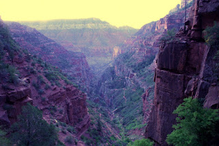

One of the first pictures that morning at first light.
 The beginning of the hike from the North Rim on the North Kaibab trail is rather steep with lots of switchbacks. It was also very dusty and you had to dodge the mule dung on the trail. It was very different to begin a hike with a long descent, and upside down hike as they are referred to. Conversation fills the time as the lack of a view other than the illuminated spot in front of your feet leaves plenty of idle time for your brain. After we reached Supai Tunnel a few miles down the light was just beginning to break through. Mules are not allowed past this point so the trail is hikers only and was much less dusty. I stowed my headlamp and attempted some early morning pictures. The view that was developing was incredible. We were in an area of intensely dark red/brown rock with a very steep switchbacking trail below us. The pictures were difficult to take as I had to prop the camera on a rock as the exposure times were 13 seconds or greater which really limited what I could take a photo of. At least now we could set off without having to look down to see where we were stepping and the views were getting better all the time.

We descended steeply down to a bridge where we could now look up the trail we had just come down and got a real feel for how steep this section is. You could see others in our party spread out along the trail by looking for their headlamps as many still had them on. It was a shame it was not an hour or so later as the views in this area were so incredible. The grand vistas of the canyon itself had not opened up yet but the view of the smaller canyon we just descended was picturesque all by itself.


The ledges.
 Shortly after the bridge we came to a section of the trail that I will refer to as the ledges. The ledges were rather wide, 4 ft. or so, with a vertical wall to our right as well as our left. The one on the right went vertically straight up, the one on the left went vertical straight down! The pictures make it look frightening but in reality we did not even notice that we were feet from impending doom as the views just kept getting better. The trail had mellowed out a bit and the descent was very pleasant. We took lots of pictures through this section and it did not look like what I had expected, it was much better!

Before long we had reached the bottom of the canyon we were descending as it merged with the Bright Angel Creek. This creek flows down to the Colorado River and we would be following it for the next 7 or so miles. There was a nice waterfall and shortly after a bathroom and water stop. Most of the group of 25 hikers wound up congregating here as we ate a snack, refilled water supplies and emptied our personal waste fluid reservoirs, our bladders!


Our trip coordinator Gayle in the blue hat and most of her crew.

Easy hiking along the bottom of the canyon.
 Back on the trail the next 7 miles to Phantom Ranch at the bottom of the Grand Canyon were magical. The trail was nearly flat and easy to follow. We were hiking along the creek and the views of the Grand Canyon were all around us. At one point the valley we were in opened up enough that we could see the Bright Angel Trail way off in the distance. It looked so far away, and so much higher than we currently were! We passed Cottonwood camp and had about 4 miles to go to reach Phantom Ranch. Somewhere in this section the valley closes up to become a slot canyon very indicative of the trails in Zion National Park. We followed along with the steep canyon walls on both sides and the creek adjacent to the trail. This was very different than the last two sections which is what is so appealing about this hike as it is constantly changing.


We arrive at Phantom Ranch.
 We finally arrived at Phantom Ranch, a destination many have been to before but typically by mule rather than on foot. There is camping and a few cabins there along with a small store for snacks and a meal if you arranged it ahead of time. We took a quick lunch break here at about 11:30AM and once again refilled with water. While it was cold up on the North Rim, we were now 5,500 ft. lower and it was getting rather warm. The forecast called for possible afternoon thundershowers and by the looks of the sky, the clouds were building and the sun was soon to be tucked away behind the clouds. Due to the heat, I was not complaining one bit about the chance of a little rain.

Our smaller group of four which consisted of Clark, Michelle, our friend Steve and myself decided to get moving. We had determined prior to our arrival that we would climb the Bright Angel Trail. Others in the group left the decision to be made on the trail. While they were deciding, we headed out as the rain looked likely and Clark and I really wanted to swim or at least soak our feet in the river.


Our bridge across the river.
 We crossed a very impressive suspension bridge that was erected to support a water pipe across the Colorado River that feeds all the water needs of the South Rim. They were nice enough to build a platform on top of it with good handrails for us hikers to cross and reach the other side. The Colorado River was flowing quite rapidly and our idea of swimming in it was not looking so good. We would have to find a very sheltered location along the river for a swim or else our hike might end with Clark and I reaching Lake Mead!


The view upriver from the bridge.
 Once on the far side of the river we found a nice rest stop with a wonderful fast flowing creek shortly up the Bright Angel Trail. We stopped here as Steve needed to do some foot repair and the rest of us wanted to soak our feet in the cold water and put on a fresh pair of socks. We took the opportunity to rehydrate and cool our feet before continuing onward. We all knew the route from here was up and the three I was with had done this section of the trail back in February. About this time we heard a loud clap of thunder which told us that the predicted weather would soon be upon us. This was all the motivation we needed to get our gear packed back up and hit the trail.

Michelle breaks out the rain jacket.


One of the great views behind us as we reached Indian Gardens.
As expected, a light rain had begun. We also reached a fairly steep switchback section as we climbed up out of the river gorge. The rain would come and go and only Michelle put on a rain jacket only to find that was too hot and the rain not heavy enough to worry about so it came off shortly thereafter. Every now and then we had to remind ourselves to stop and turn around as the views behind us were magnificent! The trail traveled a fairly open area and wide vistas of the belly of the Grand Canyon were before us. Before long we encountered more greenery and trees indicating were near Indian Gardens, a popular destination for many hiking down from the South Rim.


Steve poses by one of many signs
telling you to never go from the rim
to the river and back in a day. Hahh!!
 Our arrival at Indian Gardens was one of mixed emotions. We were that much closer to our ultimate destination, only 4 1/2 miles to go, but it also meant that the peace and tranquility we had enjoyed all morning was coming to an end. Indian Gardens is a popular destination for day hikers. There were quite a few people there wearing jeans that looked completely unprepared especially considering the return trip back up to the rim. We took a quick water and snack break and were on our way. From here on to the rim there are water and bathroom stops every mile and a half. We carried little water knowing that the next stop was not far ahead to reduce the weight on our backs during this final steep section of trail.


About halfway up the switchbacks looking across the canyon.

The switchbacks got steeper, much steeper and the rim was visible but I got a cramp in my neck looking up so high to see it! We all stuck together up to the three mile to go point where I chugged some additional water and had some electrolytes. I had a small amount of water on me as I had drank my fill at the rest stop. I set out on a solid pace, quicker than the others wanted to go. We had decided ahead of time that we would all hike our own pace to finish out the hike. I wanted to finish in under 12 hours and kept my pace accordingly. I hiked right past the final rest/water stop as I felt as if I stopped I would never get going again. As I neared the top of the rim the trail was loaded with Asian tourists as if several tour buses unloaded them and sent them down the trail. While others complained that they blocked the whole trail and they had a hard time getting by I did not experience this. While the trail was loaded with people, I think the combination of my 6'5" size, speed and certainly smell parted the visiting tourists as I sped by. I reached the top of the South Rim at 4:45PM, 11 1/2 hours after starting that morning.

I was very happy to be on the South Rim!
Reaching the rim was fantastic but now I needed to find my parents so I could get into my room. Flashbacks of finishing the Rosarito to Ensenada bike race went through my head as I finished the race in just under 3 hours and then spent the next three hours trying to find my parents in a foreign country! Lucky for me, I quickly spotted my Dad and son Eric sharing an ice cream cone in front of the Bright Angel Lodge. I staggered over to them and gave them both a big hug. I had a seat and devoured what was left of the ice cream. I told them the quick version of the days adventure while we waited for the rest of my immediate group to complete the hike. After about 15 minutes I decided I would head back to the end of the trail to keep an eye out. I discovered that I could barely walk! I stretched out my very sore muscles and regained my ability to walk.

Right on the 12 hour mark from when we started the rest of our immediate group appeared at the top. Michelle headed directly to get checked into her room while Clark, Steve and I staggered around a little along the touristy South Rim area before stumbling over to our adjacent rooms. We got cleaned up and headed over to the El Tovar Lodge to make our 7:30 dinner reservation that Michelle had optimistically placed over a month prior. We once again enjoyed a fantastic dinner and appreciated the fact that we did not have to cook it on a backpacking stove. We learned that a few hikers from our group were just finishing as some had opted for the shorter, yet steeper South Kaibab trail. Many missed their dinner reservations or were just to darn exhausted to make it to dinner. We spotted Gayle on our way back to our rooms that night. She had a bag of ice and was going to take and ice bath to relieve her tired muscles. She claimed it worked well but I much prefer the warm bath I took to accomplish the same thing!

With the whole hike complete we had a chance to compare our thoughts. We all agreed that the trip was just too short, 3 days in total, and we would much prefer to spend lots more time here exploring the area.The North Rim was an awesome experience and would have been a great place to spend a full day to really soak in all the beauty. The hike itself was not really that difficult as elevation was not a big factor. The final three miles were difficult but out of 25 miles to have 3 uphill strenuous miles is a small price to pay. The logistics of this trip were very complicated including lodging, transportation and car/gear shuttling. I cannot begin to fathom the logistical nightmare of a Himalayan expedition including flights, gear requisition and transportation and everything else that goes along with it. We just travelled to an adjacent state and it was a difficult task!

We all agreed we would do it again. Our planning was good and our equipment worked perfectly. We seem to be getting better at this stuff as we go as we are learning fewer lessons the hard way. A multi day trip through the canyon would sure be fun to explore all the other trails that are down there. They will just have to wait until we return.

Click here for the full set of photos from our trip.