Tuesday, May 11, 2010

Fabricating Your Own Alcohol Stove System


So you want to build an alcohol stove do you? Well I was faced with this same question a little over a year ago after my son won a Pepsi can alcohol stove at a Scout Fair. I was impressed with the weight but it lacked what looked like any type of self contained useable system so I began to research the topic. For a great resource I would suggest Zen Stoves.

I will save you hours of searching for a stove design and all accompanying items that make the stove a useful tool. It is not just the stove but also the pot, pot stand, windscreen and other pieces that make the system I will describe into a complete cook system. I have used it many times on day hikes as I got tired of eating a sandwich at the summits and wanted more. I have taken it on 4 day backpack trip as my sole cooking setup and been very pleased. When combined with freezer bag cooking you have an ultra reliable and ultra simple system. Best of all, your complete stove and cooking set will weigh in at about 5 oz!

I want to stress that I did not invent any of this. I have taken many peoples different ideas and refined them into this stove system. I have spent hours in my garage on rainy days testing different ideas and concepts to develop this system. There are plenty of ideas out there that sound good and even look impressive but when tested fail miserably.

The Stove and Fuel:

After much research I chose the Super Cat alcohol stove for my design. Please view this link as it provides everything you would want to know about the stove, how it works and excellent instructions on making one. I have used them with holes made from a hole puncher at ¼ inch as well as ones with holes at 3/16 inch from a Whitney punch as described. Both work just fine but I prefer the 3/16 holes as my testing proved a faster boil and less wind interference. While several variants are discussed I just use the basic supercat. I chose it because it was simple to make, does not require a pot stand or priming pan and you can easily see how much fuel you have added to it. Make sure to use the 3 oz. Fancy Feast or potted meat can as the flare fits the pot I recommend perfectly. He also provides lots of great information on fuels. I just stick with SLX Denatured Alcohol from Home Depot but I have used the Ace Hardware house brand and had identical results.

The Cookpot:

There is plenty of info out there to overwhelm you. While you can spent over $60 for a lightweight titanium mug to cook in I have found that a $3 25oz. can of Heineken works perfectly, and you get to drink the contents as well! This can is better than the large Fosters can as it is more sturdy due to the shape and the bottom fits the supercat stove better when built with the Fancy Feast cat food can. All you need to do is use a side cutting or safety can opener and remove the top of the can. It can be a little tricky and some openers work better than others. Save the top you removed for a lid or a little heavier but a great fitting lid is the top from an Altoids Citrus Sours can.

One of the reasons this pot/stove combo works so well is that the thin wall pot absorbs heat all the way up the sides giving a much larger surface area to conduct heat through. There are many people out there that like to wrap their pot with fiberglass wick or other non flammable material to keep from burning their hand when grabbing the pot. I have wrapped one with a fireproof blanket I trimmed down to cover a 2 inch wide section of the middle of the pot and as I had expected, my boil times went way up. While the fireproof material is cooler to touch, it takes away pot surface area that was transferring heat. My suggestion is to either wear a glove or use a handkerchief to keep from burning your hand on the hot pot.

Windscreen:

The alcohol stove has a drawback in that it performs very poorly with any type of wind. To counter this you need a good windscreen. For lots of background on windscreens and other wind devices visit here. One can be easily fabricated from thin aluminum roof flashing available at your local home repair store. I use some stuff I picked up at Home Depot although I had to buy a 25 ft. roll. I get the 8 inch wide roll as it covers both the stove and pot. To fabricate, simply cut enough off the roll to form a 4 ½ diameter circle with about a ¾ inch overlap (about 16 inches of material). A good pair of scissors will cut this just fine. Slightly round the corners once cut.

Along one of the long sides of the flashing you will need to punch some holes so your stove can get air to keep burning. Get out your hole punch with ¼ holes and proceed to punch holes on ½  inch centers all along one side about ¾ inch up from the edge. I tested many different openings in calm and wind conditions and found this to be the best based on shortest time to produce a boil.

Now you need a way to hold this in its circle shape as it wants to spring flat. To make this easier you need to remove the temper in the metal itself. Use some old wire (with no insulation) and make a circle with a 4 ½ inch diameter, twist the ends so it holds shape and slide it over your rolled windscreen. Place this in your oven in your home and heat to 400 degrees F. for 45 minutes and then turn off the oven and let it cool with the oven closed. When done it should keep its new curved shape fairly well.

To finish off the windscreen you need a way to hold it together to maintain the proper shape. The wire worked for the oven but needs to be improved upon for field use. I tried combinations of hardware and special slots and folds when I stumbled across a write up for the windscreen beltbuckle. This rather simple device solves the problem and weighs nearly nothing. Cut a strip of flashing about 9 inches long and ¾ inches wide. Slightly round the corners and lay it along the side of your circular windscreen from top to bottom where the windscreen overlaps. You should have about a ½ inch of overlap on top and bottom. Simply fold over the top and bottom to form a clamp and squeeze to pinch the windscreen and hold its shape. Holes can be punched in the buckle to reduce the weight if desired.

The first few times you use the windscreen it will give off a little smoke and smell funny as a coating on the flashing burns off so don’t be alarmed. It will also discolor a little and look burnt. This is normal.

Cozy:

The final item to manufacture is the pot cozy. This is the item that will help your pot retain heat once you have heated your water and keep you from burning your hand when you drink hot beverage from it. This is made from a material called Reflectix and is held together with aluminum tape or duct tape. The aluminum tape is more durable and looks more professional but duct tape can be used. For the background I have provided additional information here under Mods for your Mug, see Mod 3.

Fabrication of the cozy is explained fairly well under Mods for your Mug. You will need an 18” long piece of the 16” wide Reflectix product. Cut a 13” long piece of the aluminum tape and apply half of it to the thin, non bubble section along one edge as shown. Fold the non bubble section over and tape down. Measuring from the folded tape edge, come down 5 ¾” and cut out a piece that is 5 ¾” by 13”. You should now have a rectangular piece with the tape along one side. Fit this to your pot and trim as needed so that the edges just touch, there is no overlap and the pot can easily slide out. The pot will expand slightly with heat so a slightly looser fit is OK. Follow the same instructions to make a second one to go around the first but this time use a 14 1/2” strip of tape and cut a piece that is 14 1/2” by 5 ¾”. Complete the bottoms as shown in the link. Make sure you make the bottom on the end of your circular cozy that does not already have tape on it.

When complete, the smaller cozy will fit the pot and larger one can be either doubled up on the bottom cozy or used like a cover to slide over the top of the pot and smaller cozy to make an insulated chamber.

Accessories:

You now need a few little items to complete the whole package. You need a fuel bottle to store your fuel in. I use a flip top 4 oz. bottle from REI or Sport Chalet but any bottle with a flip top that will fit inside your pot will work. A silicone wrist band (like the Lance Armstrong yellow bands) is another item you need. This is used to place around the mouth of the pot to prevent you from burning your lip when drinking from it. You need a way to light this thing so either matches or a flint and steel (my preference) goes in the pot. Lastly, you need an eating utensil. A plastic spoon is OK but I have broken and melted a few so I now carry an aluminum spork.

That sums up the making of the ideal cook kit. I have provided instructions for the packing and use of your new stove system below. I hope you enjoy it and get as much use out of yours as I have mine. I have had my Cub Scout Webelos Den make these and the kids were very excited. You have never seen a child so excited to boil water! They also make great gifts for your backcountry friends.

I am considering offering the materials in a kit. Please contact me if you are interested.


Alcohol Stove Operating Instructions: 


This stove is a complete cookset if used as described below. No additional pots, pans or other cooking items other than your preferred eating utensil are required ( I use an aluminum spork).

Fuel:

Use denatured alcohol from the hardware store. There are other alcohol based fuels out there and you can read up on those but denatured alcohol is the most consistent from my tests. NEVER USE WHITE GAS OR GASOLINE!!!

Setup:

Remove all items from the complete stove set. Set the stove (the small catfood can with the two rows of holes) on a non flammable flat surface. You may want to carry a piece of aluminum foil to place under the stove to protect the ground but that is optional. Next you need to get the windscreen ready so open it up to form a 4 ½ circle. You should just have about ¾ inch of overlap when formed correctly. Use the long metal strip to pinch the windscreen at the overlap to maintain the correct shape.  Add an appropriate amount of water to heat in the Heineken pot and place lid on pot.

Getting it started:

Add alcohol to the stove. The appropriate amount depends on many factors including water temp, air temp, wind, quantity of water and desired finish temp. When boiling 2 cups of water in cool weather I would add fuel right up to the lower set of holes in the stove. You may be able to use less but this is a good start point and will let you see how long your stove will run for. If only boiling a cup of water with no wind you may be able to get away with half as much fuel or even less. You will need to experiment to work this out as each stove is a little different.

With the fuel added, light it and observe. The flame is nearly invisible during the day so use your hand to determine if it is lit by feeling above the stove for heat. You need to let the stove burn until you start to see little bubbles in the alcohol forming near the edges of the stove. This priming phase takes less than 30 seconds typically but may take longer in cold conditions.

Add your pot with water and lid on it to the top of the stove and make sure the silicone lip guard is removed. I would suggest wearing a glove when doing this as some flame does come up the side of the pot as you place it on the stove. With the pot in place slide the windscreen over the pot to protect everything. Make sure the row of holes around the windscreen is at the bottom. Sit back and wait for steam to come out around the lid. If you are going to heat a foil packet of meat or a can of chicken you can place it directly on top of the lid for the stove unopened. It will get warm but not too hot to damage the packaging.

Finishing up:

As this stove is very hot while running, it is suggested you let it burn out before removing your windscreen and pot. Remove the windscreen when the stove has run out of fuel and remove the pot and place in the smaller cozy (the metalized bubble wrap) that snuggly fits the pot preferably with a glove on. Once in the cozy, you no longer need a glove as the pot will be well insulated. If you are making a hot beverage, mix it directly in the pot and place the silicone wrist band around the lip of the pot to make a lip guard so you do not burn your lip on the metal pot while drinking. To keep the fluid warm for a longer period of time, add the larger cozy over the top to seal the pot inside.

Storing:

When finished and it is time to pack it up, make sure the pot is dry. You will first roll up your windscreen and slide it into the pot. Next you need to put the stove into the pot, open end up, and slide it to the bottom of the pot with the windscreen touching the outside of the stove as you slide it down into the pot. Then place your fuel bottle, matches, spork and silicone wrist band into the pot. Place the lid for your pot on top of the windscreen that extends out of the pot. Place the pot lid on the top of the windscreen extending from the pot with the lip of the lid facing down to cover the top edge of the windscreen. Place the smaller cozy over the bottom of the pot and the larger one on the top covering the windscreen and you are all set.

Tips:

 My typical use of this setup includes boiling water, pouring some into a freezer bag meal I have created (adding a can of chicken I heated on top of the pot) and sealing it and placing in the bottom of the large cozy. I will then place the pot with small cozy on top of my meal to trap it between the two. I will them make a hot beverage in the pot while I am waiting on the meal to rehydrate and warm. I will add the lip guard and drink with the whole setup in my hand. Check out freezer bag cooking or FBC as this method is particularly well suited to this type of stove.

I do not claim to be the inventor of any of this stuff, I just came up with a slick way of incorporating several peoples different ideas into one handy setup. If you like it, share it with a friend. For instructions on building one of these please see my blog at http://hikingandscouting.blogspot.com


Taking Your Child on Their First Backpacking Trip


I still remember my first backpacking trip. My Boy Scout Troop headed to the back hills of Malibu to a place called Circle X. My Dad was on the trip as well so this was our first Father/Son backpacking experience. The weather was hot, my cheap backpack did not fit well and was heavy and it was 5 miles into camp, uphill! Needless to say, I was not very excited about backpacking and it was quite a few years before I did it again.

I love day hiking and have just recently started to backpack. My boys don’t necessarily like to hike but they do enjoy going to remote waterfalls or lakes to fish in. It is all about the destination for them, not the means by which we get there. Being a Scout leader myself and having attended every training course available for a Cub Scout Leader and even some Boy Scout ones, I think I have good platform on how to put on a fun first backpacking trip.

Planning this great day started over a year ago. The family knew I wanted to get my 9 year old son a good backpack. They gave him a gift card for REI for his birthday and said it was for he and Dad to use to pick out the perfect pack. Now his name is Gregory and I happen to really like the backpacks made by…..Gregory. What kid would not appreciate a pack with his name all over it! I selected one of appropriate size for him for a big daypack or light overnighter, about 35L capacity. Now he had a pack just like Dad, although his was a little smaller.

Over the next year, we went on some day hikes and he was proud to wear his pack. The family always talked it up at how impressive it was when he wore his backpack. He did a 7 mile day hike up in Mammoth to Rainbow Falls which was really impressive. He really liked it when we went about a mile to arrive at an alpine lake we had all to ourselves. He carried his own fishing pole and gear and was rewarded with a fish. This made for a perfect day hike and really showed him the fun that could be had on the trail.

We camp all the time so the outdoors are nothing new to him. He has camped in rain, wind and cold, fortunately never all three at the same time. The Spring seemed like the right time of year for our trip as the weather would be mild. I wanted to find a place for our first backpack trip that was a short hike, a mile or two at most but still remote. I needed a place with a water source nearby so we did not have to carry much water and if this place had something fun to do once we arrived it would be even better.

My coworker Clark and his wife Michelle told me about a first backpacking trip they were going to do to Tenaja Falls and Fisherman’s Camp in the San Mateo Wilderness of the Cleveland National Forest. They would do a longer hike than what I wanted but would be visiting the falls and a wilderness camp area that sounded appropriate. I would have joined them but I was in Mammoth that weekend for a snow and ice class.

They gave me their report on the trip and the conditions at the office the following Monday. I looked at the map and figured out how I could combine a short 1.4 mile roundtrip day hike to the Tenaja Falls with a 4 mile roundtrip backpack to Fisherman’s Camp. The whole trip would be following a flowing creek and the waterfall had a great swimming hole. I faxed off my application for an overnight permit and got it back approved. The trip was on!

I invited some friends and Gregory’s Uncle Jeff. They both have dogs and my son enjoys being around dogs, just not picking up after them which is a reason we don’t have one. Our friends would join us for the first part of our trip, the day hike to the falls and back. Gregory and I were on our own after that.

Two nights before the trip I had Gregory sit with me as we both loaded our packs. He got out his clothes. Before putting them in his pack I explained to him that we are not out there to smell good or impress the girls with our good smells and clean clothes. We ditched about half of the clothes he had selected. We would be doing freezer bag cooking so both headed to the kitchen to assemble our meals, some of which we created ourselves and others from some recipes I had recently used myself.  He carried his sleeping bag, clothes, ten essentials, alcohol stove he had made, snacks, a deck of cards and mini chess set. I carried the rest. His pack was around 15 lbs. and mine was, well……more.

After a very scenic drive we arrived at the trailhead to the falls. We all headed up the short trail and enjoyed the falls. The dogs played in the water, I jumped off the rocks into the swimming hole and Gregory enjoyed wading and laying on the rocks. We packed in a hearty lunch and enjoyed about 3 hours goofing off. We headed back to the car and said goodbye to our friends. As they drove off, Gregory and I put on our packs as it was time to start our first backpack adventure. It was about 3:00PM and I figured we could cover the two miles in about 1 ½ hours tops, at kid speed with plenty of breaks.

The hike to Fisherman’s Camp was gently downhill. The trail alternated between sun and shade and several creek crossings needed to be done. We even came across a family we had camped with before on the trail, the only other people we saw on the way into Fisherman’s Camp. We took frequent rest breaks and drank plenty of water. Since I had all the water, I was happy to drink it as it meant a lighter pack for me. We had great Father/Son chat and enjoyed our hike together.

We arrived at Fisherman’s Camp a little after 4:00PM. Other than another father/son group about a ¼ mile away, we had the whole camp to ourselves. As the following day was Mother’s Day I guess this was not a popular weekend. We saw what looked like the perfect camp site. Before pitching our tent we evaluated it under the Leave No Trace principles and deemed it to be an appropriate location. Camped out under a nice oak tree with a log for sitting on and a couple of flat rocks to use as a table with a small meadow surrounding us, we were ready for the evening.

We headed to the nearby creek (100 ft. away of course) and pumped water with our water filter to purify it. We headed back to camp and began our dinner prep. We figured out how much hot water we needed for our meals. We were trying a new experimental recipe we developed, stuffing with chicken. We also had another favorite, chicken gravy rice. We boiled our water in homemade alcohol stoves. I have been using one for sometime now but Gregory made his when I had his Webelos Den make them as a project to earn their Craftsman Activity Pin. We boiled our water and poured it into the freezer bags with our dinner. We waited for them to hydrate properly and dug into them. We both agreed that our new chicken stuffing creation was the best of the two and that with some dried apples tossed in it would be even better the next time.

We played some cards and Gregory did some whittling. I taught him how to tie some new knots. We decided to brew up some hot cocoa for dessert. Out came the alcohol stove for more hot water. We enjoyed our hot beverage consumed from our Heineken beer can we use for a pot with a silicone wrist band at the top to keep from burning our lips. I asked him if he was having a great time and he enthusiastically replied “Yes!” It was now about 8:30PM and time for bed as we had an early morning start ahead of us. We had promised Mom we would be home as soon as possible on Sunday and should be home for lunch.  

Upon crawling in the tent I discovered that the old insulated air mattress from 20+ years ago had a hole and provided about nothing for comfort. Gregory had a ½" closed cell foam mat that I had been using lately but I decided to carry the heavier “more comfortable” air mattress that now did little for comfort or insulation. It was a cool night and Gregory got a little cold but I had him put on his fleece jacket and we snuggled a little closer and went back to sleep.

By just before 7:00AM we were both up and I was getting water going for our quick oatmeal breakfast. By 8:00AM we had camp packed up and checked to make sure we left only footprints behind. We headed out on our 2 mile trip back to the truck. We took some pictures and talked about the fun we have had on this trip. The time passed quickly and I could tell he was ready for this. We got back to the truck at 9:15AM and took our packs off. I asked him if he would like to do more backpacking similar to this in the future. I was full of joy when again he replied with an enthusiastic, “Yes!”

My master plan had paid off! It was nearly a year in the making but I now have a child who is happy to go backpacking with me. We discussed possible locations for future trips and instead of the usual frown when I mention hiking I was seeing a smile. Now I just have to repeat this in a few years with his younger brother and I am set! We even made it home by 10:45AM for Mother’s Day and all went out to lunch together and off to my Sister’s for a family gathering that evening. If anyone knows how to get Mom to join us in all the fun let me know as I have not figured that one out yet?

Friday, May 7, 2010

My Foray into Snow, Ice and Mountaineering

As my day hiking adventures continue, I have discovered there is a whole new world out there awaiting me, snow and ice. I made my New Years resolution for 2010 to get more involved in snow and ice adventures other than skiing. I celebrated this by ringing in the new year by climbing San Jacinto Peak on snowshoes on New Years Day. Unable to stop at just that, I needed a new goal.

Over the winter I did plenty of local skiing and even got in a trip to Mammoth. While there I found a few opportunities to cruise the local golf courses in my snowshoes to get more familiar with them. I made a few trips into the local mountains of Orange County during our cold winter and found some snow up there but nothing that required anything special.

I had added new gear to my collection over the past year to prepare for what was ahead of me. I picked up mountaineering boots, crampons (spikes for your boots), snowshoes, mountaineering helmet and lastly, the icon of mountaineering, my ice axe. With all this gear comes plenty of learning. I did not want to be the guy who bought all this stuff only to die on his first trip out as he had no idea of how to use it. I needed some experience and some professional training.

A good friend of mine, Edd, who I met through the Orange County Hiking and Backpacking Club, was already a regular in the winter sports. Edd is an instructor for the Sierra Club’s Wilderness Travel Course and was willing to invite me to join him and some other mutual friends on a trip up the Mt. Baldy Bowl. After reading up on winter mountaineering skills and bringing my mountaineering boots, crampons, helmet and newly acquired ice axe we headed up for one of Edd’s famous “Brunch on Baldy” hikes which he tends to host year round. I learned a lot of the basics that day. The glissade down the Baldy Bowl was incredible (sliding on your rear using your ice axe as a brake) and I practiced self arrest, the act of stopping your fall through the proper use of your ice axe and body position. It was a great introduction but I realized I wanted….and needed more.

The beginning of May I attended my first professional instruction. I headed up to Mammoth to attend a course put on by Sierra Mountaineering International, or SMI, headed by two-time Everest summiter and worldwide mountaineering guide Kurt Wedberg. On day one, seven of us were joined by one of SMI’s experienced instructors for the Snow Travel course. This gave us instruction and lots of practice with using our ice axe in self arrest, ice axe travel across snow and ice covered slopes, roped travel with and without running belays and other general topics relating to travel in snow conditions. I chose to stay on for the second day which covered snow anchors and crevasse rescue techniques. When I asked how many other students would be staying for day two I heard nothing but silence. I was informed that it was just me and that Kurt himself would be teaching the class.

Day two was incredible. It is not every day that you get private instruction from a mountaineer as recognized as Kurt. We built different snow anchors all morning and set up crevasse rescue systems all afternoon. I learned a lot. I can comprehend plenty when I am interested in the topic and Kurt crammed in all the information I could hold. He was nice enough to take a few photos to help me remember but we were so busy with just the two of us that pictures were again not a priority.

You must be thinking by now, “Glenn must have something up his sleeve to put in all this training and effort”, and you would be correct. My plan is to summit Mt. Shasta, the northern most fourteener in California on my 40th birthday. I have made such a transformation in my lifestyle over the past 3 years. If I am going to have my “over the hill” birthday then it had better be a hill with a 14 at the beginning of it!

Keep an eye out for my future report on a first timers trip up Mt. Shasta.

Friday, April 30, 2010

Havasupai, Grand Canyon


Havasupai Backpacking Trip, April 2010


While on a recent visit to one of our clients we got sidetracked onto the topic of hiking. I shared my Mt. Whitney stories and she shared that she enjoys an annual trip with her daughter’s church group to the Native American reservation of Hualapai. This is commonly know as Havasupai and is located in the Grand Canyon. I have heard from others about this mystical place as it is famous for its’ waterfalls and lush green Garden of Eden like appearance. Upon my return to the office the following day I looked at my schedule and realized I was already going to be in Vegas for a convention so why not tag this onto the end of the trip to make it a really fun week of adventure!


Booking my reservation proved to be a trip back in time. No online reservations here, just a list of four phone numbers that you keep calling until you get through. Fortunately I did get through and was very lucky to be able to book a four day reservation for the campground as this place fills up fast. Going in late April made it easier as most people wait until the warmer months….. more on that later. I made a reservation for 8 which is the limit per campsite as I knew I had friends that would be interested. I put out an email at noon to my hiking friends and let them know of my plans. By the time I returned to work the following morning all of the slots on my trip were filled and I already had a waiting list!

Now until this point, my recent adventures have all been day hikes. I had not backpacked in about 20 years so I was new again to this sort of thing. The hike consists of a 10 mile descent from the rim of the canyon, known as the Hualapai Hilltop, to the campground. Many people hike in and have mules carry their stuff down. Some even take a helicopter as they run this service a few times per week to transport bulky items to the village of Supai that sits down in the canyon, 8 miles into the hike. Since we all think we are tough, no mule or helicopter was going to haul our stuff. We would lug our 50 lb. backpacks and all our food ourselves. Our plan was to hike in on day one, spend the next two days exploring and swimming, and hike out on day four.

Starting our adventure.
The morning finally came for us to meet up at the Hualapai Hilltop to begin our adventure. We did very well with three different cars all traveling from different locations to meet up at the hilltop with 5 minutes of each other. There was one strange occurrence however, it was snowing! Late April in Arizona along the South Rim of the Grand Canyon and it is snowing. Thankfully my hardy group of hikers embraced the elements and we all thought it was an awesome experience. We layered up and down we went.

The hike down was very scenic. The weather made it even more interesting. The beautiful scenery was occasionally interrupted by the 2 helicopters that appeared to be running the Supai Airlift, making trip after trip and even carrying cargo suspended by a cable underneath. The weather kept changing as we had snow, hail, sleet and rain that day. We checked in at the village of Supai and continued on down a few more miles to the campground. The heavy packs were beginning to get to some of us but the end was near.

As we neared the campground, we came to Havasu Falls, the first of the spectacular waterfalls. The water was a bright blue/green color and this is because of the high lime content in this spring fed river. The roar of the water and spray were quite impressive but as we were a little tired and the campground so close, we decided to press on and explore this another day. This turned out to be an excellent decision. After we explored the campground area, which is about a mile long, we settled in on a site that was plenty big enough for all our tents, adjacent to the river, and had bathrooms close enough but not too close. As soon as we had completed setting up our tents, another rain shower was upon us. We all quietly retreated to our tents, got out our sleeping bags and other gear, and once I realized this was not blowing over anytime soon, I took a nap. The camp was very quiet, especially since we had learned that about ¾ of the reservations for that day had been canceled due to the weather.

The rain cleared out and we all resurfaced from our tents. Apparently I was not the only one who opted for a nap. It was nearing dinner time so we all gathered our food and stoves. We had a few couples sharing meal plans but those of us that were without our significant other did our own food. I was using my homemade alcohol stove and cooking entirely in freezer bags. This is a fairly new concept and is the ultimate in light weight. It also means no pots to clean! All I do is boil water, pour it into my freezer bag with one of my homemade creations such as cranberry chicken couscous or chicken gravy rice, seal the bag, let it sit for 10 minutes in an insulated container, open and eat. Others grated fresh parmesan and sliced fresh garlic for their pesto spinach pasta with salmon. We had a wide variety of meals and there was plenty of sharing so meals were a fun event. One friend even brought a cake with frosting and candles as she just had her 47th birthday and my 40th was a month away. We celebrated our birthdays and enjoyed the heat given off from the candles before blowing them out and enjoying this rare backpacking treat.

The following morning most of us decided that since the weather was again going to be cold and a chance of showers that we would attempt to hike all the way down to the Colorado River and back. This would be an eleven mile hike round trip from our current location. We are all strong hikers and can average 3 MPH with light packs so we figured we would go for it.

Just below camp we came to Mooney Falls and the Mooney Cliffs. WOW!!! What a picturesque location. I could already tell our plan was in jeopardy as the views were so stunning we kept taking pictures. The descent down the face was exhilarating. It was fairly routine until we got to the sign that said, “Descend at your own risk”. At this point you are climbing into what looks like a mine shaft with steps carved into the rock. As we exited the cave, the falls are directly in front of you and plenty more pictures were taken. Through another cave and descent along some steep cliffs with chains for handholds and we were in the spray of the falls. It was wet and slippery and the final bit of the descent was on an old aluminum ladder. One in our party knew this was not for her and she stayed above to explore Havasu falls and relax.

Jason descends into the abyss.
Once down at the bottom of the Mooney Cliffs the falls were incredible. The roar and spray was intense and our camera lenses were quickly dripping with spray. Since it was a little cold, we headed downstream to get away from the spray and make our way toward the Colorado river. We headed down river on a trail that then crossed the river. We put on our water shoes and while most crossed, two of us headed right down the middle of the river. It felt so good to be walking in this lush, green forest with the blue/green water flowing all around us. Little cascades of water were every few hundred feet as we traveled downstream. We were not making very good time in the river but the pictures we were taking were well worth it. We finally met back up with our group that was taking the trail after they had paused to wait for us. It was slow going as following the poor excuse of a trail was difficult. We were keeping our eye out for Beaver Falls as our next landmark, not sure of what it looked like and wondering if we might have passed it.

Beaver Falls area.

Taking it easy at Beaver Falls
We finally arrived at Beaver Falls. More of a series of impressive cascades than a fall, it was still very pleasurable. As the sun had poked out and it was just after noon, the thoughts of another 6 or seven miles at this snails pace seemed unlikely. A few us decided Beaver Falls had everything we needed, a great view, an awesome swimming hole, a rock for some jumping in the water, and some sun. Three of us stayed put while the rest headed downriver to attempt the Colorado River.

The water was cool, but the breeze and air temp made it cooler. We lost the sun just about the time we got in the water. We still had a great time and about an hour later the rest of our crew returned and reported that the trail got a little to difficult and sketchy to follow and that they were not comfortable on a 40 ft. high narrow ledge attempting to make it downriver and opted to return. We all swam a little and decided it was time to head back to camp. A little rain shower, a trip up the Mooney Cliff’s and were back at camp for afternoon snack around 4:00 which kind of rolled into dinner. As the forecast for the following day was for sun we decided we would swim the next day.

Nature's shower, a short below Mooney Falls.
Hard to beat this for backpacking!
Me standing at the base of Mooney Falls.
Saturday morning and the sun was out! It felt good after the last couple days of clouds and wet weather. We had so much fun the day before we headed back down the Mooney Cliffs only this time it looked like a day at Disneyland. People were everywhere! Our private Garden of Eden had been overrun with people. The trip down the cliffs took much longer as the hoards of people with the same idea were ahead of us. Fortunately, most of them were drawn to the falls like an insect to a bug zapper. We headed downstream about half a mile and found a creek that flowed into the main river. We followed it and found the most impressive small waterfall we had ever seen. It looked like natures shower! This section of the river offered us our private waterfall, a sandy beach, a cave to set our packs in, a small swimming hole and cascade, and most importantly…..SUN! We spent hours here just taking it all in, swimming, sunning, eating, etc. After about 3 or 4 hours of this paradise, we decided to explore the area up the creek that was providing this wonderful waterfall. We had a great time and wound up in a canyon that dead ended, full of ferns and frogs and peace. It was time again to return but not without venturing into the spray of Mooney Falls.

Exploring the side canyon.
As it was getting later, the masses of people had thinned at the falls. We headed straight out into the pool at the base of Mooney Falls. The roar of the falls was deafening and the water spray was like being in a hurricane. We would not make any more forward progress into the falls head-on so we turned and tried to back into them. We were able to gain another foot or so. We were laughing and yelling with excitement so hard. I cannot explain what made us all have this feeling of laughter but it touched all of us. The wind must have changed the direction of falls a little as all of a sudden we were all swept off our feet and shot out to the side of the falls. What an incredible feeling! The power of nature can be overbearing and this was a great example. We swam in the pool a little farther from the falls and decided to call it a day.

That night we all had a plan. Eat everything you brought so you did not have to pack it out in the morning. We still had to carry out our trash but the less food we had the better. We all made a trip to the local spring to top off our water supply as in the morning we wanted an early start as it again would be sunny and the hike out only gets hotter the longer you wait.

By 7:15 AM all but two were ready to leave. Since they had their own car and were traveling by car to the main Grand Canyon for another day of fun we left them behind. One friend started at about 6:00AM as she was having troubles with her pack and wanted a head start. She was thinking of paying the $20 to have the helicopter haul her pack out but since the choppers did not start operation until 10 AM with no guaranty as to when her pack would make it out, she just headed on up. It was much hotter, and the packs did not seem to loose any weight. Not sure how all that food did not seem to lighten the pack at all! We asked some hikers coming down if they had seen our friend who started early, apparently it is hard to miss a lady in a plaid kilt and a cowboy hat. They confirmed she was ahead of us so we kept up the pace. The last 1 ½ miles are where you are in full sun and have the bulk of the elevation gain of the hike. This was difficult but doable. About halfway up I saw our friend who got the early start. We actually caught up to her about 100 yards from the finish.

We got back to our cars around 11:30 , put on some fresh clothes and drove an hour or so to the nearest town, Peach Springs AZ, for a sit down lunch. We are all healthy eaters but you would not have known it by looking at what we ordered. Chicken fried steak, fry bread taco, nachos, burger and fries, basically enough calories and cholesterol for a week! I asked what are we going to do to top this? One friend chimed in and said he would put together a trip to the Narrows in Zion National Park for next summer. I have some other plans coming sooner, keep looking at this blog for future adventures.

Pictures from Havasupai are here!

Thursday, April 29, 2010

Spectrum Business Centers Mt. Whitney 2009 Adventure

Personal Goals and a Mountain


Several years ago I was a couch potato. I enjoyed the outdoors but really did not get out and explore it like I once did as a Boy Scout in my younger days. A 1 mile trek from the car was about as far I was comfortable doing. One day a friend of mine told me about a great hike she just did to Santiago Peak, the highest point in Orange County. It was about 17 miles round trip and just over 4,000 feet of gain. I told her I would love to do it…..sometime….. but if I tried it now it would probably kill me! She laughed.


The thought of exploring these great mountains right in my own backyard was very appealing. I had wanted to drop a bunch of weight I had put on since college. The married life, home ownership, daily work and children were my excuse not to exercise. I knew I wasn’t eating healthy and the combination brought me to just over 300 pounds! Mind you I am 6’5” but still, that is a lot of extra weight! The defining moment was here. I decided right then that I was going to get in shape and the time to start was right now!


The following morning I started walking. Three days a week I would walk for an hour and a half. I cut drinking soda down to one a week instead of several per day. I cut back on my portions, ate healthier items and only had French fries once a week. After about 6 weeks I visited the doctor for some minor ailment and when they weighed me I was down 30 pounds! This is unbelievable! It made me work even harder. Soda fell back to one every two weeks, french fries as well. I ate more salads, focused on eating more fiber and fruit, and upped my exercise. I started swimming, biking and hiking in the foothills. If I ever found a spare moment I went for a walk or a bike ride. I had to buy new clothes a few times as I kept shrinking. What a great feeling this was.

I ran into that friend after I had been on my exercise plan for about three or four weeks. I looked at her and I said, “At the end of the summer, let’s hike Santiago Peak together.” She smiled and said, “Sure, lets do that.” I am sure she was thinking here is yet another person making an empty promise. I told her what I had been doing and she invited me to join her hiking at Whiting Ranch where she and her husband were training to climb Mt. Whitney, the highest point in the 48 states at 14,495 ft. located near Lone Pine, CA just off of Highway 395 on the way to Mammoth. They planned on doing the 22 mile round trip journey in a single day. “Wow”, I thought. I sure would like to do that ……someday.


The following summer not only had I hiked to Santiago Peak, but also the second highest in Orange County, Modjeska Peak. I had also tackled San_Jacinto_Peak, Mt Baldy and Mammoth Mountain, all over 10,000 feet. It was during the month of August in 2008, just over a year after I started hiking that I first climbed Mt. Whitney along with my friend who got me started in all of this. Out of our group of nine that year only three of us made the summit which statistically is average as only 1/3 of those who start the climb on a single day attempt make the summit. That year was very special to me. Tears rolled down my cheeks as I approached the summit as not only had I accomplished making the summit, but I also accomplished something even bigger, returning myself to an active and healthy lifestyle. Including the three pounds I lost climbing Mt. Whitney, I was down a total of 95 lbs. from where I started. I was so skinny people who hadn’t seen me in awhile asked if I had gotten taller or asked me if everything was OK. Not only was everything OK, I had never felt better in my life!


Once you get the hiking bug in you it is something you just cannot shake. I met a lot of friends through the Orange County Hiking Club as a group of us regularly hike in Turtle Rock near Irvine to stay in shape. Many of them were interested in climbing Mt. Whitney as well. Coworkers had been following my exploits and were interested as well. My good friend, Mike Davis, who I have worked with for 17 years had gone through a similar lifestyle change and was interested in tackling Whitney. It did not take much effort for the two of us to get on board our fellow coworker Clark Elek who we have both worked with for over 15 years. That was three of us ready for a summer 2009 ascent and plenty of others who were interested.


Mt. Whitney is a very popular hiking location and a special permit is required to hike the mountain. Only 50 people per day will be issued permits to climb the mountain in a single day during the summer months. You must enter a lottery with the Inyo National Forest Service in mid February and will not find out until mid April to early May if you even have a permit. After studying the permit process I learned that the mid week dates are easier to get than weekend or Friday/Monday. Also, all the books say that the weather is least likely to interfere with your climb in August so that is when most people shoot for. Knowing this, I applied for permits for the end of July and requested Monday July 27th as our primary day and the following two days as alternates. I applied for a total of 12 permits as I had plenty of friends who were interested and were in good enough shape that with a little training I knew were capable.


The next few months went by ever so slowly. To make matters worse, the credit card I had used to pay for the permits had been cancelled and a new card issued by the credit company. Now I am wondering, “If they do select me in the lottery and my card is declined, do they move on to the next person or do they contact me?” Worse is that they take no phone calls from April 1 until April 15th while they work out the whole lottery stuff. I followed the message boards and some people were already getting permits and seeing that their credit cards had been charged in early April. I kept waiting, fearing that if selected I had been passed over. On April 16th I called and got through to someone at the Forest Service and trying not to be rude I let them know that I was not calling to see if I was selected which is a big no-no but rather to see what happens to a person in my predicament. Fortunately I was informed it happens all the time and that they will call me to get a new card number. Well I dodged that bullet but I still do not have permits.


It took until early May, with me reading the message board posts saying the Forest Service has completed the lottery process, before my wife called me with the good news. We were selected for our primary date and we have 12 permits being reserved for us! I never knew being a group leader meant this kind of pressure! I expect that up on a mountain but not this early in the planning. When I got back to the office I sent out the email I had typed up several weeks prior to let all of my friends who had showed interest that the trip was on and let me know ASAP so I could reserve a slot for them.


My coworkers Mike and Clark were as excited as I was when I returned to the office. Clark’s wife had been thinking about it and for her it proved a good reason to stop smoking. She was in! Rather quickly my friends started replying. Some had other summer plans already and others were on board immediately. I laid out a rather extensive list of training hikes and required reading for my team as I wanted everyone to follow the Boy Scout Motto so engrained in my brain, “Be Prepared”.


We began our almost weekly high altitude training hikes that were supplemented by everyone’s personal training/fitness regimes. Every weekend I said goodbye to the wife and kids for a day and headed out with our team. We really were becoming a team which was great. We all knew who routinely carried what, who were the fastest and strongest, who had altitude problems, who was best on uphill, downhill, rocky terrain and flat. The team consisted of coworkers and spouse Mike, Clark and Michelle, hiking club friends Alisa, Ros, Lyn, Alex, Alex II, Kevin and Rick and a Scout parent and friend Greg who was the only other one to have summited before but as a two day trip. Our team was 8 men and 4 women and included at least 5 of us who had recently battled weight loss, a smoker on the path to quitting, an ex-pro football player who suffers from altitude sickness and a few with a fear of heights. I am sure you are asking if this is the best team I can come up with? The answer is not just yes but it was the best group I have spent so much time with ever.


Training hikes took us to every 10,000 ft. plus peak we could trek to in a day in Southern California. We did Mt. Baldy several times by different routes, San Jacinto several times by different routes, San Bernardino Peak, Mt. Baden Powell, and finished with a 22 mile hike to San Gorgonio and Jepson, the two highest points in Southern CA. It is important to spend time above 10,000 feet to get your body used to the reduced amount of oxygen you will encounter on Mt. Whitney. You learn how your body adapts, or fails to adapt and what your personal issues are in this environment. Headaches are common, upset stomach, lack of energy and other issues are also possible. There are drugs to help with these issues such as Diamox but as always they too have their side affects.

With just one week to go I headed with my family up to Mammoth Lakes to spend some quality time together. It doubled as acclimatization as I was 8,500 feet all week with hikes to 11,300 ft. on a couple of occasions. The rest of the group was to head up to the Whitney Portal Campground at 8,500 ft. just outside Lone Pine, CA on the Saturday before our climb. While there, they would do some easy hikes to around 10,000 to 11,000 ft. to be ready for Monday’s big adventure. Just to emphasize how important all this training is, while our group was acclimatizing at Horseshoe Meadows around 10,500 ft. the day before the climb, a Long Beach resident lost her life on nearby 14,000+ ft. Mt. Langley. She had become separated from her group and was not properly prepared for the ice she encountered. Her group had radioed her and told her to stay put and they would be down to help. Unfortunately she tried to cross the ice without appropriate footwear, she slipped and fell over a thousand feet and was killed. I believe it was her thought process that was affected by altitude that was a major factor in this mishap. We learned of this upon our return from our trip. This was another reason for all the training. We never let people fall behind the group without someone else there to assist.


While up at the campground you meet plenty of people that are either going up the mountain or have just gotten down. Clark’s wife Michelle asked several ladies coming off the trail how they enjoyed the experience. As a new non-smoker Michelle was a little concerned about the physical toll it would place on her. Unfortunately the first person she asked said it was the hardest thing she had ever done and that it was not fun. Fortunately Michelle followed up the question with, “What training hikes did you do?” The answer was a short one, “Baldy” was the reply. Even Michelle could instantly tell this was the story from an unprepared person. One hike to 10,064 ft. probably by people who took the ski lift halfway up is not even close to the level of our preparation. The next day she would know the real answer.


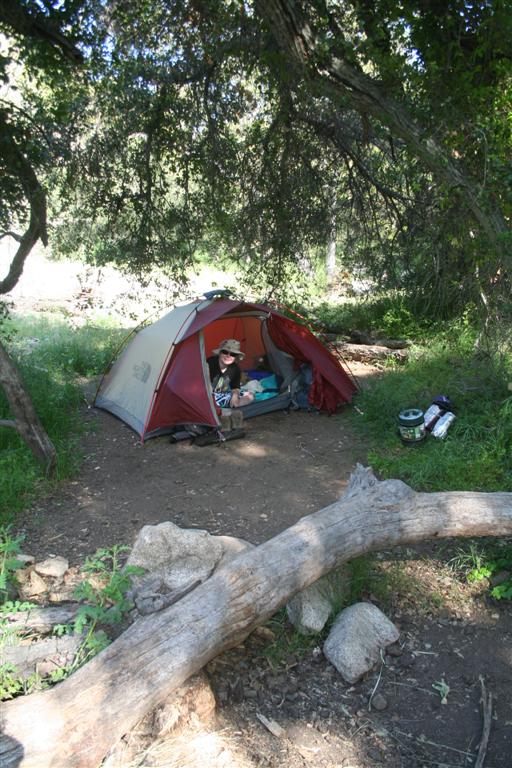
I rolled into the campground and was dropped off by my family. Mike had brought his son Patrick along to enjoy the trip although he had no intentions of climbing any mountain. Patrick greeted me and gave me the lowdown on where everybody was. We were lucky to have reserved a group campsite back when I applied for permits as there are only 3 such group sites available that book up months in advance. When everyone returned from the days excursions I realized we were missing one. Unfortunately one of our twelve made it as far as Ridgecrest before she had to head back for a family medical issue. So we were eleven. Clark and Michelle had stopped at the Forest Service office earlier in the day and picked up our permits and “WAG bags”. Essentially, you must pack out everything from the trail, including human waste which is why you are issued a WAG bag complete with instructions. We shared stories, handed out permits and WAG bags and headed to bed early as we were to get up around 2:15AM to try to be on the trail by 3:00AM. Due to some noisy folks that rolled into camp sometime around midnight we did not sleep much. I got a whopping 2 hours but then woke up with my mind racing through the excitement the day would bring. I was up from 10:30PM until I got out of my tent at 2:00AM to start getting ready. I began waking up the team at 2:15AM as scheduled. We all had plenty to get ready, food to prep, water to top off and breakfast to eat that we were all rather quiet. I gave a glow stick to everyone so that we would be easier to identify in the darkness on the trail.


We all got into our cars around 3:15AM and headed up the road a mile to the trailhead which had a fair amount of activity. Everyone had their headlamp on plus our team all had a glow stick which really helped to identify them in the darkness. We did our best to snap a couple of pictures in the darkness at the start, most of which were too blurry before we headed out at 3:30AM. I gave a final speech before we set off reminding everyone that it not a race and take their time and most importantly, take lots of pictures! Off we went. Only 22 miles and 6,000 vertical feet before we are back at this location again, later today……we hope!


The beginning of the hike takes you up quite a few switchbacks as you climb out of the Mt. Whitney Portal area on your way to Lone Pine Lake, about a third of the way to the summit. In these dark hours we crossed several creeks. We were very careful as none of us wanted to fall in and hike the rest of the way in wet clothes. Our group was rather chatty in these early morning hours as the thick air left us with plenty of breath to spare. You could see other headlamps above and below us zigzagging up the switchbacks and could occasionally hear large amounts of water flowing just off the trail in the black of night. We caught up to another group of about a dozen people that had the same idea we did with the glow sticks and looked like a multicolored train ascending the switchbacks. I tried to get a picture of it but again the lighting was terrible and it did not turn out.


Just under 2 hours later we arrived at Lone Pine Lake and more importantly, “The Mt. Whitney Zone.” A sign along the trail indicates that beyond this point a special permit is required. That would be those permits I worked so hard to obtain months prior. This was a planned rest stop to regroup as I did not want to get separated in the dark. We were all pretty much together anyway so it only took a few minutes to gather everyone. We all took a few group shots in the dark, of which only one looked any good, and proceeded onward.


Shortly after the stop at the Mt. Whitney Zone sign, the first hint of daylight blessed the night sky. The view to the East was inspiring as we looked out of the deep ravine that the Mt. Whitney Portal sits in. Granite cliffs on either side appeared as giant black shadows with the glow of the sun just bringing some color to the sky. We all stopped to take in the beauty. After that was a trip through a lovely meadow with creeks flowing all around the trail which signaled that we were close to Outpost Camp. This is a camp used by many people that make the trek over two or three days. I am certain we woke up a few people there as our conversation was picking up as the sun rose and the views just kept getting better.


We blew through Outpost Camp heading to our next designated stop, Trailside Meadow. This is a little past halfway to the summit and I remembered from last years journey that it makes a very comfortable rest stop with good access to water. At this point we had gotten a little separated, partly because part of our lead group (non picture takers) had made a wrong turn on a poorly marked section of trail just before Outpost Camp at yet another creek crossing. I, thinking I had fallen way behind while taking pictures, stepped up the pace to reach Trailside Meadow expecting the rest of the group to be waiting. To my surprise, I was the first one there. Now I know I had described this location in detail to the group, made them aware that this was the next stop and for goodness sake there is a sign marking it as “Trailside Meadow”. Had they blown through it? Greg is with them and he has done this before so they must know this is the place. Following the plan, I dropped my pack, grabbed some trail mix and started pumping water. Within about 10 minutes the rest of them rolled on in and informed me of their slight detour. It sure was nice to know we had a plan. I could already see the less prepared having a big issue with this. We still had not even turned on our radios of which we had 3 on the trail and one with Patrick down at base camp.


Pumping water was the next order of business. Unfortunately, gone are the days of just scooping water out of a stream and refreshing your thirsty desires. While many say it is safe, I have had a case of Guardia in the past while rafting the American River and do not wish to repeat the experience of gastric distress. We had several water filters among the group to pump water out of the creek with and into our water bladders. Last year I had run out of water with two miles to go to the summit. I had to fill my water bladder with snow very near the summit, thaw it against my body to get it into liquid, drop purification tablets in it and then wait 30 minutes more. That process took about 3 hours from getting snow to drinkable water and I was not going to repeat that this time! This small meadow is the last patch of green you see until your return trip back to this point. Above here, only rock and lunar landscape will be seen. An occasional flower is spotted clinging to life sticking out of some crack but it is the very rare exception to the other worldly view above where there is not enough oxygen to support normal plant life. We woke up Greg as he likes to nap at every stop. He knows he does not handle altitude well and the worst is still ahead. With packs back on and more pictures, it was time to move out.


Our next regroup point is Trail Camp. This is another of the camps used by two and three day trekkers. Rock shelters from the wind abound as prior visitors have created these to sleep within the confines of a wind break. Today was nothing but sunny skies and no wind. Another break is taken and Greg takes another nap. I advise everyone that just ahead is the last reliable source of water so evaluate your water supply and plan accordingly. Last year I missed this as it was still frozen up in the early morning and the flow was so little I did not even notice it. This is also the final stop before you begin the infamous 99 switchbacks. There is debate as to whether there are 98, 99, 100 or 101 but it really doesn’t matter. It is a long climb of never ending switchbacks from 12,000 ft. up to 13,600 at what is know as Trail Crest where you have reached the ridgeline of the Sierras. We woke up Greg and headed out.


Shortly into the switchbacks we hit the spring that eluded me the year prior. About half of us stopped to fill up and the rest continued onward to our next designated stop, Trail Crest. We slowly made our way up the 99 switchbacks. Counting them would be too depressing so I just chose to look out at the amazing view before me. More lakes were visible down below and you could view plenty of other hikers that looked like ants among this vast mountain terrain making their way up. Conversation was nearly non existent. Every little bit of oxygen went to those leg muscles that were screaming for more. An odd thing happens here in the thin air. You may be panting for air but unlike at sea level, your heart is not racing. A slow and steady pace is what is required at these altitudes when climbing. Our pal Greg started to really feel the altitude sickness setting in. Being an ex-pro football player he has an ability to push his body with his mind far beyond what I could ever hope to do. He lightened his load as we call it (vomited) about three times as documented by Clark and Michelle and pushed on. About ¾ of the way up you come across a section known as the cables. These cables were placed there many years ago to provide a little help as this section of the trail can get very icy, even in the summertime. A little snow and ice was present but not enough to cause any alarm. As I stopped to take plenty of pictures I was now in the middle of the group.


Once I hit Trail Crest at the top of the 99 switchbacks the incredible view of the Sierra’s and Sequoia National Park opens up to the West before your eyes. This marks the end of the hardest climbing but you still have 2 miles to go. We regrouped and took a food break here. Many pictures were taken at this most picturesque location. Alisa decided she would eat her foot long turkey sandwich which made us all envious. I grabbed a PB&J out of my pack and some electrolytes. Not quite the same as the turkey sandwich but it will do. It was about 10 when we rolled out of there. Not bad really, 9 miles up 5,000 vertical ft. in 6 ½ hours. We woke up Greg (as usual) and headed out.


The final two miles to the summit are full of incredible views, steep drop off’s, narrow trail, basically fear factor on steroids! Along this path is the unmarked route to Mt. Muir. I had studied the route to the top and thought if it was early enough and I had enough energy left in me, I would grab that on the way back and make it two fourteener’s (the name for the peaks over 14,000 ft.) in a day. As you near Mt. Whitney along this rock strewn poor excuse of a trail you come across features known as the windows. These are areas where the trail narrows to just a few feet wide and crosses what seems like a bridge with a cliff on your left and a deep vee shaped opening in the rock on your right, with the obligatory sheer drop. They provide some incredible picture taking opportunities for some or sheer terror for those with a fear of heights. In Greg’s trip a few years prior, his partner crawled across the trail in these sections just to give you an idea on what this does to your mind. Near the final window the summit of Mt. Whitney becomes visible. At this point your motivation changes from “what a beautiful adventure” to “please let me just get there”! Along the back of the summit we hit a small patch of snow about 50 feet in length. Fortunately the snow had softened by this time and it was easily passed. If it was iced over this could have provided an obstacle too risky to cross as none of us had brought crampons, metal spikes to attach to your boots, to cross such terrain. A slip in ice could have meant a slide down several hundred feet or more of snow and ice covered slope with only jagged granite to catch our fall.


We all straggled onto the summit between 11:00 AM and 12:00PM with me in the middle. A stone hut built 100 years ago by the Smithsonian still stands and houses some scientific measurement devices. A sign on the door reminds you not to seek shelter from lightning on the summit and descend immediately if lightning is present. There was another sign eluding to this earlier which was of interest to Michelle who has several relatives that have been struck. We all high fived each other and hugs went all the way around our group. Alisa was rethinking that turkey sandwich which wasn’t sitting too well with her. She along with Kevin and Alex II were feeling the effects of the altitude and knew the best course of action was to descend. Greg rolled in at noon and proceeded to take a nap. Others in the party that arrived earliest were ready to head down. Some were feeling the effect of altitude and others were getting cold, even on this sunny late July day. Unfortunately four of them escaped before we could get a group shot on the summit so we only have a partial picture. I was thrilled when Greg arrived as that meant that all eleven who started with our team made the top. We beat the odds. Now you really have not accomplished anything unless you make it back down in one piece. We all signed the register and took our final pictures including the one of Mike, Clark and I holding the Ricoh banner which we were hoping would be destined for a marketing campaign back at the office. Mike and Clark decided to hang out on top and attempt to play hacky sack, a game we enjoy playing here at the office on lunch. Michelle stuck around to photograph this pathetic event. According to all the witnesses, the guys could barely get their foot on the hacky sack. Apparently heavy boots, thin air and pure exhaustion hampered their efforts so they packed up and headed down. By this time, about 1:00PM some dark clouds were beginning to form so the decision to start moving down was wise.


I did not find any takers amongst our team to climb Mt. Muir on the way back down. Since I had already summited Whitney in a day the year prior, I needed something extra to make this a standout adventure so I would do it solo. I would not have ventured out to do this solo except for the fact that it is only a ½ mile detour round trip and the main Mt. Whitney trail is in view the whole time. I was in the middle of the group once again and figured I could get up and down Mt. Muir and still be near the end of our group which was strung out from the summit to near Trail Crest. As there is no defined trail to Mt. Muir, you have to study pictures before you go of how to identify the mountain and the common demarcation point where you scurry up a rock gulley off the main trail. Sure a GPS would be helpful but I didn’t really want to carry the extra weight and I hate relying on electronic devices. I found the point OK and headed up.


Within about 50 ft. of my climb up Mt. Muir I realized there was no need to lug my pack to the top and back. I took a long drink of water, looked to the sky to make sure the dark clouds were holding off, stashed my pack behind a rock and continued on. This hike to the top is very steep with lots of loose rock. I was actually glad nobody was ahead of me for fear of being struck by falling debris. I climbed on with the main trail looking smaller behind me. About 100 ft. from the top it becomes a rock climb. Everything I have read up to this point claims it is a class 2 rock scramble with class 3 exposure. Basically they say, if you follow the designated route which you better had remembered from photos because there is nothing there to mark it, the worst that could happen if you fall is a broken bone or two. I followed the route I had studied the weeks, days and even night before from photographs and it all looked familiar. Near the top you do have to make a few interesting moves to get around a large rock blocking the path. I made the summit and held on for dear life! If I ever did this again I would want to be on a rope as that was terrifying. I am not a guy who is scared of heights but this was hairy! I signed the log book at the top, I was the third and by the looks of things the final person to climb it that day. I got some great pictures of the 99 switchbacks that you cannot get from anywhere else and even took a self portrait. I look scared to death in the photo, and I was, because I had one less hand holding onto something on this very small peak that could only fit a couple people. I did it! My second fourteener in a day!


I reversed my path to head down from the summit. I had to fall back on rock climbing skills I had learned in the Boy Scouts 25 years ago. As I was just completing the most difficult part of the descent I saw Alisa on the main trail below me. I yelled to her and she snapped a few pictures and I did the same. She went on her way while I continued on my way down. I was smiling now, unlike my composure near the summit. I got my pack, took a long swig of water and realized I had just drained the last of my water supply. I quickly threw my pack on and got back on the main trail to hopefully catch up to Alisa. Mike, Clark and Michelle were still behind as I checked in on the radio once I got back to my pack.


Not too much farther I came around a corner and found Alisa laying there in the sun looking like a lizard sucking up the sun. I asked if she was alright and after about a 5 second delay she said, “Yeahhhhhhhhhh”. I told her she did not sound very convincing. The stretch of trail before us was a small uphill section just before Trail Crest. I think the thought of going uphill was what stopped her at this point. I bummed some water from her as she had plenty and slugged it down. We then hiked together, slowly, UP to Trail Crest where we bumped into a couple others from our team and Clark, Michelle, Greg and Mike caught up. I stopped at the nearest snow bank and collected the water melting off the bottom. I did not filter it as I figured there was no trail above it so the chances of contamination were slim and I was THIRSTY! I filled up with enough to get me to a lower source that would be easier to collect and filter.


The descent down the 99 switchbacks is much easier than going up. The snow melt from above even makes it more interesting as the trail is criss-crossed by the flowing water so much that at times it is like hiking in a clear flowing rocky creek. We all pretty much kicked in the afterburners and quickly headed down. We did need to break out our rain jackets as it rained on several occasions but it was never that heavy that we needed them for longer than five or ten minutes. We did hear some thunder and were glad to be off the peaks and ridges and were in the relative safety from lightning strike. We all knew that the Whitney Portal Store takes the last order for a hamburger at 7:45PM and closes at 8:00PM so we were all motivated to get down the mountain in time.

Mike and Greg stopped to soak their tired feet in Mirror Lake, a beautiful lake we passed in the near darkness that morning. The team straggled into the Whitney Portal Store between 7:00PM and 8:00PM with me in the middle. Mike used his radio for the most important item of the day, he radioed his son Patrick to get him a burger as he knew he would be a few minutes late to get in his order. Due to low batteries on the radios we missed the burger order for the last few in our party as we were not sure when they would be down. We all had a beer or two and congratulated each other on a job well done. We headed back to camp where Patrick had a campfire all ready to be lit. I hung out for about 10 minutes before the exhaustion set in combined with my 2 hours of sleep from the night before. Only Clark, Michelle, Mike, Alisa and Patrick had enough energy left to hang out around the campfire and eat a little more as several of them missed the burger deadline.


After about 11 hours of uninterrupted sleep I woke up to a new day. With the big adventure I had been planning and training for behind me I felt a little emptiness. Everyone asks you once you complete something like this, “What’s next?” They throw out the logicals like Kilimanjaro and Everest. For me, I may start working on the fourteeners in California of which there are thirteen. I also want to do more snow adventures. There are so many challenging hikes to do I just don’t know what to focus on next. The most important thing for me is to pick something and start training for it as it is the goal of accomplishing the next big mountain that has kept me in good shape. It is almost three years since I decided to turn my life around. It has been motivation for my family to eat better and exercise more and I have been mentor for several people who have taken a similar path of a healthier lifestyle. I am also proud to say that the remainder of the crew I hiked Mt. Whitney with in 2008 made the summit this year. They trained hard and this year their entire team was rewarded for it with a 100% success rate. It has proven to me that if you want to accomplish something you must work hard at it and it will be yours.


Please click to view pictures from this trip.