Friday, May 25, 2018

AREA-51, Rachel Nevada

So unless you have been living under a rock your whole life you have probably heard about Area-51, the ultra secret military installation in the Nevada desert where theoretically everything from top-secret military aircraft development all the way through reverse engineering of alien spacecraft and alien autopsies are conducted. The famous interview with Bob Lazar brought public light to this location back in 1989. I have also read the book Skunk Works which was a personal account by Ben Rich of his time working with Kelly Johnson at Lockheed on the black projects they developed like the U-2, SR-71 and F-117 and while never specifically saying Area-51, he certainly described a remote dry lake bed deep in the Nevada desert ringed by mountains, and it being the perfect location to conduct secretive aircraft testing. He did all but say Area-51 but at least you can go back and read the first hand account of what got this location on the map so to say. So with all this mystique about this facility and a buddy of mine who had recently gone out there to get a glimpse of Rachel Nevada and the gate at Area-51, it was on a return trip from Bryce and Zion National Parks with my boys a year ago, as we skirted along the surrounding area of Area-51 that I decided this Easter Break WE would have an epic Boy Scout adventure to Nevada and see for ourselves what this place had in store for us.

I put the word out to my troop, Boy Scout Troop 604 out of Lake Forest, CA and let them know what I was planning. Here was my announcement that I hoped would get the boys excited:


Our upcoming Spring Break will be packed with new adventures in Nevada. Our plan is to head to Red Rock Canyon outside Vegas for a day and a half of hiking in this beautiful location.
From there we put on our foil hats (to protect us from alien mind control) and head up the infamous Extraterrestrial Highway to visit Rachel Nevada, home of the Little A’Le’Inn and immerse ourselves in alien folklore.  Follwing this we will proceed to the Black Mailbox, a congregation spot for UFO hunters and then on to the nearest location you can observe Area 51 from, Tikaboo Peak. The plan, weather permitting, is to camp at or on the peak and observe Area 51 through our own telescopes/spotting scopes and hopefully see the definitive proof for ourselves that aliens do exist and the government cover up is real. A viewing of either Independence Day or Men In Black will be shown that evening complete with popcorn! Following that we will head to Valley of Fire State Park to hike several different scenic trails among the unique rock formations and stay the night in or near the park. We can add an optional final night on the way home if we want and enjoy a fun little spot in the Mohave Preserve called TeutoniaPeak to break up the drive home. We will return home completely exhausted and our camera memory cards will be full of amazing pictures, our memories however will have been wiped clean if our foil hats have fallen off, or if the “Camo Dudes” patrolling Area 51 zapped us with a neuralyzer. If you don’t know what that is it is simply an electro bio-mechanical neural transmitting zero synapse repositioner. If you still need help, watch Men In Black!

With this tease I was able to get 11 scouts plus fellow Scout leader Scott and our Scoutmaster Thomas to join in the fun as they were as excited as I was to see what was out there. I will keep this story to just the Area-51 portion of the trip. Red Rock and our other locations which wound up including Zzyzix, Afton Canyon and the Mohave River were fun but I'll keep this focused on the main attraction.

After camping and hiking Red Rock Canyon outside Vegas for a couple days we headed off to Rachel Nevada, the closest town, if you can call it a town, to the Area-51 access points. A few points, fuel is scarce once you leave Vegas so make sure you are full and having a 5 gallon gas can might be wise. Also pack food and water, you don't know what can happen out there in the middle of nowhere, and as you read further, we were planning on really being in the middle of NOWHERE!

I put the trip together from multiple sources of info. We had to stop at the Little A'Le Inn, the gathering point of UFO hunters and Area-51 conspiracy theorists and have lunch. Also on the list was the Black Mailbox, another UFO hunter gathering point, one of the Area-51 gates where we hoped to interact with the Camo-Dudes and the peace de resistance, climbing Tikaboo Peak to see inside Area-51 itself. I wasn't sure how much time to allow nor how long these travels would take to accomplish so it was a scheduling difficulty but I had three vehicles full of adventurous Scouts and two additional Scout Leaders, Scott and our Scoutmaster Thomas, that were as excited to do this as I was.

After having the boys make foil hats to protect us from alien mind control we packed up camp in Red
The sign just south of Rachel.
Rock near Vegas and headed for Rachel to have lunch at the Little A'Le Inn. It took about 3 hours to make the journey including a fuel stop outside Vegas. It was difficult in some respects because to go to Rachel meant driving right by the road to Tikaboo Peak, the Black Mailbox, the Main Gate and a few other surprise items. We did stop at the Extraterrestrial Highway sign at the junction of Hwy 93 and 375 to take a photo while wearing our foil hats only to discover a much better sign just outside Rachel as you approach it, hold out for that one. As we were nearing Rachel, maybe 10 miles or so away we came across the infamous Black Mailbox, we HAD to stop!!!

As of April 2018, this Black Mailbox was at the typical location.
The Black Mailbox, contrary to numerous reports saying otherwise, is still there as of April 2018! Let me add to that statement, A BLACK MAILBOX is still there, it's not the original, it's not the white one, this is a hokey looking black mailbox probably put there by tour companies leading trips to this exquisite location but if you stop it does have letters left by visitors, some addressed to the aliens themselves. My Scouts looked through many of them, my personal favorite was from a lady letting them know she dressed up for them, wore high heels, did her makeup and even wore her special alien colored nail polish and was sad that they did not come by to abduct her that night. As we were getting hungry we continued on to Rachel.

Definitive proof of alien/government cattle mutilation!
As you make your way to Rachel on Hwy 375 pay particular attention to the cattle signs along the road, they have been vandalized in humorous ways. As luck would have it, a pair of additional sightings fell into our laps. One was a much better ExtraTerrestrial Highway sign so we stopped for a group photo. We also got a little surprise at finding a dead cow on the side of the road. This was no ordinary dead cow however, while it looked complete when viewed from its top as it laid there on the side of the road, further inspection, because who doesn't stop to investigate a dead cow when in Rachel Nevada, showed that the cow was hollowed out from it's belly just leaving the ribs with the hide still attached! Perhaps someone was a Star Wars fan and wanted to test if slicing open a cow and spending the night inside the belly would keep them as warm as a tauntaun on Hoth? Maybe it was definitive proof of alien/government cattle mutilation? Perhaps it was just a dead cow, but then we are near Area-51 so I'm betting on the alien cattle mutilation theory.

Arriving at Rachel Nevada is an experience. To someone not seeking out such a location I am sure there thoughts would be, "what a horrible place to be stuck in", to us however, the little flying saucer attached to a tow truck and an alien statue stating Earthlings Welcome was our little paradise! As we got out of our vehicles and descended upon this little cafe with our group of 14 it looked like we were taking over the place. The inside is perhaps a bit underwhelming, I expected to find a bunch of UFO freaks and people sharing wild and outlandish tales of alien
sightings and what "really" is going on at the base. I then realized that when you look around for the weirdos and you don't see any, chances are it's you! The food was good and reasonably priced and the waitresses appreciated us bringing the Scouts out here for the adventure. When we shared that we were going out to Tikaboo Peak to camp that night and climb it they changed their tune, well one of them anyway. We were told the road is terrible and we would never make it. She informed us "you can't drive to the top you know?" and we said we planned on hiking the last mile or so but she said its all shale and we will never make it. My research said otherwise so we nodded our heads and thanked them and told them we would at least give it a shot. One additional item on the Little A'Le Inn, there is a red line on the floor demarking the restaurant from the bar, DO NOT let a minor cross the red line into the bar section, they are very serious about this.

Notice our Camo Dude shadow atop the hill?
Now we were headed to the so called Main Gate. Some call it the East Gate, had I known about the "Back Gate" I would have gone there as well. Back down the road we headed and opted to pass the Black Mailbox and make a right on the unlabeled Groom Lake Road that is straight as an arrow for nearly 10 miles. We made quick time on the dirt superhighway and reached what we were expecting, the signs indicating you had arrived. We were all very excited to see this which sounds funny to those that don't get it but if you do, this is an awesome experience! We took photos at the perimeter all the while being observed by the Camo Dudes in a white Ford Raptor up on the hill nearby. He would pull forward from his K-rail protected perch atop the hill to get a better view and then back up into his perch once again. It was when we completely blocked the roadway with all three vehicles for a picture that a second white truck came racing up the dirt road from beyond the perimeter and then veered off to join his buddy up on the hill. We decided to move our trucks and not block the road as that might anger them and I drove up on a nearby hill where I could look at them as they looked at me. I was
hoping for a little interaction with these guys, not get arrested, pay the $1,000 fine and spend a night in the Lincoln County Jail kind of interaction
This photo op got the second Camo Dude
to come speeding up for backup.
but at least a little cat and mouse. Well from my hilltop where our other vehicles soon joined me I got out my binoculars and looked at the Camo Dudes as they were obviously looking at me. The second truck headed away but did return a little later as we broke into two groups with some of my Scouts walking the perimeter fence line one way with another group heading straight towards the line with me included. Both of our groups were now out of visual contact with the Camo Dudes which must have got them a bit ruffled as I soon heard a roaring sound and then I looked up to see a White Chevy pickup barreling down the hill on a dirt road! He turned the wheel hard to follow the road and that truck must have gone 50+ feet straight ahead before the front tires bit into the dirt and it swerved and raced by us. I suspect he was trying to intimidate us but all our Scouts watched the show quite calmly and I grabbed a quick picture of the truck racing away, we never saw that truck again. We soon decided we had enough pictures and had adequately engaged the Camo Dudes so it was time for the next phase of our adventure to Tikaboo Peak.

We got back to the highway and headed south. I was using a map from Dreamland Resorts, click here and go to Maps and GPS and the Tikaboo Peak Map with GPS Coordinates. We drove the easier yet longer road to Tikaboo Peak that starts off Hwy 93 between the two Pahranagat Lakes just South of Alamo. We were driving a pair of Ford F-250 lifted 4x4's and one 2wd Toyota 4Runner with decent ground clearance but stock. Following the map to Tikaboo worked pretty well and 90+% of the drive was dirt super highway so once again, it
went quickly covering the just over 20 miles back to Tikaboo. I did use a GPS and mapping software on my tablet to help guide us. My mileage was slightly different than that provided on the map but if you stop at the 22.0 mile point listed on the map and camp there you will be good. It was about an hour until dark so we made camp and rounded up plenty of firewood of which there is plenty to be had in this high desert forest. The route description I have linked to talks about a "road to the left", headed roughly due West that continues for an additional 1/10 of a mile. Forget about it, just walk that as to drive it would be ridiculous and there is no need, you are going to walk to the peak anyway and you'll go faster on foot.

We had a very nice evening and while we expected cold weather at almost 7,000 ft in early April it turned out to be absolutely perfect. In the morning we hiked nearly due West up towards a saddle just a few hundred yards up the so called road. Our Scouts pushed right over the saddle and down into the ravine on the other side, hiking what they thought was a straight line to the peak. As it turns out, the CORRECT way to reach the peak is to look for a faint trail at the obvious saddle and noticeable camp site. This trail heads South, following a ridge up towards a false peak. The trail wraps around the false peak to another saddle and then on to the top of Tikaboo which has a remote weather station on top so look for the antennae. We suspect this so called weather station may have just a bit more than weather monitoring instruments, specifically we noticed a small dome that likely housed a camera of some sort.


The view through the spotting scope (top)
Group photo on Tikaboo Peak (lower)
From Tikaboo, you have the closest view into Area-51 since the expansion of the base some years ago that incorporated Freedom Ridge as part of the restricted area. You now look over the top of Freedom Ridge to gain a view of the base. While we hauled a telescope up there we found that a spotting scope as well as 9x binoculars gave us a great view. There is a lot to see, buildings, hangers, large antennae arrays, vehicles and other stuff supporting the base. To see this place with your own eyes is something to really take in, especially since it was such a secret that the government denied its existence until just recently. It makes you wonder what other secrets our government is keeping from us as a bunch of Boy Scouts just discovered that they were lied to by their government, what else is out there that might take more than a 4x4 and a willingness to hike up a mountain to discover.....

For me this was a bucket list adventure, I get the feeling that a lot of the boys on this adventure felt much the same. I really enjoyed getting caught up in all the mystery and the tall tales, makes me consider a little trip to Roswell New Mexico to see what I can out there although this place is pretty darn good!

For the photos please click here


Friday, September 1, 2017

Boy Scout Sierra Trek, Lake Sabrina

Hungry Packer Lake
It's been way too long since I updated my blog. Too many adventures, too little time it seems. I realized I've done numerous Sierra Treks with the scouts, Death Valley and Mohave adventures, mountain biking on Catalina, Bryce/Zion/Escalante as well as picking off a few more fourteeners and none of it has made it here to be shared. I promise to do better and what better way to start than share an incredible adventure to a new area of the Sierra's for me, the Lake Sabrina basin.

We had many great ideas for this years trek, options in Yosemite and summiting Halfdome on a 5 day trek included, the long lasting snow pack and availability to get permits dictated our selection more than we ever knew it could! At the end of the day, we could get permits for the Lake Sabrina trailhead for a larger group and went with that, my friend and co-leader Thomas and I would figure out the details later and put together a trip.

Upon looking over the topo maps for this area, I was pleased to see numerous lakes to be explored, some on trail, some off trail. I came up with a route that would potentially get us to 15 different lakes in all if we could get to some of the higher ones that might be obscured by snow.

Our group of 8 boys plus me in the back.
With a group of 8 boys plus my co-leader and I we were 10 people for the adventure. We headed up to Bishop to camp out in the Buttermilks before starting our trek the following day. As our first day was only about 7 miles or so on the trail and about 1,000 ft. of climbing, it was going to be relatively easy so we didn't have to get up too early to begin which was very nice. In fact, we didn't have to get up early at all on the trip, it was great!

My view for 3 days near Topsy Turvey.
After about 4 1/2 miles of hiking we came to Blue Lake. It was a very nice lake and of substantial size but as it's the first lake you come to it was a bit crowded. Our destination was Topsy Turvey Lake a few more miles in. Along the way we passed the Emerald Lakes (ponds) and Dingleberry Lake with a fair collection of people camped there as well. We did some off trail
exploration and made our way up to Topsy Turvey. We had been warned about the terrible mosquitoes in the area and chose to camp right at about treeline and a little away from the lake and other water and on a rocky outcropping to hopefully get a little breeze to keep the pests away. That thinking was sound and while we had fewer than we discovered at other areas, we still had a fair number of them and I used insect repellent for the first time in about 10 years during the morning and evening hours when they were at their worst.

Along the way to Hungry Packer Lake
Moonlight Lake and the lagoon in the foreground.
The following morning we were off to explore Hungry Packer, Moonlight and Sailor Lakes as well as a few other possibles. The boys had a nice time on the trail with light packs and we had made a base camp at Topsy Turvey for 3 of our 4 nights on the trail. We made quick time getting to Hungry Packer, a lake I have seen many pictures of and wanted to get to for some time. One of our champion swim team boys decided to swim across a large section of the lake, he found out that swimming in water not much warmer than the snow filling it can be challenging but he completed his 100 yard swim none the less. Most of the other boys enjoyed sledding on a nearby snow bank and throwing snowballs, in mid August no less! We found a nice meadow and enjoyed lunch and a swim before moving on.

Our next destination was Moonlight Lake. Upon our arrival we found it to be a wonderful turquoise color from the glacial melt feeding it. We explored a bit and found a little section of the lake that was connected to the main water body but had large rocks almost making a protected lagoon. We opted to swim again and this time the boys did some relay races while others of us tested our diving and cannon ball techniques. It was around this point in time that my friend Thomas came up with a great incentive/plan. For every lake you swam you earned a point. Those with 6 points qualified for a free slice of pie back at the the Lake Sabrina store/cafe! As I had jumped in back at Blue Lake the day prior (I was the only one) and two more this day, I was already at 3! Our distance swimmer was awarded a bonus point for his long swim so he and I were tied. We dried off and hiked past the Sailor Lakes, not really deep enough to swim and headed back to camp for an enjoyable evening, despite the flying vampires biting at our exposed skin.

Day three had us exploring a different branch of the basin and our destination was to be Midnight Lake and then some off trail adventure up to Blue Heaven and the Hell Diver Lakes. We got back to Midnight and like all of these lakes surrounded by peaks towering 13,500 ft. above, it was gorgeous! What I did notice however on the far side of the lake is what I had been seeking. It may sound crazy but my ultimate goal was to find a snow bank that we could slide down and go directly into the water of an ice cold Sierra lake! I could see a
My boys and I along the trail.
snow bank that had potential, we just needed to see if was
The snow bank and drop into the lake, brrrr!!!
possible to transition from the snow bank safely into the lake. Upon further examination, it had about a 3 ft. drop from the edge of the snowbank into at least 6 ft. deep water, perfect! My friend Thomas checked it out first with a short slide and into the water he went, and popped up successfully. It then became a challenge as to how much farther up the hill the boys and I would start on the snow to begin the slide and how much velocity we could maintain until the final plunge. I went a couple times it was so fun before drying off on a nice warm rock. Wow! What a treat! It was determined that the snow slide plunge was worth 2 points towards the goal of 6 for free pie so that helped motivate the majority of the crew to give it a shot.
Midnight Lake below and on our way to Hell Diver.

After the ice slide we headed up a talus pile towards Blue Heaven Lake. We were about halfway but found that a couple boys were just not up to the long climb at this elevation and we diverted over to the Hell Diver Lakes. We just went to the lower lake. Only a couple of us went in and we all agreed that while the other lakes were cold, this one was easily 5 to 10 degrees colder! We threw in some large snow/ice chunks and they didn't seem to melt so I guess that gave us the answer on how cold they were.

Nearing completion of the new rock crossing.
We packed up camp in the morning on day 4 and were relocating to Blue Lake for our final night. It was just a few miles there and we would drop our packs and explore some other lakes in the area. We also wanted to do a service project to help our boys earn the Backpacking merit badge as this is one of the requirements. I remembered a river crossing we had to make on the way in that involved removing our shoes to cross as the stones placed across it were mostly submerged. The boys agreed that this would be a great project. We got to the river and proceeded to get to work. We selected larger rocks from within the river to elevate existing ones and firm up some wobbly footholds. A little over an hour of working at it, and testing, and working some more, we had a group of volunteer testers that needed to cross. They all made it across feet dry so it was a success! With our good deed for the day under our belt we moved on to Blue Lake and the boys selected a nice camp area with plenty of space.

Following lunch and camp setup most of us headed up to Donkey Lake. It is a short hike from Blue
The jump point for the front flip.
and Donkey Lake was very nice with large granite slabs and deep water below towering bluffs, just perfect for jumping in! We swam yet again however one of the boys was looking for a 2 point opportunity here. He was able to talk Thomas into offering 2 points for a front flip! From about a 6 ft. high rock and a running start a very nice front flip was executed and 2 more points were in the bag! I had made my quota at this lake and most of the other boys had as well with a few of our guys at 7. We certainly had a clean bunch of Boy Scouts! ;-)

While some boys talked about earning bonus points for a night swim with a headlamp on out to the middle of Blue Lake, Thomas and I didn't hear any splashing that evening and nobody came forward to claim the points for that so apparently the only points at Blue were from a regular dip near camp.

Our final morning came and the boys agreed that they would be packed up and ready to hike out by 8 as I recall. They did and we made our way on out to where we began 5 days earlier. Of course the end of the trail just meant time for pie for those that earned it and for those that didn't was a little negotiation to pool their points to make 6 and then share a slice. I didn't care, I got a piece and enjoyed every last bite!

The arch in the Alabama Hills.
We headed back into Bishop and had lunch in town and talked over the trip with the boys. We had plenty of time to go home that afternoon but we had told the parents we would be back the following day and gave an option to the boys to go home or continue the adventure. It was unanimous, they wanted to keep the party going! We headed to Manzanar, the Japanese internment camp off Hwy 395 for a visit there and then down to Lone Pine and camped in the Alabama Hills, a favorite location of mine and home to many movies filmed out there. We all took a dip in Lone Pine Creek and enjoyed some sausages and onions boiled in beer in my Dutch Oven for dinner before sleeping under the stars for our final night. In the morning we enjoyed a hike to the Mobius Arch and then a trip into town for the movie museum where we spent a little over an hour learning about the local film history. It was finally time to get home. The boys had plenty of stories to share.


Monday, April 29, 2013

Grand Canyon Backpacking Adventure

I have hiked the Grand Canyon Rim to Rim in a day before. When my friend CP suggested a multi-day backpacking trip in the Grand Canyon I knew that I had to go as the immense size and scope of the canyon is just too much to comprehend in just a one day trip. The plans were set in motion and the trip was set up. It would be 4 days in the Canyon plus a bonus hiking day in Sedona at the end to relax.

Once again I have limited time to write a long story, especially after compiling hundreds of photos and editing them so I have provided a link below to the journaled photo collection to take you through the trip and share all the wonderful scenery.

Grand Canyon Photo Journal

Monday, February 25, 2013

Bryce Canyon in the Winter

I had not been to Bryce Canyon in years, since I was a little kid. When my friend Uliana suggested we all go with our kids to enjoy it over President's Weekend I figured why not, sounds like fun! Well by the time it was all put together one of my kids was ill and she could not go but I rounded up a few other regular adventurers and off we went!

Once again, this has been done in a photo journal format. Please click on the link below to explore the full adventure.

Bryce Canyon Photo Journal


Friday, November 30, 2012

Mohave Preserve Exploration

Singing Dune in the Mohave Preserve

I had been told about the Mohave Preserve by my friend Erica as she likes to visit it with her family. I decided that following a recent trip out to my desert property that I would explore this remote section of the Mohave for myself and show my boys all the fun things I had heard about within it.

I am trying a new format this time so please click on the link below for the photo journal adventure through the preserve.

Mohave Photo Journal

Wednesday, September 12, 2012

Cloudripper, 13,525 ft.

Cloudripper, 13,525 ft. living up to its name.
With my summer drawing to a close after so many great adventures it is hard to believe that one more opportunity was just around the corner for me. Having started the summer with a Memorial Day birthday trip to Mammoth for skiing and mountain biking, followed  a month later by a trip to climb Halfdome in Yosemite, then another month later to spend a fabulous week on the John Muir Trail with many of my friends. Throw in a couple overnight backpack trips I led for the Boy Scouts  to the Bridge to Nowhere and then cap it with a full week Sierra Trek I led for the Scouts and I must admit, I had already had one heck of a summer!

While cruising through REI to stock up for one of the fore mentioned trips, I bumped into my friend Edd who asked me if I wanted to go on a Sierra Club hike he was leading to summit Cloudripper. Fortunately my wife Denise was standing beside me, he told me the date and she said, "sure, go for it." Well getting permission had never been so easy so I jumped on the opportunity immediately! One grand finally to climb a substantial peak before the summer season drew to an end. My Boy Scout Trek had me in the vicinity of Cloudripper just a few weeks prior. I  told the boys the reason I would not be at the next Court of Honor was because I would be climbing that, as I pointed to the peak towering above us at 13,525 feet with what looked like a near vertical face on the western side.

Just a week and a half after returning from my week long Boy Scout trek to Long Lake and vicinity I was yet again on my way up highway 395, my fifth of the season! This was to be a 3 day hike, quite leisurely at 6 miles per day and no more than 3,000 ft. of elevation gain per day with a base camp among the Big Pine Lakes, an area I had never been to before. We all met up at the trail head  and finished packing and were ready to head out. We were a group of eleven, I knew the Sierra Club leaders on the trip, and a few of the others. One included Bill Burke, the oldest American to have summited Mt. Everest as well as one of the very few to have summited the highest peak on every continent. It is not every day you get to travel with someone with that kind of resume and I was looking forward to talking with him on the trip as I had met him at a seminar he did on Everest a couple years prior.

Edd and Erica pose by Big Pine Creek.
The hike included a great opportunity to follow along Big Pine Creek as we made our way up to the Big Pine Lakes for an easterly approach on Cloudripper. We followed Sierra Club hiking rules, not unlike the Boy Scout protocols I must follow, taking regular breaks, not separating and stopping at all trail intersections. It is slow travel but all for good reason. We stopped for lunch after having gained over 1,500 ft. and doing half our distance and put our feet in the creek and enjoyed some shade on this rather warm day. I had an opportunity to talk to Bill about Everest and ask some different questions than your typical stuff which led into a very interesting discussion on many Everest topics. What a great way to spend lunchtime!

Want to swim?
Shortly after heading out from lunch we got to see some of the lakes. Several of these lakes are glacier fed from several of the glaciers here in the Palisades region of the Sierra Nevada. The water in these glacial fed lakes is unlike any you have ever seen before. When the sun is shining on the water it takes on an almost iridescent green color. Interesting as on the JMT trip we came across a different glacial fed lake, Lake Catherine, that was so medium blue in color it looked fake. I guess it depends on the amount of silt and the contents of such silt as to how the water would be colored. I knew I would have to swim in one of these before the trip was over, cannot pass up on opportunities like that!

Fresh pizza from the oven! Backpacking food at its best.
As we headed back toward lake 4, the views of the Palisade Glacier appeared and the towering ridge above it, home to several fourteeners, came into view. We hunted for a good spot to make camp to comfortably hold all eleven of us and finally found the perfect spot. As we all settled in for the evening we also got out our cooking stuff as tonight was happy hour at 6PM followed by our dinners. We all gathered in our common kitchen area and let the sharing begin. A plethora of cheeses came out, crackers, meats, nuts, chocolate and ..... whiskey. I contributed some melba crackers with some of my chipotle brined smoked chicken which is always a big hit. Following happy hour I set up for the coup de gras, a fresh baked smoked bbq chicken pizza! I had fabricated a little oven by using a pot and lid upside down, a small spacer in the bottom and a piece of sheet aluminum for a cookie sheet. I had tested this at home successfully and wanted to try it on the trail. I had made my own wheat pizza dough at home and wood fired it on my Weber bbq so I had a great crust. I topped it with a little olive oil, garlic powder and salt, spread some bbq sauce from Lucilles on it, topped with fresh mozzarella, my smoked chicken and green bell peppers. In the oven it went over my near 30 year old MSR XGK stove and about 20 minutes later out came a gorgeous trail pizza! I had some and shared the rest and proceeded to make another and do the same. For dessert I took a lesson from my pal Clark and made fresh popcorn and once again shared that. Dinner on the trail had never been so good!

Erica lectures Bill Burke, who has summited Everest,
on the dangers of the final ridge traverse.
On the summit, overlooking where I was with the Scouts
two weeks prior.
Fourteeners abound, Split on the left, Sill in center,
and Starlight, Polemonium, North Palisade and Thunderbolt.
The following morning it was an early start, on the trail by 7AM to head out for Cloudripper. Fairly early on, the trail vanished and it was class 2 from here on out. We first had to climb a fairly steep talus field to gain the ridge that would lead us to the summit. This was a little difficult as not only was it steep but the upper section had many loose rocks and we did not want to dislodge them and send them down toward the rest in our group. We made the ridge and then had to do a little route finding to make our way along the ridge towards the summit. We finally neared the summit block and scouted out the best way to get there. The final 100 feet or so along the ridge involved some easy class 3 climbing provided we were on the correct route. It was at this point that Erica, always looking for a good joke, lectured Bill Burke on the dangers of this final ridge to the summit. We all got a great laugh and Bill, who has been to Mt. Everest the last 6 years and summited back in 2009, just sat there and listened to every word with a smile on his face. We all made our way over and touched the summit right at noon. Cloudripper at 13,525 had been summited! What was better was that nobody seemed to be suffering any altitude issues at all which can be common over about 10,000 ft. We all took pictures of the surroundings and each other. I could look down upon where I had been just two weeks prior with the Scouts, see Chocolate Peak that I led a couple of them up and all the lakes we had explored that week. I could look to the south and see Thunderbolt Peak which eluded my friend Jason and I a year ago just 100 ft. from the summit as well as Split Mountain further south that we tried to summit and ski off the top of but only made it to 12,000 ft. before weather turned us around. Other fourteeners in view included Sill, North Palisade, Starlight and Polemonium. What a great view! We rolled off the peak and over to a nearby flatter spot on the ridge for some lunch. Before long rain was visible nearby and it was time to head down. We got back into camp at about 5PM with light rain falling occasionally. Too late for a swim again, it was time to pump water, clean up, and make dinner.

Dinner that night was not near as exciting but I did make my trail tacos which are always a hit. A lot of food sharing took place and I once again made popcorn to share. Rain just started to fall as we finished up so it was off to the tents for an early night. After a long day off trail and big summit we were all tired and welcomed the early night.

The lake for the final swim. COLD!!!
The hike out the following morning was nice and included a little exploration of the meadows and lakes in the area. I finally got in that swim I was hoping for but it was so cold it did not last very long. It did not help that the sun kept ducking behind the clouds and then rain began to fall as I wanted to warm up in the sun and eat lunch! Back down the trail we went, in and out of the edge of the rainfall and sun. Another stop was made to soak our feet in the creek in the shade as it was getting hot and of course after a little while the rain caught us again! Down we headed all the way back to the cars for the drive home.
Big Pine Creek on the way out as rain
began to fall.

This was a fantastic trip, an area I would like to explore much more in the future. It might even be the location for a future Boy Scout Sierra Trek. The summit was spectacular and hiking with both new and old friends was great. The trail cooking I did was really fun and something practical on a short hike like this. With no future hikes to the Sierras planned I am afraid my summer backpacking season has come to a close. With predictions of an El Nino year in the long range forecast I am hoping to get back up there, or even locally, with the backcountry skis for several adventures this winter. Every cloud has a silver lining as they say, I just hope this winters include a heck of a lot of moisture to go with that silver!

The full set of pictures are available to view by clicking here.


Sunday, August 12, 2012

Eastern Sierra Adventure on the JMT

Banner Peak over Thousand Island Lake.
I must admit that this summer has been one of the best ever for outdoor adventures as you can see from many of the great stories I have already posted. Continuing in the seemingly never ending quest for adventure was a backpack trip put together by a good friend Erica whom I hike with bi-weekly at Turtle Rock. She inquired if any of us regulars at Turtle Rock would be interested in a week long backpacking trip along the John Muir Trail (JMT) in the Sierras in the summer. Nearly all of us had expressed early interest in such a trip so the plan was put in motion to make it a reality back in the early Spring.

Erica was able to grab a permit for us to depart from Silver Lake along the June Lake Loop following the Rush Creek trail. Our plan was to head up from there to Thousand Island Lake and spend several days exploring before heading on north via the JMT over Donohue Pass and dropping into Lyell Canyon and finishing our hike at Tuolomne Meadows where we would catch a bus back to where we started. We had lots of time to complete the hike which was only about 28 miles without our exploration days and for a bunch of folks who normally head out to climb big peaks and pound out excruciatingly long distances this sounded quite pleasant. The trip would consist of Erica as our group leader, Alex, Jason and his wife Alisa, CP and I. I had backpacked with all of them before except Erica whereas she had never backpacked with any of us. I knew we would have a great time together. All of us were very experienced backpackers, all with different styles but certainly all very fit, easy going personalities and ready for whatever we would face.

Group photo, less me, at the start of our trip.
When working out the logistics I suggested a 3AM departure from home on the day of the hike. While some question the very early start I always like to sleep in my bed the night before a trip and travel the desert in the darkness and watch the sunrise as I approach the southern end of the Sierras. Everyone agreed and we met up in Mammoth a little after 8AM for breakfast after picking up our permit in the ranger station. We were all excited to begin a great adventure together. Half of us had recently completed a trip up Halfdome in Yosemite and the thought of being together again on the trail for another epic adventure was overwhelming. It shouldn't be legal to have this much fun, but I won't tell if you don't!

Arriving at our trailhead near Silver Lake we sorted out our group gear. We would only bring two stoves, my MSR Reactor for our hot water needs and Jason's traditional canister stove with fancy homemade windscreen and fry pan for cooking. Two water filters and enough canister fuel rounded out the collection. We rolled out of the Rush Creek trailhead just before 11AM. It is a fairly good elevation gain on the first day, about 3,000 ft., with full packs on a very sun exposed trail before dropping into the basin containing Thousand Island Lake at 10,000 ft. Along the way we passed several reservoirs that feed the hydro power generation along the way. While the water is nice they still look a little too man made so we all appreciated it once we got back into the wilderness far enough to leave man made stuff behind and get a taste of the real backcountry where the only stuff we saw was from nature except for a few trails to aid us in getting there. Lunch was taken along the Clark Lakes and most of us opted for a swim to cool off from the climb that was now behind us.

The group, less CP, as we arrive at Thousand Island Lake.
We rolled into Thousand Island Lake that afternoon and it was everything the pictures I had looked at made it out to be and more. Banner Peak rises majestically at the end of the lake making it a very picturesque place, probably why EVERY photo you look at on the Internet of Thousand Island Lake includes a shot of Banner in the background. The lake itself is rather large and had many islands, nowhere near one thousand but lots is good enough. I have heard about the beauty of this lake and have wanted to day hike it while in Mammoth in the past but it is a 20 mile round trip day hike from Agnew Meadows which does not leave much time to enjoy the location. We arrived at the lake about 3:30PM and headed far off the JMT to try and find a more secluded camp location at this very popular destination. Near the JMT people were camped  literally right on top of each other! We all agreed that we did not come to the backcountry to camp next to others like a campground so we explored the distant northwest shore of the lake where we found a good location with a lovely rock to make our common kitchen area on that sported a great view, comfortable rock ledges for natural seating and backrests, and as Alisa pointed out, plenty of large black ants to provide a cleaning service for any crumbs we happen to drop to keep us bear safe!

After setting up camp, Jason and Alex headed off to try their hand at fishing, something they had both been very excited about. While I do enjoy fishing and have spent lots of time doing it in Alaska, I really wanted to spend my time exploring and swimming on this trip and left the fishing gear at home. I guess for me it is something I enjoy much more with my boys so exploring and swimming with friends sounded more appealing to me. The remainder of us went for a swim in what was left of the afternoon sun as it would be dropping behind Mt. Davis to the west of us in the late afternoon. The water was rather chilly as is expected in the Sierras but sure felt good on the feet and offered a chance to get semi clean after a hot and dusty hike in.

Our camp kitchen on our first night.
Full moon over Banner Peak.
Our fishermen returned empty handed. The lake was too shallow at our end for good fishing which likely explains why we did not see anyone else trying to fish near us. It was now dinner time and to make our evenings a little more fun we had agreed that each of us would bring a dinner to share with everyone. This not only gave the element of surprise as it related to what was for dinner but also gave us all a break as we only had to prepare our meal on our night and got to just observe and relax in camp on all the other nights. Jason went first as he tends to bring lots of fresh ingredients that may not keep too long. He worked up quite a feast with some tortillas he cooked up made with some powdered masa and filled them with some peppers and sausage he had grilled up along with some cotija  cheese. It was a very nice first meal together and Erica who was really only used to seeing traditional freeze dried meals on the trail was most impressed. CP who typically brings wine on backpack trips figured the alcohol to weight ratio was no good on wine and this time elected for some scotch! I had a small plastic measuring cup, AKA shot glass, that was filled and passed around to liven up the evening a little. We enjoyed a great meal together and headed off to bed shortly after nightfall as the full moon rose just thereafter casting it's reflection along the lake before us. What a great view to go to bed with.

CP and Erica with Garnet Lake below.
Day two was to be an "easy" exploration day. We all decided that a great day trip would be to travel cross country (no trail, just a map and compass to guide us) over a nearby ridge to the south and drop into Garnet Lake. The hike over was spectacular, both the scenery and terrain occupied our minds during our travels. It did not take too long before we were over the ridge and descended into a very lush valley holding Garnet Lake and the creeks that feed it. The views there were incredible as well as it was much greener on this side of the ridge. The other surprising thing was that there was nearly nobody at this lake as they were all packed around Thousand Island Lake right off the JMT! We got down to waters edge and half of us went swimming while the other half fished. The first fish was snagged by Jason as soon as he put his pole in the water and before we could even get our shoes off to swim! This was a good sign for the day for sure. A couple more fish later and Jason held class on holding fish. Erica who used to catch and dissect eels for Environment Canada was a little uneasy with these local trout. She gave it a try but quickly decided the job was not for her. Jason's wife Alisa was ok with holding them however and posed with a fish she caught for a picture.

The girls show off one of the prized first fish.
It was lunchtime shortly thereafter and Erica and I swam out to an island to have our lunch. We thought others would be joining us but it turned out they were having too much fun fishing. I decided to take my small daypack with me, holding it up out of the water with one hand. I figured I swim regularly and should be able to manage about 100 yards this way. Well, I was wrong! About 75 yards out I found it very difficult to hold the pack out of the water and found myself struggling. Erica, a former lifeguard and regular swimmer, offered to take the pack. I told her I had it but she insisted. I handed it to her, who weighs about half what I do, and she began to sink almost instantly and handed right back! At this point I figured better to let the pack get a little wet, whatever was inside can dry, and I swam the remainder and got on the island. Ugg! That was not fun, perhaps it would have been easier had we not been at 10,000ft.? Our friends on shore cooked up some trout while we dined on the island. I was not looking forward to the swim back and the wind had picked up as well, blowing against the direction of our return. We waited for the wind to die down AND we drank lots of the fluids I had in the pack to lighten it. Ultimately we figured a way to attach it to my head so I could swim back with both arms and this proved to be no problem.

Alex takes in the view before dropping into Ruby Lake.
Once back on shore Jason offered up some fresh trout. Erica shared with us that she had never eaten something she had seen killed before. Needless to say, this was the freshest fish she had ever had and we all enjoyed it. After our feast it was time to swim again, back to the island, sans pack, with Jason, Alisa and I for a little sun before returning to move onward. We had chosen to head back by cutting over a different spot on the ridge and cruising by Ruby Lake. Along the way we noticed a little swimming hole that felt fairly warm, at least compared to the others swiming spots, so we all jumped into that one. We had to have been the best smelling backpackers in the entire area with all this bathing going on! We finally got out and headed over the ridge to Ruby Lake and hung out there for a short time before heading back to camp. Jason and Alex once again headed out to catch fish while the rest of us relaxed in camp.

Erica enjoys her first day of eating fresh fish.
That night was my turn to cook. I made my favorite, trail tacos, and they were well liked with fresh cheese and avocado and this time even a little dehydrated sour cream. We once again had some trout that Jason returned with before dinner. Erica proclaimed her love of fresh trout and was first in line to have a little. Jason cooked it up with some fresh peppers and sage from his garden making it all the better. That night Erica broke out a card game she had brought called Quiddler. It is kind of a card game version of Scrabble. We found it very fun and played a few rounds before bed. Erica was quite good at it and made sure we all knew it, she did not realize that she had just signed her Quiddler death warrant!

Jason and I at North Glacier Pass.
The next morning we were up a little earlier as our destination was Mt. Davis, another day excursion from camp. This peak was just over 12,000 ft. and we needed to go cross country over North Glacier Pass to get up to it. The off trail travel was fun and route finding fairly easy. We made it to the pass and found out how absolutely beautiful Lake Catherine is at this high pass. The deep blue water was something not often found in the Sierra's and likely the result of the glacial waters that drain into it from the Banner/Ritter saddle. We admired it and moved on. Now the travel got a little more difficult with some rock scrambling and route finding required. We made it up to about 11,500 ft. and viewed what might be Mt. Davis, or not. The path ahead was loads of talus and the climb up appeared a little too much for a fun excursion for all but Jason and I. The rest opted to head back to Lake Catherine while Jason and I pushed on.

Jason and I atop Mt. Davis with Banner and Ritter behind us.
Alisa goes all in back at glacial fed Lake Catherine. Brrrrr
The rest of the trip to the summit of Davis was not as bad as it first appeared. Several hundred more yards of difficult talus before we got onto some snow for easier travel and then to smaller rock that was not too bad. I had estimated that when the others turned back we were only and hour from the peak, I was close, 50 minutes later we were signing the summit register! Jason and I had lunch and enjoyed the incredible views offered from this vantage point. Banner and Ritter were very prominent to the south, Thousand Island Lake to the east, to the north was Donohue Pass which we would be crossing the next day but it was hard to make out. We headed back down, making very good time as Jason and I are very quick in this type of terrain together. We crossed over the pass and came across CP and Erica at the bottom of a short glissade. Jason and I yelled a hello down to them and then got on our butts and slid down in the glissade path they had created and rejoined the group for the final descent back to camp. We heard of their swimming stories in the frigid lake and we shared our tales of getting to the summit. Back in camp it was dinner time, preceded by a swim, some relaxation and of course a game or two of Quiddler. CP proved victorious this time. It was Alex's turn for dinner and he did a fresh pasta carbonara with parmesan and salami that was very delicious.

A little more fresh trout for the evening with lemon.
Our forth day we decided to pack up and move over Donohue Pass and drop into Lyell Canyon. It was another long day on the trail. We started by travelling cross country over a nearby ridge to rejoin the JMT, shaving at least a mile off of the days travels. It was to be about a 8 to 10 mile day to get to where we thought we would like to camp where the river would run slow and wide giving Alex the perfect conditions for his fly rod that as of yet had not landed any fish. Along the way we came across a father with his 7 year old son hiking from Devils Postpile all the way to Yosemite Valley. They were fun to talk to and we gave the youngster a lot of praise for his efforts and hiked on by. Lunch was yet again along a river and offered a chance for a little foot soaking before pushing on. We only had to climb 1,000 ft. to get over the pass but for some reason it felt just as tough as the first day to me. Not sure why but I cannot help how I feel.

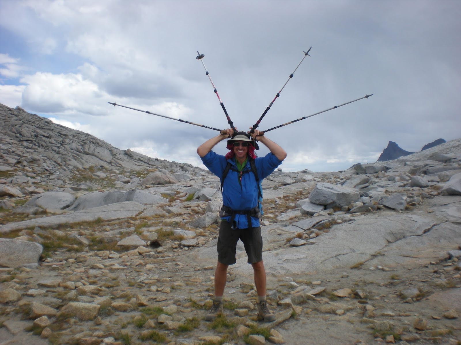
The Glenn Lightning Rod. Do not try this at home kids!
Erica, our group leader atop Donohue Pass with map in hand.
The weather was building up and looking like rain was nearby as we approached the pass. Not a good spot to encounter weather when you are at the high point of your travels and very exposed. Sure enough, we started to get a little light rain as we were climbing the final portion of the pass. Out came rain jackets and even though they are fancy Gortex breathable material it was still questionable if they kept more water out or trapped more in. Earlier in the day the group guessed what time we would cross the pass, Alisa was dead on in her timing, 2PM I think. We waited up top for everyone. Since I had been offered by our group leader to serve as the lightning rod for the group due to my height, I grabbed a few trekking poles and arrayed them over my head for a great picture of me doing my group duty. It was good for a few laughs for sure! While we waited on CP to arrive at the pass, Erica and I headed up to the top of nearby hill to get a better view. From the top we could see the peaks we were leaving behind as well as the meadows we were heading towards for that nights camp. We could also clearly see Mt. Lyell and the Lyell Glacier signifying we had crossed over Donohue Pass and were now on the descent to the lush valley below. From this high vantage point we could identify some of the peaks in the area, and the weather closing in upon us! We also came across the infamous Sierra mini bear, AKA the marmot.

The group below the Lyell Glacier.
We quickly descended the pass and took a break at an unnamed lake below the Lyell Glacier. It was quite interesting to look up at this glacier as it holds a little history to me. Once upon a time my dad and his college roommate were going to climb Mt. Lyell and glissade down this very glacier, probably after reading one of John Muir's tales or perhaps a story out of Roughing It by Mark Twain. Well dad got as far as buying the ice axe, which he still has in his closet to this day, but the closest he is ever going to get to that glacier is the picture I took at its base!

Fortunately the skies were clearing a little as we made our way down. We came across a spot that is popular with the JMT hikers to camp and once again they were crammed on top of each other like sardines in a can. We headed on down a little further to where the meadows began and found just what we were looking for about 500 yards off the main trail. We discovered the most incredible camp, used by the folks with the pack animals as best we could figure, ready for us to use. It had a great fire pit, stack of precut wood, plenty of spots to put tents and lots of local firewood and kindling as well as access to water nearby. All this with an absolutely incredible view of the meadows below us. We quickly set up camp and now that we were in an area we could have a fire, we proceeded to use this right and got one going right away! I harvested some wood from a downed tree nearby as I did not want to use that which had already been left there. We were in a Yosemite paradise. We could see folks on the JMT as they passed at a distance and we were fortunate to have stumbled across this location. While we did not swim this afternoon, most if not all of us did wash up down at the river before putting on our evening clothes.

Alex hanging out by our campfire in this perfect location.
Dinner was great as once again I did not have to cook! CP had brought some freeze dried lasagna as well as some beef stroganof. For dessert he also had a blueberry cheesecake as I recall, whatever it was it was good! We all enjoyed hanging by the campfire, quite a novelty when backpacking for many of us due to fire restrictions. As the evening progressed we noticed clouds building and heard a few distant claps of thunder. Before long and shortly after dark the lightning grew much closer and a full on rain storm came with it! Now this is exactly what I had been waiting for, something I was so accustomed to encountering when camping in Tuolomne Meadows as a kid. Off to our tents we went to ride out the storm. It rained fairly heavy for about an hour or so and the lightning continued for about that long as well. It was so enjoyable to be hunkered down in the tent, warm and dry, with the storm brewing outside. I slept very well that night.

Alex drops his fly in the water and is treated with an instant bite!
Hard to beat this location, Jason drops in a fly to test the waters.
Yet another morning was upon us. By this time in the trip I had really forgotten what day it was, how many days in we were and since I was not wearing a watch by choice to help me really unwind, (no pun intended) I had completely lost all relation of days entirely. It was such a great feeling!!! So in that spirit, on day whatever it was, we all got up late and had absolutely no plans whatsoever. Over breakfast we discussed what we might like to do. We knew Jason and Alex wanted to go fishing and this was a great location for them to fly fish. I wanted to explore but didn't much care where and CP and Erica liked that plan and Alisa wanted to enjoy camp and the fire. With those plans we all headed out with a plan to return to camp for a group lunch in the early afternoon. Jason and Alex were scouting the river for fishing holes while CP, Erica and I looked for good swimming holes. Our paths crossed right when the guys put their lines in the water. Both had bites almost immediately! This was especially good news for Alex as it was the first bite on his new fly rod that was ideally suited for this type of slow river fishing. CP, Erica and I continued downstream scouting out swimming holes and hiked on down river enjoying the views before rejoining the JMT to hike back to camp.

The final Quiddler match following the NeoAirlympics
We all returned to camp and had lunch. Alisa had a group lunch for us that day and we had egg noodles with some fresh basil and who knows what else, it was just good so I really did not care. The guys had caught lots of fish but they were too small and were all throw backs. Not that big a deal as they had a great time catching. We had scouted a great swimming hole and wouldn't you know that the perfect camp spot we had picked out also had a perfect swimming hole just a few hundred yards away! Now to add to the afternoon swimming fun, Erica and I grabbed our Thermarest NeoAir mattresses and brought them with us. We had envisioned the NeoAirlympics as we were missing the official Summer Olympics in London while we were on the trail. We all got down to the water and tried out the air mattresses and found them to be really good as a water toy. We all participated in a few runs going head to head against each other before getting out and drying off and laying in the adjacent meadow to sun ourselves. Lucky for us, Erica brought the Quiddler cards again so a round of that ensued. We had a great time just laying there, playing the game, getting some sun and some much needed relaxation. Just as the sun was dropping over the nearby ridge we wrapped up the game, CP pulled off the victory again much to Erica's dismay. We needed to get back to camp for some warmer clothes. We got our fire going and settled in for our final meal. Erica had the final night, sweet and sour pork. It was really good and we found that the six of us could quite easily eat 10 servings with no problem. She had one of my favorite desserts, raspberry crumble, and we devoured that as well. Now this being the last night Jason put out the call for whatever extra food we all had. Some granola, oatmeal, chocolate chips, sugar and few other items came out. With a little olive oil he whipped up something with all of this stuff, kind of like a really grainy pancake like thing. At this point it did not matter, it was GOOD! Shortly after that we headed off to bed for our final night on the trail.

Group photo as we head down the JMT toward Tuolomne.

The final swimming hole near the bridge.
Our last morning was upon us and I think we all felt a little sad to be packing up for the final time. We dried our tent bottoms and packed up our gear once the meadow dried as the sun came out. We still had about 8 miles to go to reach our final destination, Tuolumne Meadows, where a fully stocked store awaited us as well as a bus back to our starting point. We got on the trail and happened to come across the father and son team we had met a few days earlier. The 7 year old was still doing great although his dad seemed to tag along on my heels for awhile for what I am certain was a chance to enjoy a little adult conversation. Having backpacked with my kids, I certainly understand this need. Come lunchtime we had found yet another great swimming hole so in we went, riding the current and enjoying a dip on a fairly warm day. It was now time to head out. Fortunately we were running a little ahead of schedule and we were able to stop one last time at a great bridge along the river where a trail from the Tuolomne Lodge crosses over the river to join the JMT. I have been there many times before and in fact just one year prior Erica and I missed each other there by one day while travelling with our families and we both agreed it would be a great place to swim. In we all went one more time. Now after a week on the trail we had to win an award as the nicest smelling backpackers ever!

Lembert Dome, the first and last "Peak" I did with my dad.
Just a mile to go from the bridge and we soon encountered a view of Lembert Dome, the first and last peak, if you can even call it a peak, I did with my dad. Thereafter we arrived at the Tuolomne store. This place has special meaning to me because as a kid I came here with my family every year. I would see, and smell, the backpackers cruising through and think how great that would be to do someday. My dad had talked about backpacking the High Sierra camps with me when I was younger but by the time I was old enough and in shape to do it, he was not. I have backpacked to many locations but finally I was the backpacker rolling into the Tuolomne Store, dropping my pack out front and raiding the store for everything sweet and salty I could grab. It may have taken me 35 years to make that dream a reality but it was finally MY reality. The finish did bring a tear to my eye as it was something I had been thinking about for many years. To have done this with GREAT friends, all of whom I have met through the Orange County Hiking and Backpacking Club made this trip something I will always remember. I head off with the Boy Scouts in a week to lead them on a Sierra Trek of their own. I hope it inspires them as much as I was as a young boy spending time up in the mountains. I want to follow through on the thought my dad had when I was younger with my boys, perhaps we will follow in the footsteps of the father/son team we met on this trip and hike from Devils Postpile to Yosemite Valley. Who knows, maybe I can get my boys to make the side trip over to the Lyell Glacier and complete an adventure hatched by their grandfather and his college roommate so many years ago. It would be even better if we can complete it and share the story and the pictures with him while he can still enjoy them. For symbolic reasons, I would likely take that ice axe from his closet to complete the adventure and give it back to him, with all the scratches and wear marks an ice axe should have after such a journey.

For all the pictures from this adventure please click here.